TopoQuest Logo
Do you find TopoQuest useful?
Help keep TopoQuest running and adding new maps/features by donating!
Bitcoin:  19c7KJd3qBynnjoSw5npx9KScwjBe4ifkT
Litecoin:  LXs6TkuXGGXo1vDsWCkWVdjQX94eUKd6ui
Home View Maps Find Maps Find Places Resources & Links


Milton, Wisconsin Topographic Map

USGS Map Title: Milton, WI
USGS Map MRC: 42088G8
DRG (GeoTIFF) Download: o42088g8.tif


Neighboring USGS Topographic Map Quads:


  Rockdale, WI  
42089H1
 

  Busseyville, WI  
42088H8
 

  Fort Atkinson, WI  
42088H7
 

  Edgerton, WI  
42089G1
 

  Milton, WI  
42088G8
 

  Lima Center, WI  
42088G7
 

  Janesville West, WI  
42089F1
 

  Janesville East, WI  
42088F8
 

  Avalon, WI  
42088F7


Map MRC Location:

N43°
W89°
N43°
W88°
H8 H7 H6 H5 H4 H3 H2 H1
G8 G7 G6 G5 G4 G3 G2 G1
F8 F7 F6 F5 F4 F3 F2 F1
E8 E7 E6 E5 E4 E3 E2 E1
D8 D7 D6 D5 D4 D3 D2 D1
C8 C7 C6 C5 C4 C3 C2 C1
B8 B7 B6 B5 B4 B3 B2 B1
A8 A7 A6 A5 A4 A3 A2 A1
N42°
W89°
N42°
W88°

Milton, WI USGS 1:24K Topographic Map Preview:
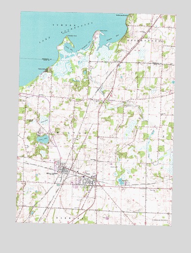
Milton, WI USGS Topographic Map
Click on map above to begin viewing in our Map Viewer.

This topographic map contains these locations and features:
Feature Name Type Latitude Longitude GNIS ID View Map
Bellaire FarmsLocaleN42.7897°W88.9025°2632177View Map
Binghams BayBayN42.8564°W88.9446°1561800View Map
Bowers LakeLakeN42.7847°W88.9187°1562098View Map
Burr Oak SchoolSchoolN42.8156°W88.8857°1562451View Map
Camp WakondaLocaleN42.8203°W88.9146°1562672View Map
Central ParkParkN42.7772°W88.9546°1833952View Map
Charlie BluffPopulated PlaceN42.8403°W88.9782°1562957View Map
City of MiltonCivilN42.7751°W88.9430°1583722View Map
Clean Sweep FarmLocaleN42.8008°W88.9533°2632179View Map
Clear LakeLakeN42.7994°W88.9795°1563146View Map
Cranberry MarshSwampN42.8100°W88.9873°1563498View Map
Duck LakeLakeN42.7961°W88.9849°2760396View Map
East Elementary SchoolSchoolN42.7750°W88.9376°1834100View Map
Faith United Methodist ChurchChurchN42.7814°W88.9604°1834002View Map
First Congregational ChurchChurchN42.7725°W88.9376°1834019View Map
First United Methodist ChurchChurchN42.7728°W88.9362°1834026View Map
Goodrich ParkParkN42.7736°W88.9379°1834038View Map
Grass LakeSwampN42.8111°W88.9793°1565772View Map
Haights BayBayN42.8611°W88.9248°1565965View Map
Hilltop ParkParkN42.7736°W88.9523°1834050View Map
KoshkonongPopulated PlaceN42.8461°W88.9193°1567627View Map
Koshkonong MoundsPopulated PlaceN42.8742°W88.9121°1567630View Map
Koshkonong SchoolSchoolN42.8642°W88.8993°1567631View Map
La Mar ParkParkN42.7831°W88.9671°1567680View Map
Lake KoshkonongLakeN42.8724°W88.9612°1567632View Map
Lautz BayBayN42.8536°W88.9601°1567880View Map
Liberty ParkParkN42.7811°W88.9651°1834074View Map
Meier Airport (historical)AirportN42.8136°W88.9971°1582078View Map
MiltonPopulated PlaceN42.7756°W88.9440°1569532View Map
Milton CemeteryCemeteryN42.7801°W88.9380°1834096View Map
Milton City HallBuildingN42.7756°W88.9384°1834097View Map
Milton College (historical)SchoolN42.7745°W88.9421°1834098View Map
Milton College Historic DistrictParkN42.7745°W88.9426°1834099View Map
Milton Fire DepartmentBuildingN42.7836°W88.9626°2697857View Map
Milton Grange HallBuildingN42.7856°W88.9634°1834101View Map
Milton High SchoolSchoolN42.7743°W88.9555°1834102View Map
Milton House MuseumBuildingN42.7767°W88.9362°1834103View Map
Milton JunctionPopulated PlaceN42.7825°W88.9629°1569533View Map
Milton Junction CemeteryCemeteryN42.7833°W88.9579°1834104View Map
Milton Junction Post Office (historical)Post OfficeN42.7825°W88.9623°1834105View Map
Milton Middle SchoolSchoolN42.7810°W88.9513°1834106View Map
Milton Police DepartmentBuildingN42.7703°W88.9362°2759675View Map
Milton Post OfficePost OfficeN42.7774°W88.9522°1834107View Map
Milton Public LibraryBuildingN42.7731°W88.9434°1834108View Map
Milton Town Police DepartmentBuildingN42.7823°W88.9618°2759961View Map
Milton Township HallBuildingN42.7825°W88.9615°1834109View Map
North Milton SchoolSchoolN42.7878°W88.9365°1570468View Map
North ParkParkN42.7767°W88.9376°1834118View Map
Northside Intermediate SchoolSchoolN42.7823°W88.9473°2716357View Map
Oakridge Golf CourseLocaleN42.7889°W88.9315°1834119View Map
Otter CreekStreamN42.8561°W88.9346°1570889View Map
Otter Creek CemeteryCemeteryN42.8224°W88.9358°1570898View Map
Otter Creek SchoolSchoolN42.8236°W88.9282°1570903View Map
Riesterer FarmsLocaleN42.7747°W88.9761°2632176View Map
Rock River CemeteryCemeteryN42.8219°W88.9948°1572466View Map
Rock River SchoolSchoolN42.8256°W88.9840°1572470View Map
Saint Johns Lutheran ChurchChurchN42.7731°W88.9354°1834161View Map
Saint Mary Catholic ChurchChurchN42.7689°W88.9421°1834167View Map
Saint Mary CemeteryCemeteryN42.7742°W88.9673°1834168View Map
Seventh Day Adventist ChurchChurchN42.7806°W88.9598°1834187View Map
Seventh Day Baptist ChurchChurchN42.7772°W88.9376°1834192View Map
Seventh Day Baptist ChurchChurchN42.7811°W88.9596°1834193View Map
Stony PointCapeN42.8617°W88.9382°1574957View Map
Stores Lake PitMineN42.7756°W88.9094°2634498View Map
Storrs LakeLakeN42.7755°W88.9164°1574960View Map
That Tree FarmLocaleN42.7525°W88.9886°2632178View Map
The FarmLocaleN42.8136°W88.9544°2632180View Map
Thiebeau PointCapeN42.8589°W88.9632°1575348View Map
Town of MiltonCivilN42.8064°W88.9561°1583723View Map
Vickerman SchoolSchoolN42.7714°W88.8957°1576078View Map
West Elementary SchoolSchoolN42.7835°W88.9667°1834110View Map
Whitford Memorial HallBuildingN42.7742°W88.9418°1834217View Map

Note: Coordinates in the location and feature list above are referenced to NAD83 datum.


Copyright (C) 2008-2024 Ryan Niemi / Sunset Dynamics ... All Rights Reserved