TopoQuest Logo
Do you find TopoQuest useful?
Help keep TopoQuest running and adding new maps/features by donating!
Bitcoin:  19c7KJd3qBynnjoSw5npx9KScwjBe4ifkT
Litecoin:  LXs6TkuXGGXo1vDsWCkWVdjQX94eUKd6ui
Home View Maps Find Maps Find Places Resources & Links


Forks of Salmon, California Topographic Map

USGS Map Title: Forks of Salmon, CA
USGS Map MRC: 41123C3
DRG (GeoTIFF) Download: o41123c3.tif


Neighboring USGS Topographic Map Quads:


  Somes Bar, CA  
41123D4
 

  Medicine Mountain, CA  
41123D3
 

  English Peak, CA  
41123D2
 

  Orleans Mountain, CA  
41123C4
 

  Forks of Salmon, CA  
41123C3
 

  Sawyers Bar, CA  
41123C2
 

  Salmon Mountain, CA  
41123B4
 

  Youngs Peak, CA  
41123B3
 

  Cecilville, CA  
41123B2


Map MRC Location:

N42°
W124°
N42°
W123°
H8 H7 H6 H5 H4 H3 H2 H1
G8 G7 G6 G5 G4 G3 G2 G1
F8 F7 F6 F5 F4 F3 F2 F1
E8 E7 E6 E5 E4 E3 E2 E1
D8 D7 D6 D5 D4 D3 D2 D1
C8 C7 C6 C5 C4 C3 C2 C1
B8 B7 B6 B5 B4 B3 B2 B1
A8 A7 A6 A5 A4 A3 A2 A1
N41°
W124°
N41°
W123°

Forks of Salmon, CA USGS 1:24K Topographic Map Preview:
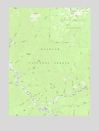
Forks of Salmon, CA USGS Topographic Map
Click on map above to begin viewing in our Map Viewer.

This topographic map contains these locations and features:
Feature Name Type Latitude Longitude GNIS ID View Map
Acorn SpringSpringN41.2560°W123.3501°256108View Map
Barrel SpringSpringN41.3051°W123.3361°256550View Map
Bennett CemeteryCemeteryN41.2584°W123.3252°256831View Map
Big CreekStreamN41.2865°W123.2506°219172View Map
Blue RidgeRidgeN41.2604°W123.2773°257277View Map
Bonally MineMineN41.2654°W123.3064°257332View Map
Boyd GulchValleyN41.2826°W123.3520°257421View Map
Brazille FlatFlatN41.2676°W123.3401°257441View Map
Bull Barn FlatFlatN41.2554°W123.3245°257655View Map
Chimney RockPillarN41.3651°W123.2717°258293View Map
Chimney Rock LakeLakeN41.3702°W123.2738°258295View Map
China GulchValleyN41.2824°W123.2659°258309View Map
Codfish Hill MineMineN41.2890°W123.3581°258505View Map
Crapo CreekStreamN41.2924°W123.3628°258879View Map
Crapo MeadowsFlatN41.3585°W123.2770°258880View Map
Crapo MineMineN41.2951°W123.3603°258881View Map
Dead Horse GulchValleyN41.2779°W123.2773°259114View Map
Dead Mule GulchValleyN41.2651°W123.3323°259119View Map
Dollar MeadowsFlatN41.3696°W123.2573°259460View Map
Dougherty BluffCliffN41.2824°W123.2587°259510View Map
Dougherty MineMineN41.2810°W123.2578°259512View Map
Evergreen MineMineN41.3129°W123.3317°259995View Map
Fong Wah BarBarN41.2754°W123.3456°260228View Map
Fong Wah GulchValleyN41.2693°W123.3420°260229View Map
Forest and Stout MineMineN41.2743°W123.2792°260251View Map
Forks of SalmonLocaleN41.2582°W123.3228°260268View Map
Forks of Salmon Elementary SchoolSchoolN41.2593°W123.3275°1701858View Map
Forks of Salmon Guard StationLocaleN41.2585°W123.3217°277234View Map
Forks of Salmon Post OfficePost OfficeN41.2588°W123.3214°2760031View Map
Glasgow BarBarN41.2507°W123.3059°260590View Map
Hog RangeRidgeN41.2874°W123.3201°261400View Map
Horn CreekStreamN41.2590°W123.3306°266817View Map
Horn FieldFlatN41.2635°W123.3328°266818View Map
Indian PointCapeN41.2729°W123.2964°261755View Map
Knudsen BarBarN41.2804°W123.3517°262230View Map
Kramer MineMineN41.2860°W123.3109°262241View Map
Logan GulchValleyN41.2721°W123.3403°262784View Map
Maple SpringSpringN41.2507°W123.3616°263183View Map
McNeal CreekStreamN41.2540°W123.3164°266992View Map
McNeal MineMineN41.2768°W123.3495°263412View Map
Mills FlatFlatN41.2612°W123.3176°263651View Map
Morehouse MeadowsFlatN41.3601°W123.2934°263815View Map
Murderers GulchValleyN41.2740°W123.2900°263966View Map
Nordheimer CreekStreamN41.2968°W123.3601°267063View Map
Nordheimer FlatFlatN41.2993°W123.3620°264117View Map
North Fork Salmon RiverStreamN41.2568°W123.3234°264205View Map
Picayune GulchValleyN41.2799°W123.2567°264692View Map
Picayune LakeLakeN41.2650°W123.2579°264694View Map
Pollocks GulchValleyN41.2735°W123.3023°264917View Map
Portuguese CreekStreamN41.3354°W123.3714°264970View Map
Portuguese PeakSummitN41.3676°W123.3339°264973View Map
Quail FlatFlatN41.2879°W123.3634°265082View Map
Salmon River Volunteer Fire and RescueBuildingN41.2581°W123.3266°2621937View Map
Sauerkraut GulchValleyN41.3046°W123.3687°265854View Map
Sauerkraut MineMineN41.3110°W123.3748°267212View Map
Sauerkraut PeakSummitN41.3207°W123.3442°265855View Map
Sawpit FlatFlatN41.2782°W123.2673°265889View Map
Shumway FlatFlatN41.2654°W123.3048°266149View Map
South Fork Salmon RiverStreamN41.2568°W123.3234°267500View Map
Steinacher LakeLakeN41.3679°W123.2815°267719View Map
Swans GulchValleyN41.2626°W123.3176°268009View Map
Tom Payne PeakSummitN41.3737°W123.3645°268337View Map
Tripp PointCapeN41.3332°W123.3681°268419View Map
United States Forest Service StationLocaleN41.2585°W123.3220°277456View Map

Note: Coordinates in the location and feature list above are referenced to NAD83 datum.


Copyright (C) 2008-2024 Ryan Niemi / Sunset Dynamics ... All Rights Reserved