TopoQuest Logo
Do you find TopoQuest useful?
Help keep TopoQuest running and adding new maps/features by donating!
Bitcoin:  19c7KJd3qBynnjoSw5npx9KScwjBe4ifkT
Litecoin:  LXs6TkuXGGXo1vDsWCkWVdjQX94eUKd6ui
Home View Maps Find Maps Find Places Resources & Links


Carroll, Pennsylvania Topographic Map

USGS Map Title: Carroll, PA
USGS Map MRC: 41077A2
DRG (GeoTIFF) Download: o41077a2.tif


Neighboring USGS Topographic Map Quads:


  Jersey Shore, PA  
41077B3
 

  Linden, PA  
41077B2
 

  Williamsport, PA  
41077B1
 

  Loganton, PA  
41077A3
 

  Carroll, PA  
41077A2
 

  Williamsport SE, PA  
41077A1
 

  Woodward, PA  
40077H3
 

  Hartleton, PA  
40077H2
 

  Mifflinburg, PA  
40077H1


Map MRC Location:

N42°
W78°
N42°
W77°
H8 H7 H6 H5 H4 H3 H2 H1
G8 G7 G6 G5 G4 G3 G2 G1
F8 F7 F6 F5 F4 F3 F2 F1
E8 E7 E6 E5 E4 E3 E2 E1
D8 D7 D6 D5 D4 D3 D2 D1
C8 C7 C6 C5 C4 C3 C2 C1
B8 B7 B6 B5 B4 B3 B2 B1
A8 A7 A6 A5 A4 A3 A2 A1
N41°
W78°
N41°
W77°

Carroll, PA USGS 1:24K Topographic Map Preview:
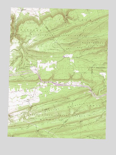
Carroll, PA USGS Topographic Map
Click on map above to begin viewing in our Map Viewer.

This topographic map contains these locations and features:
Feature Name Type Latitude Longitude GNIS ID View Map
Bald Eagle State Forest Ranger StationLocaleN41.0306°W77.2205°1196775View Map
Betterton TrailTrailN41.0931°W77.1497°1169440View Map
Big Mountain TrailTrailN41.0912°W77.2044°1169541View Map
Big Rock SpringSpringN41.0990°W77.2439°1169558View Map
Black GapGapN41.0062°W77.2122°1169705View Map
Brushy Ridge TrailTrailN41.0767°W77.1361°1205727View Map
Bucks Gap TrailTrailN41.0584°W77.1558°1170577View Map
Captain Green MonumentParkN41.0526°W77.1797°1196929View Map
CarrollPopulated PlaceN41.0487°W77.2097°1171261View Map
Castle RocksPopulated PlaceN41.0979°W77.2416°1203232View Map
Chestnut Flat TrailTrailN41.0117°W77.1552°1206940View Map
CrabappleLocaleN41.0023°W77.1977°1196778View Map
Crabapple PathTrailN41.0059°W77.2030°1172581View Map
Cracker Bridge TrailTrailN41.0137°W77.1505°1206941View Map
Dry Hollow TrailTrailN41.1001°W77.2297°1205730View Map
Dunbar TrailTrailN41.0954°W77.1752°1173594View Map
Duncan TrailTrailN41.0334°W77.1464°1206938View Map
East End TrailTrailN41.0579°W77.1419°1173806View Map
East Point Fire Tower (historical)TowerN41.0306°W77.2152°1196777View Map
EastvillePopulated PlaceN41.0356°W77.2230°1173931View Map
Eastville RunStreamN41.0337°W77.2239°1173932View Map
Fourth Gap TrailTrailN41.0295°W77.1455°1206939View Map
Frying Pan Gap TrailTrailN41.0176°W77.1605°1206942View Map
Fryingpan GapGapN41.0165°W77.1583°1175318View Map
Gann RunStreamN41.0790°W77.2341°1175411View Map
Gottshall RunStreamN41.0995°W77.2444°1175855View Map
Grape Vine TrailTrailN41.0784°W77.1294°1205728View Map
Green GapGapN41.0390°W77.1758°1176063View Map
Green Gap TrailTrailN41.0370°W77.1727°1176065View Map
Heintz TrailTrailN41.0142°W77.2336°1176781View Map
Hemlock SpringSpringN41.0665°W77.2325°1176815View Map
Hoffey School (historical)SchoolN41.0717°W77.1964°1196773View Map
Horse PathTrailN41.1095°W77.1647°1177443View Map
Kelly TrailTrailN41.0712°W77.1797°1205726View Map
Krape RunStreamN41.0873°W77.2350°1178664View Map
Little Gap TrailTrailN41.0879°W77.2064°1179555View Map
Mags PathTrailN41.0145°W77.2364°1180199View Map
McCall Dam (historical)DamN41.0173°W77.1795°2339520View Map
McCalls Dam State ParkParkN41.0170°W77.1826°1180608View Map
McMurrin GapGapN41.1187°W77.1791°1180790View Map
Meixell TrailTrailN41.0445°W77.1841°1180875View Map
Mount Blessing CampLocaleN41.0706°W77.2211°1181646View Map
Mount Union ChurchChurchN41.0684°W77.2202°1181873View Map
Naked MountainSummitN41.0051°W77.1814°1182155View Map
Nippenose MountainSummitN41.1120°W77.2258°1182474View Map
North White Deer RidgeRidgeN41.1115°W77.1466°1182654View Map
Pennsylvania Conservation and Natural Resources District 12 Tiadaghton ForestBuildingN41.0729°W77.2298°2645695View Map
Pine Hollow TrailTrailN41.0901°W77.2472°1206934View Map
Pot Pie HollowValleyN41.0238°W77.1311°1184321View Map
Price CemeteryCemeteryN41.0435°W77.2426°1184406View Map
RauchtownPopulated PlaceN41.1229°W77.2361°1184700View Map
Rauchtown Lookout TowerTowerN41.0948°W77.1936°1213337View Map
Ravensburg State ParkParkN41.1101°W77.2430°1184715View Map
Reed TrailTrailN41.1001°W77.1922°1184825View Map
Refuge TrailTrailN41.1062°W77.1355°1184860View Map
Rockey RunStreamN41.0998°W77.2441°1185306View Map
Rocky Corner TrailTrailN41.0065°W77.1786°1206944View Map
Sand MountainSummitN41.0020°W77.1502°1193282View Map
Sand Mountain TowerTowerN41.0017°W77.1314°1212574View Map
Sand SpringSpringN41.0978°W77.2239°1186922View Map
Sand Spring FlatFlatN41.1048°W77.2180°1186926View Map
Schroyer TrailTrailN41.0254°W77.2086°1187128View Map
Schwenks GapGapN41.0203°W77.2489°1187143View Map
Schwenks Gap TrailTrailN41.0120°W77.2464°1187144View Map
Shakespeare ClubPopulated PlaceN41.0145°W77.1783°1196776View Map
Sheller Shanty TrailTrailN41.0259°W77.1872°1187444View Map
Sugar Valley ChurchChurchN41.0354°W77.2247°1188980View Map
Tea SpringSpringN41.0473°W77.1436°1189330View Map
The Rocky GorgeValleyN41.1143°W77.2415°1202364View Map
Three Hills TrailTrailN41.0192°W77.2239°1189538View Map
Walters TrailTrailN41.0895°W77.1391°1190562View Map
Webster TrailTrailN41.0779°W77.1358°1190763View Map
Welshans TrailTrailN41.0890°W77.1589°1190822View Map
Wet Rock TrailTrailN41.0909°W77.2411°1191188View Map
White Deer Creek TrailTrailN41.0154°W77.2011°1191268View Map
Windsor Camp (historical)LocaleN41.0784°W77.1633°1196774View Map

Note: Coordinates in the location and feature list above are referenced to NAD83 datum.


Copyright (C) 2008-2024 Ryan Niemi / Sunset Dynamics ... All Rights Reserved