TopoQuest Logo
Do you find TopoQuest useful?
Help keep TopoQuest running and adding new maps/features by donating!
Bitcoin:  19c7KJd3qBynnjoSw5npx9KScwjBe4ifkT
Litecoin:  LXs6TkuXGGXo1vDsWCkWVdjQX94eUKd6ui
Home View Maps Find Maps Find Places Resources & Links


Williamsport SE, Pennsylvania Topographic Map

USGS Map Title: Williamsport SE, PA
USGS Map MRC: 41077A1
DRG (GeoTIFF) Download: o41077a1.tif


Neighboring USGS Topographic Map Quads:


  Linden, PA  
41077B2
 

  Williamsport, PA  
41077B1
 

  Montoursville South, PA  
41076B8
 

  Carroll, PA  
41077A2
 

  Williamsport SE, PA  
41077A1
 

  Allenwood, PA  
41076A8
 

  Hartleton, PA  
40077H2
 

  Mifflinburg, PA  
40077H1
 

  Lewisburg, PA  
40076H8


Map MRC Location:

N42°
W78°
N42°
W77°
H8 H7 H6 H5 H4 H3 H2 H1
G8 G7 G6 G5 G4 G3 G2 G1
F8 F7 F6 F5 F4 F3 F2 F1
E8 E7 E6 E5 E4 E3 E2 E1
D8 D7 D6 D5 D4 D3 D2 D1
C8 C7 C6 C5 C4 C3 C2 C1
B8 B7 B6 B5 B4 B3 B2 B1
A8 A7 A6 A5 A4 A3 A2 A1
N41°
W78°
N41°
W77°

Williamsport SE, PA USGS 1:24K Topographic Map Preview:
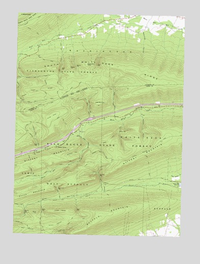
Williamsport SE, PA USGS Topographic Map
Click on map above to begin viewing in our Map Viewer.

This topographic map contains these locations and features:
Feature Name Type Latitude Longitude GNIS ID View Map
Bear GapGapN41.0142°W77.0777°1168874View Map
Bear Gap TrailTrailN41.0115°W77.0777°1168877View Map
Beartrap HollowValleyN41.1169°W77.0315°1168978View Map
Buck Path TrailTrailN41.0548°W77.0533°1170526View Map
Buffalo MountainSummitN41.0109°W77.0600°1170610View Map
Buffalo Mountain TrailTrailN41.0079°W77.0819°1170612View Map
Clark TrailTrailN41.0392°W77.1130°1171923View Map
Cowbell HollowValleyN41.0465°W77.0756°1172555View Map
Cowbell Hollow TrailTrailN41.0456°W77.0997°1206935View Map
Fawn RidgeRidgeN41.0806°W77.1125°1174644View Map
First GapGapN41.0965°W77.0641°1174785View Map
Fourth GapGapN41.0884°W77.1133°1197055View Map
Glen Cabin GapGapN41.0262°W77.0916°1175693View Map
Glen Cabin TrailTrailN41.0234°W77.0911°1175694View Map
Grosses Gap TrailTrailN41.0215°W77.0533°1176267View Map
Hoffa TrailTrailN41.1148°W77.1127°1177156View Map
Kettle HoleBendN41.0712°W77.0322°1178421View Map
Kettle Hole TrailTrailN41.0584°W77.0464°1206937View Map
Keystone Camp (historical)LocaleN41.0587°W77.0769°1197057View Map
Kurtz GapGapN41.0504°W77.1077°1178713View Map
Kurtz Gap TrailTrailN41.0554°W77.1097°1178714View Map
Lake TrailTrailN41.0692°W77.0816°1178788View Map
Lick RunStreamN41.0651°W77.0477°1179299View Map
Lick RunLocaleN41.0673°W77.0500°1212575View Map
Lick Run TrailTrailN41.0787°W77.0516°1179311View Map
Little MountainSummitN41.0740°W77.0630°1179608View Map
Long KnobSummitN41.0131°W77.0897°1179862View Map
Lyman GapGapN41.0584°W77.0469°1180104View Map
Lyman Gap TrailTrailN41.0392°W77.0244°1180105View Map
Metzger TrailTrailN41.0967°W77.1111°1205695View Map
Mile RunStreamN41.0631°W77.0669°1181098View Map
Mile Run CampLocaleN41.0545°W77.0691°1197058View Map
Mile Run TrailTrailN41.0773°W77.0761°1181099View Map
Milton Camp (historical)LocaleN41.0292°W77.0586°1197059View Map
Mud Hole TrailTrailN41.1042°W77.1147°1205725View Map
Pine FlatFlatN41.0667°W77.0975°1183785View Map
Pine Flat TrailTrailN41.0634°W77.0883°1183786View Map
Potato HillSummitN41.0945°W77.0850°1184326View Map
Round KnobSummitN41.0123°W77.1100°1185532View Map
Running GapGapN41.0337°W77.0614°1185622View Map
Sand Spring CampLocaleN41.0454°W77.1144°1197056View Map
Sand Spring RunStreamN41.0592°W77.0747°1186931View Map
Second GapGapN41.0959°W77.0802°1187211View Map
Second Gap TrailTrailN41.1001°W77.0830°1205696View Map
Sheet Iron TrailTrailN41.0437°W77.0964°1206936View Map
Shoemaker KnobSummitN41.0965°W77.0722°1187578View Map
South White Deer RidgeRidgeN41.0904°W77.0294°1188121View Map
Spruce GapGapN41.0129°W77.1169°1188328View Map
Stony GapGapN41.0137°W77.1039°1188772View Map
Third GapGapN41.0940°W77.0911°1189456View Map
Third Gap TrailTrailN41.1020°W77.0911°1189457View Map
Top Mountain TrailTrailN41.0354°W77.0852°1189661View Map
Township of WashingtonCivilN41.1192°W77.0500°1216775View Map
Webster TrailTrailN41.0804°W77.1152°1190764View Map

Note: Coordinates in the location and feature list above are referenced to NAD83 datum.


Copyright (C) 2008-2024 Ryan Niemi / Sunset Dynamics ... All Rights Reserved