TopoQuest Logo
Do you find TopoQuest useful?
Help keep TopoQuest running and adding new maps/features by donating!
Bitcoin:  19c7KJd3qBynnjoSw5npx9KScwjBe4ifkT
Litecoin:  LXs6TkuXGGXo1vDsWCkWVdjQX94eUKd6ui
Home View Maps Find Maps Find Places Resources & Links


Center Point NW, Iowa Topographic Map

USGS Map Title: Center Point NW, IA
USGS Map MRC: 42091B8
DRG (GeoTIFF) Download: o42091b8.tif


Neighboring USGS Topographic Map Quads:


  Brandon, IA  
42092C1
 

  Cheney, IA  
42091C8
 

  Walker, IA  
42091C7
 

  Vinton, IA  
42092B1
 

  Center Point NW, IA  
42091B8
 

  Center Point, IA  
42091B7
 

  Van Horne, IA  
42092A1
 

  Center Point SW, IA  
42091A8
 

  Shellsburg, IA  
42091A7


Map MRC Location:

N43°
W92°
N43°
W91°
H8 H7 H6 H5 H4 H3 H2 H1
G8 G7 G6 G5 G4 G3 G2 G1
F8 F7 F6 F5 F4 F3 F2 F1
E8 E7 E6 E5 E4 E3 E2 E1
D8 D7 D6 D5 D4 D3 D2 D1
C8 C7 C6 C5 C4 C3 C2 C1
B8 B7 B6 B5 B4 B3 B2 B1
A8 A7 A6 A5 A4 A3 A2 A1
N42°
W92°
N42°
W91°

Center Point NW, IA USGS 1:24K Topographic Map Preview:
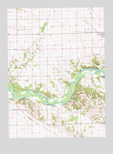
Center Point NW, IA USGS Topographic Map
Click on map above to begin viewing in our Map Viewer.

This topographic map contains these locations and features:
Feature Name Type Latitude Longitude GNIS ID View Map
Benton City (historical)Populated PlaceN42.1583°W91.9338°465539View Map
Benton City Fry Recreation AreaParkN42.1622°W91.9180°454521View Map
Benton City Post Office (historical)Post OfficeN42.1583°W91.9307°2000205View Map
Benton County HomeBuildingN42.1522°W91.9913°463302View Map
Christian ChurchChurchN42.2222°W91.8807°2000255View Map
City of UrbanaCivilN42.2284°W91.8873°2397098View Map
Cox CemeteryCemeteryN42.1992°W91.9104°2000359View Map
East BluffCliffN42.1619°W91.9832°456117View Map
Hoefle Dulin Recreation AreaParkN42.1633°W91.9777°457530View Map
Ice House LakeLakeN42.1839°W91.8771°457741View Map
Kisling CemeteryCemeteryN42.2050°W91.8896°458116View Map
Mud CreekStreamN42.1650°W91.9941°459389View Map
Oak Grove ChurchChurchN42.1383°W91.8768°459700View Map
Pettit Hill CemeteryCemeteryN42.1917°W91.9974°2000358View Map
Plum Grove CemeteryCemeteryN42.1411°W91.9652°2000345View Map
Prairie Creek ChurchChurchN42.2250°W91.9591°460408View Map
Township of BentonCivilN42.1521°W91.8890°467440View Map
Township of PolkCivilN42.2428°W91.8884°468554View Map
Unity Post Office (historical)Post OfficeN42.1625°W91.9057°2000193View Map
Urbana Area AmbulanceBuildingN42.2261°W91.8821°2599679View Map
Urbana Fire DepartmentBuildingN42.2261°W91.8821°2000253View Map
Vinton QuarryMineN42.1819°W91.9975°2571229View Map
Wildcat BluffCliffN42.1919°W91.8866°463030View Map
Wildcat Bluff Recreation AreaParkN42.1955°W91.8888°463031View Map

Note: Coordinates in the location and feature list above are referenced to NAD83 datum.


Copyright (C) 2008-2024 Ryan Niemi / Sunset Dynamics ... All Rights Reserved