TopoQuest Logo
Do you find TopoQuest useful?
Help keep TopoQuest running and adding new maps/features by donating!
Bitcoin:  19c7KJd3qBynnjoSw5npx9KScwjBe4ifkT
Litecoin:  LXs6TkuXGGXo1vDsWCkWVdjQX94eUKd6ui
Home View Maps Find Maps Find Places Resources & Links


Cheney, Iowa Topographic Map

USGS Map Title: Cheney, IA
USGS Map MRC: 42091C8
DRG (GeoTIFF) Download: o42091c8.tif


Neighboring USGS Topographic Map Quads:


  Jesup, IA  
42092D1
 

  Independence, IA  
42091D8
 

  Quasqueton, IA  
42091D7
 

  Brandon, IA  
42092C1
 

  Cheney, IA  
42091C8
 

  Walker, IA  
42091C7
 

  Vinton, IA  
42092B1
 

  Center Point NW, IA  
42091B8
 

  Center Point, IA  
42091B7


Map MRC Location:

N43°
W92°
N43°
W91°
H8 H7 H6 H5 H4 H3 H2 H1
G8 G7 G6 G5 G4 G3 G2 G1
F8 F7 F6 F5 F4 F3 F2 F1
E8 E7 E6 E5 E4 E3 E2 E1
D8 D7 D6 D5 D4 D3 D2 D1
C8 C7 C6 C5 C4 C3 C2 C1
B8 B7 B6 B5 B4 B3 B2 B1
A8 A7 A6 A5 A4 A3 A2 A1
N42°
W92°
N42°
W91°

Cheney, IA USGS 1:24K Topographic Map Preview:
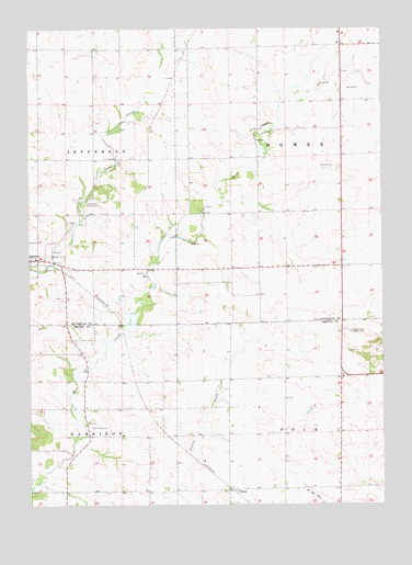
Cheney, IA USGS Topographic Map
Click on map above to begin viewing in our Map Viewer.

This topographic map contains these locations and features:
Feature Name Type Latitude Longitude GNIS ID View Map
Bear Creek CemeteryCemeteryN42.2707°W91.9792°454421View Map
Bear Creek School CemeteryCemeteryN42.3167°W91.9585°2000174View Map
Bearbower Sand Prairie AreaParkN42.3055°W91.9285°2000052View Map
Burke Post Office (historical)Post OfficeN42.2792°W91.9824°466640View Map
CheneyPopulated PlaceN42.2542°W91.9274°464496View Map
Clayton CemeteryCemeteryN42.3339°W91.9001°2000175View Map
First CemeteryCemeteryN42.3046°W91.9914°2000173View Map
HamervillePopulated PlaceN42.3125°W91.8896°464157View Map
Hamerville Post Office (historical)Post OfficeN42.3125°W91.8896°2000074View Map
Harrison TownhallBuildingN42.2714°W91.9807°463630View Map
Jefferson Township CemeteryCemeteryN42.3156°W91.9932°463629View Map
KGAN-TV (Cedar Rapids)TowerN42.2942°W91.8863°467356View Map
Kounty Pond - Hoffman Woods AreaParkN42.3097°W91.9557°2000051View Map
Likins Post Office (historical)Post OfficeN42.2639°W91.9057°2000192View Map
Lime Creek County ParkParkN42.3289°W91.9810°458349View Map
Polk Township Wildlife AreaParkN42.2833°W91.9474°2000182View Map
Township of HarrisonCivilN42.2527°W91.9902°468010View Map
Township of HomerCivilN42.3418°W91.8895°468050View Map

Note: Coordinates in the location and feature list above are referenced to NAD83 datum.


Copyright (C) 2008-2024 Ryan Niemi / Sunset Dynamics ... All Rights Reserved