TopoQuest Logo
Do you find TopoQuest useful?
Help keep TopoQuest running and adding new maps/features by donating!
Bitcoin:  19c7KJd3qBynnjoSw5npx9KScwjBe4ifkT
Litecoin:  LXs6TkuXGGXo1vDsWCkWVdjQX94eUKd6ui
Home View Maps Find Maps Find Places Resources & Links


Lone Pine, Louisiana Topographic Map

USGS Map Title: Lone Pine, LA
USGS Map MRC: 30092H3
DRG (GeoTIFF) Download: o30092h3.tif


Neighboring USGS Topographic Map Quads:


  Lecompte, LA  
31092A4
 

  Cheneyville, LA  
31092A3
 

  Belle d'Eau, LA  
31092A2
 

  Cocodrie Lake, LA  
30092H4
 

  Lone Pine, LA  
30092H3
 

  Bunkie, LA  
30092H2
 

  Pine Prairie, LA  
30092G4
 

  Saint Landry, LA  
30092G3
 

  Whiteville, LA  
30092G2


Map MRC Location:

N31°
W93°
N31°
W92°
H8 H7 H6 H5 H4 H3 H2 H1
G8 G7 G6 G5 G4 G3 G2 G1
F8 F7 F6 F5 F4 F3 F2 F1
E8 E7 E6 E5 E4 E3 E2 E1
D8 D7 D6 D5 D4 D3 D2 D1
C8 C7 C6 C5 C4 C3 C2 C1
B8 B7 B6 B5 B4 B3 B2 B1
A8 A7 A6 A5 A4 A3 A2 A1
N30°
W93°
N30°
W92°

Lone Pine, LA USGS 1:24K Topographic Map Preview:
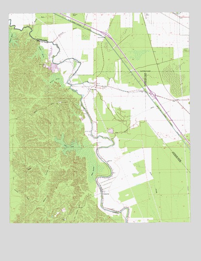
Lone Pine, LA USGS Topographic Map
Click on map above to begin viewing in our Map Viewer.

This topographic map contains these locations and features:
Feature Name Type Latitude Longitude GNIS ID View Map
Barstaw Spur (historical)LocaleN30.9938°W92.2571°551815View Map
Bayou TaureauStreamN30.9188°W92.3415°532787View Map
CentervillePopulated PlaceN30.8932°W92.3099°533850View Map
Centerville ChurchChurchN30.9121°W92.3068°533852View Map
Elm BayouStreamN30.9246°W92.3043°534804View Map
Griffin CemeteryCemeteryN30.9471°W92.3390°535424View Map
HaasPopulated PlaceN30.9482°W92.2593°554636View Map
Johnson CemeteryCemeteryN30.9299°W92.3182°536086View Map
Jordan Spur (historical)LocaleN30.9980°W92.2660°551847View Map
Lone PinePopulated PlaceN30.9557°W92.3196°543412View Map
Lone Pine ChurchChurchN30.9538°W92.2824°536667View Map
Lone Pine ChurchChurchN30.9557°W92.3157°551212View Map
McIntosh BayouGutN30.9994°W92.3326°537001View Map
McIntosh BayouStreamN30.9832°W92.3443°537002View Map
Morgans BayouStreamN30.9913°W92.3587°555374View Map
Morning Glory Church (historical)ChurchN30.9621°W92.3135°543870View Map
Robert BrakeSwampN30.9777°W92.3553°538633View Map
Stewart (historical)Populated PlaceN30.9571°W92.2682°545582View Map
Tiger LakeLakeN30.9212°W92.3334°556245View Map
Townsend Lake (historical)ReservoirN30.9310°W92.2599°556264View Map
Turtle BayouLakeN30.9767°W92.3461°540055View Map
Wilson BrakeSwampN30.9591°W92.3444°540479View Map

Note: Coordinates in the location and feature list above are referenced to NAD83 datum.


Copyright (C) 2008-2024 Ryan Niemi / Sunset Dynamics ... All Rights Reserved