TopoQuest Logo
Do you find TopoQuest useful?
Help keep TopoQuest running and adding new maps/features by donating!
Bitcoin:  19c7KJd3qBynnjoSw5npx9KScwjBe4ifkT
Litecoin:  LXs6TkuXGGXo1vDsWCkWVdjQX94eUKd6ui
Home View Maps Find Maps Find Places Resources & Links


Cooper-Good Ranch, New Mexico Topographic Map

USGS Map Title: Cooper-Good Ranch, NM
USGS Map MRC: 33103B6
DRG (GeoTIFF) Download: o33103b6.tif


Neighboring USGS Topographic Map Quads:


  Mescalero Point, NM  
33103C7
 

  Soldier Hill, NM  
33103C6
 

  Dallas Store, NM  
33103C5
 

  Caudill Ranch, NM  
33103B7
 

  Cooper-Good Ranch, NM  
33103B6
 

  Frier Ranch, NM  
33103B5
 

  Cedar Point SE, NM  
33103A7
 

  Dean Ranch, NM  
33103A6
 

  Fort Ranch, NM  
33103A5


Map MRC Location:

N34°
W104°
N34°
W103°
H8 H7 H6 H5 H4 H3 H2 H1
G8 G7 G6 G5 G4 G3 G2 G1
F8 F7 F6 F5 F4 F3 F2 F1
E8 E7 E6 E5 E4 E3 E2 E1
D8 D7 D6 D5 D4 D3 D2 D1
C8 C7 C6 C5 C4 C3 C2 C1
B8 B7 B6 B5 B4 B3 B2 B1
A8 A7 A6 A5 A4 A3 A2 A1
N33°
W104°
N33°
W103°

Cooper-Good Ranch, NM USGS 1:24K Topographic Map Preview:
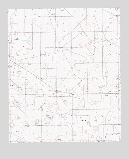
Cooper-Good Ranch, NM USGS Topographic Map
Click on map above to begin viewing in our Map Viewer.

This topographic map contains these locations and features:
Feature Name Type Latitude Longitude GNIS ID View Map
10024 Water WellWellN33.1654°W103.6661°930678View Map
10025 Water WellWellN33.1654°W103.6644°930679View Map
10749 Water WellWellN33.2496°W103.6516°930671View Map
10750 Water WellWellN33.2387°W103.6283°930670View Map
10929 Water WellWellN33.2240°W103.6922°930828View Map
10930 Water WellWellN33.2182°W103.7405°930830View Map
10934 Water WellWellN33.2029°W103.7494°930674View Map
10935 Water WellWellN33.1987°W103.7319°930673View Map
10936 Water WellWellN33.1851°W103.7191°930672View Map
10937 Water WellWellN33.1737°W103.7394°930823View Map
10938 Water WellWellN33.1690°W103.7291°930821View Map
10939 WAter WellWellN33.1693°W103.6975°930822View Map
10940 Water WellWellN33.1787°W103.6666°930825View Map
10942 Water WellWellN33.1393°W103.7222°930820View Map
10943 Water WellWellN33.1476°W103.6913°930677View Map
10946 Water WellWellN33.2101°W103.6383°930827View Map
10947 Water WellWellN33.2096°W103.6277°930826View Map
10950 Water WellWellN33.1776°W103.6419°930824View Map
10955 Water WellWellN33.1654°W103.6361°930680View Map
10956 Water WellWellN33.1659°W103.6361°930681View Map
Baum North Oil FieldOilfieldN33.1848°W103.6533°928876View Map
Baum Oil FieldOilfieldN33.1451°W103.6508°928877View Map
Cooper-Good RanchLocaleN33.1726°W103.6969°897348View Map
Price RanchLocaleN33.2057°W103.7491°893477View Map

Note: Coordinates in the location and feature list above are referenced to NAD83 datum.


Copyright (C) 2008-2025 Ryan Niemi / Sunset Dynamics ... All Rights Reserved