TopoQuest Logo
Do you find TopoQuest useful?
Help keep TopoQuest running and adding new maps/features by donating!
Bitcoin:  19c7KJd3qBynnjoSw5npx9KScwjBe4ifkT
Litecoin:  LXs6TkuXGGXo1vDsWCkWVdjQX94eUKd6ui
Home View Maps Find Maps Find Places Resources & Links


Dallas Store, New Mexico Topographic Map

USGS Map Title: Dallas Store, NM
USGS Map MRC: 33103C5
DRG (GeoTIFF) Download: o33103c5.tif


Neighboring USGS Topographic Map Quads:


  Caprock, NM  
33103D6
 

  Lane Salt Lake, NM  
33103D5
 

  Johnson Ranch, NM  
33103D4
 

  Soldier Hill, NM  
33103C6
 

  Dallas Store, NM  
33103C5
 

  Simanola Valley, NM  
33103C4
 

  Cooper-Good Ranch, NM  
33103B6
 

  Frier Ranch, NM  
33103B5
 

  Alston Ranch, NM  
33103B4


Map MRC Location:

N34°
W104°
N34°
W103°
H8 H7 H6 H5 H4 H3 H2 H1
G8 G7 G6 G5 G4 G3 G2 G1
F8 F7 F6 F5 F4 F3 F2 F1
E8 E7 E6 E5 E4 E3 E2 E1
D8 D7 D6 D5 D4 D3 D2 D1
C8 C7 C6 C5 C4 C3 C2 C1
B8 B7 B6 B5 B4 B3 B2 B1
A8 A7 A6 A5 A4 A3 A2 A1
N33°
W104°
N33°
W103°

Dallas Store, NM USGS 1:24K Topographic Map Preview:
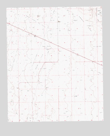
Dallas Store, NM USGS Topographic Map
Click on map above to begin viewing in our Map Viewer.

This topographic map contains these locations and features:
Feature Name Type Latitude Longitude GNIS ID View Map
05004 Water WellWellN33.3673°W103.6075°925221View Map
05005 Water WellWellN33.3432°W103.5988°925253View Map
05022 Water WellWellN33.3051°W103.6213°925289View Map
10002 Water WellWellN33.3287°W103.5583°925273View Map
10668 Water WellWellN33.3723°W103.6100°925343View Map
10671 Water WellWellN33.3557°W103.5669°925329View Map
10672 Water WellWellN33.3568°W103.6011°925332View Map
10675 Water WellWellN33.3543°W103.6233°925324View Map
10676 Water WellWellN33.3462°W103.5647°925244View Map
10677 Water WellWellN33.3440°W103.5825°925309View Map
10678 Water WellWellN33.3409°W103.5675°925261View Map
10679 Water WellWellN33.3329°W103.5750°925262View Map
10680 Water WellWellN33.3398°W103.6227°925258View Map
10684 Water WellWellN33.3126°W103.6163°925284View Map
10685 Water WellWellN33.3262°W103.6030°925268View Map
10688 Water WellWellN33.3673°W103.5047°925220View Map
10690 Water WellWellN33.3573°W103.5205°925228View Map
10697 Water WellWellN33.3271°W103.5080°925270View Map
10698 Water WellWellN33.3359°W103.5352°925266View Map
10699 Water WellWellN33.3171°W103.5436°929821View Map
10738 Water WellWellN33.3048°W103.5927°925288View Map
10739 Water WellWellN33.2909°W103.6102°929799View Map
10740 Water WellWellN33.2971°W103.5897°925295View Map
10741 Water WellWellN33.2926°W103.5733°925303View Map
10755 Water WellWellN33.2968°W103.5341°925293View Map
11267 Water WellWellN33.3032°W103.5688°929811View Map
12647 Water WellWellN33.3590°W103.6005°925333View Map
13054 Water WellWellN33.3746°W103.5663°925344View Map
13230 Water WellWellN33.3515°W103.5152°925321View Map
13387 Water WellWellN33.3568°W103.5358°925331View Map
13407 Water WellWellN33.2982°W103.5152°929806View Map
13531 Water WellWellN33.3371°W103.5591°929838View Map
Acrey RanchLocaleN33.2876°W103.5750°885552View Map
Bagley North Oil FieldOilfieldN33.3593°W103.5855°928869View Map
Bagley Oil FieldOilfieldN33.3182°W103.5822°928870View Map
Bagley West Oil FieldOilfieldN33.3207°W103.6152°928871View Map
Dallas StoreLocaleN33.3437°W103.5872°888186View Map
Fence Line WindmillLocaleN33.3312°W103.5086°888997View Map
Four Lakes RanchLocaleN33.3665°W103.5033°889180View Map
Goat WindmillLocaleN33.3540°W103.5158°889460View Map
Meadow WindmillLocaleN33.3704°W103.5050°891813View Map
Medlin RanchLocaleN33.2773°W103.5377°891832View Map
West Pasture WindmillLocaleN33.3604°W103.5363°896400View Map

Note: Coordinates in the location and feature list above are referenced to NAD83 datum.


Copyright (C) 2008-2025 Ryan Niemi / Sunset Dynamics ... All Rights Reserved