TopoQuest Logo
Do you find TopoQuest useful?
Help keep TopoQuest running and adding new maps/features by donating!
Bitcoin:  19c7KJd3qBynnjoSw5npx9KScwjBe4ifkT
Litecoin:  LXs6TkuXGGXo1vDsWCkWVdjQX94eUKd6ui
Home View Maps Find Maps Find Places Resources & Links


Copeland, Idaho Topographic Map

USGS Map Title: Copeland, ID
USGS Map MRC: 48116H4
DRG (GeoTIFF) Download: o48116h4.tif


Neighboring USGS Topographic Map Quads:


  Smith Falls, ID  
48116H5
 

  Copeland, ID  
48116H4
 

  Hall Mountain, ID  
48116H3
 

  Pyramid Peak, ID  
48116G5
 

  Farnham Peak, ID  
48116G4
 

  Ritz, ID  
48116G3


Map MRC Location:

N49°
W117°
N49°
W116°
H8 H7 H6 H5 H4 H3 H2 H1
G8 G7 G6 G5 G4 G3 G2 G1
F8 F7 F6 F5 F4 F3 F2 F1
E8 E7 E6 E5 E4 E3 E2 E1
D8 D7 D6 D5 D4 D3 D2 D1
C8 C7 C6 C5 C4 C3 C2 C1
B8 B7 B6 B5 B4 B3 B2 B1
A8 A7 A6 A5 A4 A3 A2 A1
N48°
W117°
N48°
W116°

Copeland, ID USGS 1:24K Topographic Map Preview:
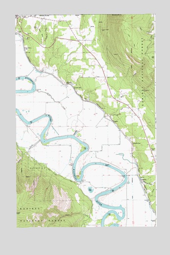
Copeland, ID USGS Topographic Map
Click on map above to begin viewing in our Map Viewer.

This topographic map contains these locations and features:
Feature Name Type Latitude Longitude GNIS ID View Map
Bass LakeLakeN48.9668°W116.4799°398484View Map
Bass Lake AccessLocaleN48.9680°W116.4802°394205View Map
Brush CreekStreamN48.8955°W116.3852°378329View Map
Camp EightLocaleN48.9374°W116.4135°396223View Map
Cedar CreekStreamN48.8911°W116.3821°379096View Map
CopelandPopulated PlaceN48.9022°W116.3888°396326View Map
Copeland CemeteryCemeteryN48.9202°W116.3793°379680View Map
Copeland FerryLocaleN48.9047°W116.4027°379682View Map
Edwards SpurLocaleN48.9238°W116.3960°381266View Map
Fisher CreekStreamN48.8797°W116.4238°381779View Map
Golen Scepter MineMineN48.9911°W116.4244°382426View Map
Hall CreekStreamN48.9405°W116.4174°382827View Map
Hall Mountain Volunteer Fire Department Station 1BuildingN48.9847°W116.4444°2619053View Map
Harpers SpurLocaleN48.9566°W116.4491°382920View Map
Houcks SpurLocaleN48.9594°W116.4555°383461View Map
Independent Order of Odd Fellows CemeteryCemeteryN48.9994°W116.4840°383589View Map
Jerome SloughStreamN48.9290°W116.4481°383893View Map
Kerr LakeLakeN48.8970°W116.4339°384188View Map
KV Farm SpurLocaleN48.9808°W116.4922°384087View Map
Lucas CreekStreamN48.9561°W116.4827°386258View Map
Mission CreekStreamN48.9055°W116.4027°387040View Map
Montgomery MineMineN48.9552°W116.3860°387103View Map
Olds CreekStreamN48.9666°W116.4758°394206View Map
Parker CreekStreamN48.9266°W116.4783°388218View Map
PorthillPopulated PlaceN48.9983°W116.4980°397059View Map
Porthill Post OfficePost OfficeN48.9990°W116.4971°2766869View Map
Seelovers SpurLocaleN48.8827°W116.3758°390095View Map
Stein MountainSummitN48.9933°W116.4810°397210View Map

Note: Coordinates in the location and feature list above are referenced to NAD83 datum.


Copyright (C) 2008-2025 Ryan Niemi / Sunset Dynamics ... All Rights Reserved