TopoQuest Logo
Do you find TopoQuest useful?
Help keep TopoQuest running and adding new maps/features by donating!
Bitcoin:  19c7KJd3qBynnjoSw5npx9KScwjBe4ifkT
Litecoin:  LXs6TkuXGGXo1vDsWCkWVdjQX94eUKd6ui
Home View Maps Find Maps Find Places Resources & Links


Hall Mountain, Idaho Topographic Map

USGS Map Title: Hall Mountain, ID
USGS Map MRC: 48116H3
DRG (GeoTIFF) Download: o48116h3.tif


Neighboring USGS Topographic Map Quads:


  Copeland, ID  
48116H4
 

  Hall Mountain, ID  
48116H3
 

  Eastport, ID  
48116H2
 

  Farnham Peak, ID  
48116G4
 

  Ritz, ID  
48116G3
 

  Meadow Creek, ID  
48116G2


Map MRC Location:

N49°
W117°
N49°
W116°
H8 H7 H6 H5 H4 H3 H2 H1
G8 G7 G6 G5 G4 G3 G2 G1
F8 F7 F6 F5 F4 F3 F2 F1
E8 E7 E6 E5 E4 E3 E2 E1
D8 D7 D6 D5 D4 D3 D2 D1
C8 C7 C6 C5 C4 C3 C2 C1
B8 B7 B6 B5 B4 B3 B2 B1
A8 A7 A6 A5 A4 A3 A2 A1
N48°
W117°
N48°
W116°

Hall Mountain, ID USGS 1:24K Topographic Map Preview:
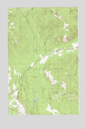
Hall Mountain, ID USGS Topographic Map
Click on map above to begin viewing in our Map Viewer.

This topographic map contains these locations and features:
Feature Name Type Latitude Longitude GNIS ID View Map
American Girl MineMineN48.9183°W116.3310°376594View Map
Bethlehem MineMineN48.8938°W116.3044°377416View Map
Bethlehem MountainSummitN48.9002°W116.2880°399781View Map
Brush LakeLakeN48.8912°W116.3284°378335View Map
Brush Lake CampgroundLocaleN48.8874°W116.3296°394160View Map
Danquist TrailTrailN48.9158°W116.2738°380241View Map
East Fork Mission CreekStreamN48.9869°W116.3430°381138View Map
Hall MountainSummitN48.9738°W116.3716°396604View Map
Hall Mountain TrailTrailN48.9533°W116.3499°382831View Map
Hall Mountain Volunteer Fire Department Station 2BuildingN48.8936°W116.3604°2619194View Map
Harvey MountainSummitN48.9919°W116.2860°396619View Map
Miller Brothers MineMineN48.9486°W116.2985°386961View Map
Miller CreekStreamN48.9438°W116.3010°386969View Map
Mission MountainSummitN48.9944°W116.2983°396905View Map
Mount Hall Elementary SchoolSchoolN48.8945°W116.3603°400660View Map
Round PrairieFlatN48.9522°W116.2721°389664View Map
Tungsten Hill MineMineN48.8997°W116.2758°392450View Map
Tungsten MountainSummitN48.9113°W116.2774°397276View Map
Zion CreekStreamN48.9922°W116.3530°393787View Map

Note: Coordinates in the location and feature list above are referenced to NAD83 datum.


Copyright (C) 2008-2024 Ryan Niemi / Sunset Dynamics ... All Rights Reserved