TopoQuest Logo
Do you find TopoQuest useful?
Help keep TopoQuest running and adding new maps/features by donating!
Bitcoin:  19c7KJd3qBynnjoSw5npx9KScwjBe4ifkT
Litecoin:  LXs6TkuXGGXo1vDsWCkWVdjQX94eUKd6ui
Home View Maps Find Maps Find Places Resources & Links


Cornwall, Virginia Topographic Map

USGS Map Title: Cornwall, VA
USGS Map MRC: 37079G3
DRG (GeoTIFF) Download: o37079g3.tif


Neighboring USGS Topographic Map Quads:


  Goshen, VA  
37079H4
 

  Brownsburg, VA  
37079H3
 

  Vesuvius, VA  
37079H2
 

  Lexington, VA  
37079G4
 

  Cornwall, VA  
37079G3
 

  Montebello, VA  
37079G2
 

  Glasgow, VA  
37079F4
 

  Buena Vista, VA  
37079F3
 

  Forks of Buffalo, VA  
37079F2


Map MRC Location:

N38°
W80°
N38°
W79°
H8 H7 H6 H5 H4 H3 H2 H1
G8 G7 G6 G5 G4 G3 G2 G1
F8 F7 F6 F5 F4 F3 F2 F1
E8 E7 E6 E5 E4 E3 E2 E1
D8 D7 D6 D5 D4 D3 D2 D1
C8 C7 C6 C5 C4 C3 C2 C1
B8 B7 B6 B5 B4 B3 B2 B1
A8 A7 A6 A5 A4 A3 A2 A1
N37°
W80°
N37°
W79°

Cornwall, VA USGS 1:24K Topographic Map Preview:
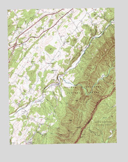
Cornwall, VA USGS Topographic Map
Click on map above to begin viewing in our Map Viewer.

This topographic map contains these locations and features:
Feature Name Type Latitude Longitude GNIS ID View Map
Big Dark HollowValleyN37.8191°W79.2565°1481722View Map
BlacksburgPopulated PlaceN37.8187°W79.3192°1481840View Map
Broad View School (historical)SchoolN37.8732°W79.3709°1779352View Map
Buck HillSummitN37.8685°W79.2745°1492655View Map
Canaan HillSummitN37.8654°W79.3611°1779354View Map
Cherry Orchard HollowValleyN37.7996°W79.3240°1482461View Map
Chestnut SagGapN37.7649°W79.2917°1482510View Map
Chimney Rock MountainSummitN37.7512°W79.3153°1492763View Map
Clarks Church (historical)ChurchN37.8049°W79.2506°1805974View Map
Clarks Mountain CemeteryCemeteryN37.8051°W79.2506°1482551View Map
Coates MountainSummitN37.7896°W79.2942°1482610View Map
Concord ChurchChurchN37.8604°W79.2731°1482680View Map
CornwallPopulated PlaceN37.8046°W79.3186°1492808View Map
Craig CreekStreamN37.8187°W79.2539°1482802View Map
Crossroads StorePopulated PlaceN37.8246°W79.3286°1482857View Map
Cypress FallsLocaleN37.7979°W79.3345°1482891View Map
Deckers HillSummitN37.8090°W79.3203°1492849View Map
Dismal HollowValleyN37.8594°W79.2545°1483026View Map
DonaldsburgPopulated PlaceN37.8437°W79.3086°1492873View Map
Falling RunStreamN37.8476°W79.2720°1483354View Map
Henry HillSummitN37.8376°W79.3261°1484042View Map
Interchange 195CrossingN37.8415°W79.3667°1779375View Map
Irish CreekStreamN37.8118°W79.3164°1484353View Map
Marl CreekStreamN37.7826°W79.3620°1485190View Map
MarlbrookPopulated PlaceN37.8621°W79.2531°1493251View Map
Marlbrook CreekStreamN37.8621°W79.2545°1485194View Map
McClure PeakSummitN37.7621°W79.3067°1485265View Map
McCutchen ChurchChurchN37.7682°W79.3384°1485280View Map
McCutcheons ChapelChurchN37.8090°W79.3161°1805997View Map
McDowell CemeteryCemeteryN37.8687°W79.3106°1485287View Map
MidvalePopulated PlaceN37.8360°W79.2867°1493285View Map
Mill BranchStreamN37.8099°W79.2653°1485402View Map
Mount AtlasSummitN37.8618°W79.3695°1481356View Map
Mountain ViewPopulated PlaceN37.7785°W79.3536°1779383View Map
Mountain View ChurchChurchN37.8054°W79.3439°1485704View Map
Mountain View Elementary SchoolSchoolN37.7813°W79.3561°1485710View Map
Mountain View School (historical)SchoolN37.8018°W79.3495°1779384View Map
Neriah ChurchChurchN37.7874°W79.3648°1485826View Map
Nicholson RunStreamN37.7518°W79.2661°1485873View Map
Paxton HillSummitN37.7990°W79.3548°1493403View Map
Prospect HillsSummitN37.8293°W79.2970°1493457View Map
Rising Zion ChurchChurchN37.8262°W79.3481°1486625View Map
RiversidePopulated PlaceN37.7896°W79.3403°1493493View Map
Riverside ChurchChurchN37.7957°W79.3350°1486640View Map
Rock BranchStreamN37.7965°W79.2792°1486692View Map
Round HillSummitN37.8457°W79.2984°1493508View Map
Roundtop RidgeRidgeN37.7796°W79.3245°1486796View Map
Sheep CreekStreamN37.7987°W79.3350°1487167View Map
Shenandoah Valley Health Care CenterBuildingN37.7507°W79.3513°1501929View Map
South MountainSummitN37.8321°W79.2617°1493631View Map
South River DistrictCivilN37.8329°W79.2730°1927509View Map
Spring Valley ChurchChurchN37.8490°W79.3134°1487466View Map
StewardsburgPopulated PlaceN37.7512°W79.3739°1493655View Map
Stony RunStreamN37.7935°W79.3348°1487630View Map
Timber RidgePopulated PlaceN37.8554°W79.3650°1487916View Map
Timber RidgeRidgeN37.8374°W79.3484°1487918View Map
Timber Ridge CemeteryCemeteryN37.8424°W79.3579°1806016View Map
Timber Ridge ChurchChurchN37.8424°W79.3578°1487923View Map
Whites GapGapN37.7582°W79.2920°1488334View Map
Whites Gap OverlookLocaleN37.7560°W79.2931°1488335View Map
Whites PeakSummitN37.7715°W79.3014°1488336View Map
Whites RunStreamN37.8046°W79.3164°1488337View Map
Whitesides RunStreamN37.8474°W79.2759°1488340View Map
WREL-FM (Buena Vista)TowerN37.7693°W79.3595°1502608View Map

Note: Coordinates in the location and feature list above are referenced to NAD83 datum.


Copyright (C) 2008-2024 Ryan Niemi / Sunset Dynamics ... All Rights Reserved