TopoQuest Logo
Do you find TopoQuest useful?
Help keep TopoQuest running and adding new maps/features by donating!
Bitcoin:  19c7KJd3qBynnjoSw5npx9KScwjBe4ifkT
Litecoin:  LXs6TkuXGGXo1vDsWCkWVdjQX94eUKd6ui
Home View Maps Find Maps Find Places Resources & Links


Costin, North Carolina Topographic Map

USGS Map Title: Costin, NC
USGS Map MRC: 34078E1
DRG (GeoTIFF) Download: o34078e1.tif


Neighboring USGS Topographic Map Quads:


  Harrells, NC  
34078F2
 

  Wallace West, NC  
34078F1
 

  Wallace East, NC  
34077F8
 

  Atkinson, NC  
34078E2
 

  Costin, NC  
34078E1
 

  Burgaw, NC  
34077E8
 

  Point Caswell, NC  
34078D2
 

  Currie, NC  
34078D1
 

  Rocky Point, NC  
34077D8


Map MRC Location:

N35°
W79°
N35°
W78°
H8 H7 H6 H5 H4 H3 H2 H1
G8 G7 G6 G5 G4 G3 G2 G1
F8 F7 F6 F5 F4 F3 F2 F1
E8 E7 E6 E5 E4 E3 E2 E1
D8 D7 D6 D5 D4 D3 D2 D1
C8 C7 C6 C5 C4 C3 C2 C1
B8 B7 B6 B5 B4 B3 B2 B1
A8 A7 A6 A5 A4 A3 A2 A1
N34°
W79°
N34°
W78°

Costin, NC USGS 1:24K Topographic Map Preview:
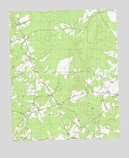
Costin, NC USGS Topographic Map
Click on map above to begin viewing in our Map Viewer.

This topographic map contains these locations and features:
Feature Name Type Latitude Longitude GNIS ID View Map
Bear Den BranchStreamN34.5849°W78.1147°1025115View Map
Bee BranchStreamN34.6027°W78.0464°980887View Map
Buxton BranchStreamN34.5363°W78.0989°1025210View Map
Clear Branch SchoolSchoolN34.5241°W78.1044°983253View Map
CostinPopulated PlaceN34.5832°W78.1014°1019798View Map
Cypress CreekStreamN34.5304°W78.0289°983885View Map
Dry BranchStreamN34.6121°W78.1192°1025291View Map
Herring CemeteryCemeteryN34.5004°W78.0236°1025381View Map
Herring CemeteryCemeteryN34.5077°W78.0511°986654View Map
Herring ChapelChurchN34.5007°W78.0242°986657View Map
Lake ChapelLakeN34.5638°W78.1203°983028View Map
Lake ChapelChurchN34.5616°W78.1222°1004154View Map
Long Creek ChurchChurchN34.5010°W78.0555°988961View Map
Love Grove SchoolSchoolN34.5607°W78.0233°989056View Map
Malpass CornerPopulated PlaceN34.5024°W78.0567°1021333View Map
Mill BranchStreamN34.5357°W78.1092°1025527View Map
Mill BranchStreamN34.5091°W78.0336°989883View Map
Moores Creek ChurchChurchN34.5035°W78.1106°990201View Map
New Hope ChurchChurchN34.5604°W78.0200°1004151View Map
North Carolina State Government Fire TowerTowerN34.5364°W78.0647°2638554View Map
Page CemeteryCemeteryN34.5190°W78.0492°991783View Map
Pender High SchoolSchoolN34.5445°W78.0176°1004153View Map
Piney WoodPopulated PlaceN34.5663°W78.0980°1006331View Map
Red Bank BranchStreamN34.5574°W78.1242°993098View Map
Rhyne CrossroadPopulated PlaceN34.5554°W78.0086°1006349View Map
Shiloh - Columbia Volunteer Fire Department Station 1900BuildingN34.5934°W78.1036°2638831View Map
Shiloh ChurchChurchN34.6002°W78.1080°994685View Map
Taylor BranchStreamN34.5857°W78.1158°995878View Map
The LakeLakeN34.5285°W78.0319°1025747View Map
Township of ColumbiaCivilN34.5926°W78.1171°1027032View Map
Union ChapelChurchN34.5052°W78.0594°996424View Map
Walker CemeteryCemeteryN34.5629°W78.1203°996693View Map
Wards CornerPopulated PlaceN34.5346°W78.0719°1006401View Map
Wells ChapelChurchN34.5313°W78.0008°996949View Map
West Pender Primary SchoolSchoolN34.5282°W78.1030°1025953View Map
Westview ChurchChurchN34.5443°W78.0167°1004152View Map
White Oak BranchStreamN34.5871°W78.1194°1025788View Map
WVBS-FM (Burgaw)TowerN34.5010°W78.0789°1018616View Map

Note: Coordinates in the location and feature list above are referenced to NAD83 datum.


Copyright (C) 2008-2025 Ryan Niemi / Sunset Dynamics ... All Rights Reserved