TopoQuest Logo
Do you find TopoQuest useful?
Help keep TopoQuest running and adding new maps/features by donating!
Bitcoin:  19c7KJd3qBynnjoSw5npx9KScwjBe4ifkT
Litecoin:  LXs6TkuXGGXo1vDsWCkWVdjQX94eUKd6ui
Home View Maps Find Maps Find Places Resources & Links


Cotton City, New Mexico Topographic Map

USGS Map Title: Cotton City, NM
USGS Map MRC: 32108A8
DRG (GeoTIFF) Download: o32108a8.tif


Neighboring USGS Topographic Map Quads:


  Vanar, AZ  
32109B1
 

  Steins, NM  
32108B8
 

  Swallow Fork Peak, NM  
32108B7
 

  San Simon Cienega, NM  
32109A1
 

  Cotton City, NM  
32108A8
 

  Table Top Mountain, NM  
32108A7
 

  Portal NE, AZ  
31109H1
 

  Antelope Pass, NM  
31108H8
 

  Animas, NM  
31108H7


Map MRC Location:

N33°
W109°
N33°
W108°
H8 H7 H6 H5 H4 H3 H2 H1
G8 G7 G6 G5 G4 G3 G2 G1
F8 F7 F6 F5 F4 F3 F2 F1
E8 E7 E6 E5 E4 E3 E2 E1
D8 D7 D6 D5 D4 D3 D2 D1
C8 C7 C6 C5 C4 C3 C2 C1
B8 B7 B6 B5 B4 B3 B2 B1
A8 A7 A6 A5 A4 A3 A2 A1
N32°
W109°
N32°
W108°

Cotton City, NM USGS 1:24K Topographic Map Preview:
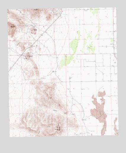
Cotton City, NM USGS Topographic Map
Click on map above to begin viewing in our Map Viewer.

This topographic map contains these locations and features:
Feature Name Type Latitude Longitude GNIS ID View Map
10082 Water WellWellN32.0912°W108.8776°921383View Map
10096 Water WellWellN32.0534°W108.9053°921382View Map
10403 Water WellWellN32.1131°W108.8942°921388View Map
1117 MountainSummitN32.0090°W108.9448°892916View Map
Alf WindmillLocaleN32.0381°W108.8837°885675View Map
Bert WindmillLocaleN32.0459°W108.9170°886264View Map
Blue Hill MineMineN32.1104°W108.9698°886513View Map
Blue MountainSummitN32.1243°W108.9676°886520View Map
Cotton CityPopulated PlaceN32.0884°W108.8792°899592View Map
Cotton City Census Designated PlaceCensusN32.1101°W108.8805°2584082View Map
Cotton City Volunteer Fire Department and Emergency Medical ServicesBuildingN32.1015°W108.8795°2658090View Map
Cowboy PassGapN32.0576°W108.9620°887987View Map
Crystal MineMineN32.1195°W108.9456°888125View Map
Eagle Nest PeakSummitN32.0068°W108.9439°899615View Map
Granddad WindmillLocaleN32.0215°W108.9281°889535View Map
Granite GapGapN32.0887°W108.9737°889546View Map
Granite Gap MinesMineN32.0793°W108.9798°915380View Map
Granite Gap MountainSummitN32.0801°W108.9773°899653View Map
Granite PeakSummitN32.1081°W108.9951°889548View Map
Martin DrawValleyN32.0034°W108.9167°891629View Map
Martin WindmillLocaleN32.0048°W108.9070°891648View Map
McCarty RanchLocaleN32.0634°W108.9478°891720View Map
Montgomery MineMineN32.0787°W108.9787°892177View Map
Preacher MountainSummitN32.1043°W108.9712°893466View Map
Richardson WindmillLocaleN32.1084°W108.9714°893884View Map
Scheelite GroupMineN32.1056°W108.9978°915242View Map
Valley View Community ChurchChurchN32.0884°W108.8792°901844View Map
Vesley MineMineN32.0768°W108.9806°896125View Map
Ward MineMineN32.1087°W108.9801°896251View Map
Washburn RanchLocaleN32.0159°W108.9170°896263View Map
Weatherby CanyonValleyN32.0187°W108.9170°896296View Map
Weatherby RanchLocaleN32.0568°W108.9306°896297View Map

Note: Coordinates in the location and feature list above are referenced to NAD83 datum.


Copyright (C) 2008-2025 Ryan Niemi / Sunset Dynamics ... All Rights Reserved