TopoQuest Logo
Do you find TopoQuest useful?
Help keep TopoQuest running and adding new maps/features by donating!
Bitcoin:  19c7KJd3qBynnjoSw5npx9KScwjBe4ifkT
Litecoin:  LXs6TkuXGGXo1vDsWCkWVdjQX94eUKd6ui
Home View Maps Find Maps Find Places Resources & Links


Vanar, Arizona Topographic Map

USGS Map Title: Vanar, AZ
USGS Map MRC: 32109B1
DRG (GeoTIFF) Download: o32109b1.tif


Neighboring USGS Topographic Map Quads:


  San Simon, AZ  
32109C2
 

  Doubtful Canyon, AZ  
32109C1
 

  Mondel, NM  
32108C8
 

  Vanar NW, AZ  
32109B2
 

  Vanar, AZ  
32109B1
 

  Steins, NM  
32108B8
 

  Blue Mountain, AZ  
32109A2
 

  San Simon Cienega, NM  
32109A1
 

  Cotton City, NM  
32108A8


Map MRC Location:

N33°
W110°
N33°
W109°
H8 H7 H6 H5 H4 H3 H2 H1
G8 G7 G6 G5 G4 G3 G2 G1
F8 F7 F6 F5 F4 F3 F2 F1
E8 E7 E6 E5 E4 E3 E2 E1
D8 D7 D6 D5 D4 D3 D2 D1
C8 C7 C6 C5 C4 C3 C2 C1
B8 B7 B6 B5 B4 B3 B2 B1
A8 A7 A6 A5 A4 A3 A2 A1
N32°
W110°
N32°
W109°

Vanar, AZ USGS 1:24K Topographic Map Preview:
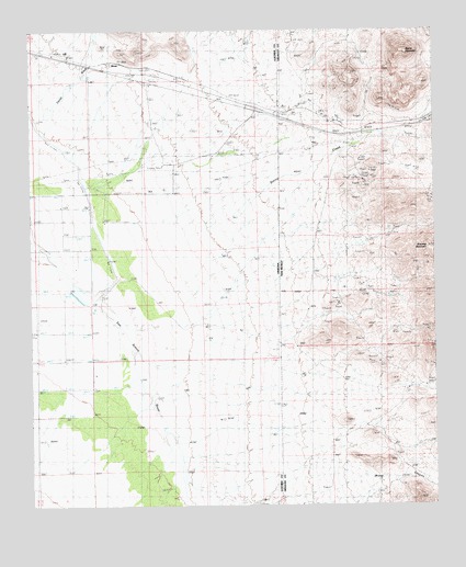
Vanar, AZ USGS Topographic Map
Click on map above to begin viewing in our Map Viewer.

This topographic map contains these locations and features:
Feature Name Type Latitude Longitude GNIS ID View Map
Attorney MountainSummitN32.1925°W109.0006°899512View Map
Barnes RanchLocaleN32.1595°W109.1026°21923View Map
Cavot InterchangeCrossingN32.2292°W109.0520°21978View Map
Dewey ProspectMineN32.1668°W109.0006°915530View Map
Hattie Lee MineMineN32.1668°W109.0006°939525View Map
Horseshoe ProspectMineN32.1668°W109.0006°915385View Map
Ironclad ProspectMineN32.1668°W109.0006°915018View Map
Little Lucile MineMineN32.1668°W109.0006°939595View Map
Mineral Mountain MineMineN32.2112°W109.0242°915029View Map
Mineral Mountain MineMineN32.2104°W109.0234°892099View Map
Peloncillo MountainsRangeN32.2001°W109.0089°43100View Map
San Simon RiverStreamN32.1254°W109.0762°897470View Map
Steins CreekStreamN32.1920°W109.0751°895333View Map
Steins MountainSummitN32.2442°W109.0087°897485View Map
Sweet MineMineN32.1668°W109.0006°939540View Map
VanarPopulated PlaceN32.2412°W109.0951°24673View Map
Vanar Railroad StationBuildingN32.2417°W109.0970°22276View Map
Wood CanyonValleyN32.1298°W109.0001°896741View Map

Note: Coordinates in the location and feature list above are referenced to NAD83 datum.


Copyright (C) 2008-2025 Ryan Niemi / Sunset Dynamics ... All Rights Reserved