TopoQuest Logo
Do you find TopoQuest useful?
Help keep TopoQuest running and adding new maps/features by donating!
Bitcoin:  19c7KJd3qBynnjoSw5npx9KScwjBe4ifkT
Litecoin:  LXs6TkuXGGXo1vDsWCkWVdjQX94eUKd6ui
Home View Maps Find Maps Find Places Resources & Links


Coupland, Texas Topographic Map

USGS Map Title: Coupland, TX
USGS Map MRC: 30097D4
DRG (GeoTIFF) Download: o30097d4.tif


Neighboring USGS Topographic Map Quads:


  Hutto, TX  
30097E5
 

  Taylor, TX  
30097E4
 

  Thrall, TX  
30097E3
 

  Pflugerville East, TX  
30097D5
 

  Coupland, TX  
30097D4
 

  Structure, TX  
30097D3
 

  Manor, TX  
30097C5
 

  Elgin West, TX  
30097C4
 

  Elgin East, TX  
30097C3


Map MRC Location:

N31°
W98°
N31°
W97°
H8 H7 H6 H5 H4 H3 H2 H1
G8 G7 G6 G5 G4 G3 G2 G1
F8 F7 F6 F5 F4 F3 F2 F1
E8 E7 E6 E5 E4 E3 E2 E1
D8 D7 D6 D5 D4 D3 D2 D1
C8 C7 C6 C5 C4 C3 C2 C1
B8 B7 B6 B5 B4 B3 B2 B1
A8 A7 A6 A5 A4 A3 A2 A1
N30°
W98°
N30°
W97°

Coupland, TX USGS 1:24K Topographic Map Preview:
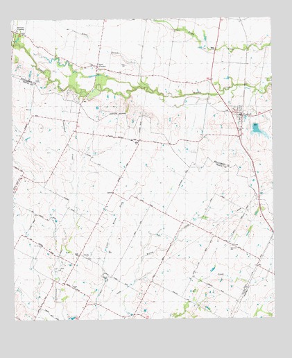
Coupland, TX USGS Topographic Map
Click on map above to begin viewing in our Map Viewer.

This topographic map contains these locations and features:
Feature Name Type Latitude Longitude GNIS ID View Map
Avery BranchStreamN30.4696°W97.4311°1351352View Map
Avery CemeteryCemeteryN30.4808°W97.4444°1351353View Map
CarlsonPopulated PlaceN30.4277°W97.4519°1353827View Map
City of CouplandCivilN30.4365°W97.3861°2761637View Map
CouplandPopulated PlaceN30.4599°W97.3886°1355183View Map
Coupland Elementary SchoolSchoolN30.4544°W97.3906°2009403View Map
Coupland Post OfficePost OfficeN30.4593°W97.3937°2732084View Map
Coupland Volunteer Fire DepartmentBuildingN30.4593°W97.3889°2552506View Map
Crosswinds AirfieldAirportN30.4350°W97.4165°2675973View Map
Kimbro CemeteryCemeteryN30.4952°W97.4936°1360646View Map
Kimbro ChurchChurchN30.3885°W97.4714°1360647View Map
LundPopulated PlaceN30.4066°W97.3964°1361976View Map
MandaPopulated PlaceN30.4027°W97.4683°1362128View Map
NormanPopulated PlaceN30.4941°W97.4942°2034661View Map
Normans CrossingPopulated PlaceN30.4913°W97.4900°1388217View Map
Rices CrossingPopulated PlaceN30.4796°W97.4583°1366416View Map
Rices Crossing SchoolSchoolN30.4946°W97.4553°1384234View Map
Skye Dance AirportAirportN30.3783°W97.4264°2676628View Map
Soil Conservation Service Site 32 DamDamN30.4535°W97.3886°1856854View Map
Soil Conservation Service Site 32 ReservoirReservoirN30.4536°W97.3875°1856855View Map
Willow Ranch SchoolSchoolN30.3944°W97.4553°1371663View Map

Note: Coordinates in the location and feature list above are referenced to NAD83 datum.


Copyright (C) 2008-2024 Ryan Niemi / Sunset Dynamics ... All Rights Reserved