TopoQuest Logo
Do you find TopoQuest useful?
Help keep TopoQuest running and adding new maps/features by donating!
Bitcoin:  19c7KJd3qBynnjoSw5npx9KScwjBe4ifkT
Litecoin:  LXs6TkuXGGXo1vDsWCkWVdjQX94eUKd6ui
Home View Maps Find Maps Find Places Resources & Links


Cow Creek, Colorado Topographic Map

USGS Map Title: Cow Creek, CO
USGS Map MRC: 40106D8
DRG (GeoTIFF) Download: o40106d8.tif


Neighboring USGS Topographic Map Quads:


  Wolf Mountain, CO  
40107E1
 

  Mad Creek, CO  
40106E8
 

  Rocky Peak, CO  
40106E7
 

  Milner, CO  
40107D1
 

  Cow Creek, CO  
40106D8
 

  Steamboat Springs, CO  
40106D7
 

  Rattlesnake Butte, CO  
40107C1
 

  Oak Creek, CO  
40106C8
 

  Blacktail Mountain, CO  
40106C7


Map MRC Location:

N41°
W107°
N41°
W106°
H8 H7 H6 H5 H4 H3 H2 H1
G8 G7 G6 G5 G4 G3 G2 G1
F8 F7 F6 F5 F4 F3 F2 F1
E8 E7 E6 E5 E4 E3 E2 E1
D8 D7 D6 D5 D4 D3 D2 D1
C8 C7 C6 C5 C4 C3 C2 C1
B8 B7 B6 B5 B4 B3 B2 B1
A8 A7 A6 A5 A4 A3 A2 A1
N40°
W107°
N40°
W106°

Cow Creek, CO USGS 1:24K Topographic Map Preview:
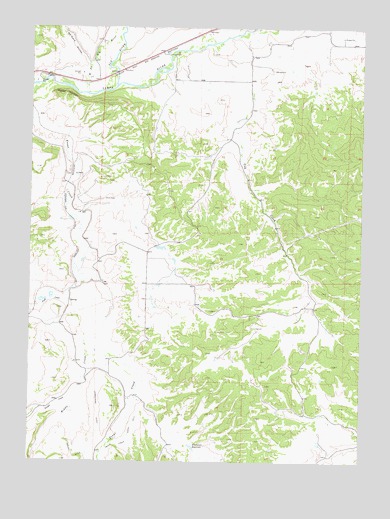
Cow Creek, CO USGS Topographic Map
Click on map above to begin viewing in our Map Viewer.

This topographic map contains these locations and features:
Feature Name Type Latitude Longitude GNIS ID View Map
Apple DamDamN40.4366°W106.9523°201594View Map
Apple Dam ReservoirReservoirN40.4366°W106.9513°201595View Map
Bear River Sand and GravelMineN40.4872°W106.9817°1683337View Map
Chergo MineMineN40.3989°W106.9803°1683338View Map
Connel DitchCanalN40.3778°W106.9837°201996View Map
Cow CreekStreamN40.4950°W106.9337°171426View Map
De Cora GulchValleyN40.4895°W106.9791°172523View Map
Elk RiverStreamN40.4833°W106.9687°172505View Map
Energy Mine Number ThreeMineN40.4191°W106.9848°1683336View Map
Fish CreekStreamN40.4266°W106.9809°171395View Map
Foidel CreekStreamN40.3958°W106.9781°171396View Map
Middle CreekStreamN40.4161°W106.9717°171406View Map
Routt CountyCivilN40.4851°W106.9912°198169View Map
Saddle MountainSummitN40.4800°W106.9862°171407View Map
Steamboat Springs Wastewater Reclamation DamDamN40.4900°W106.9089°201696View Map
Steamboat Springs Wastewater Reclamation ReservoirReservoirN40.4900°W106.9089°201697View Map
Thompson PitMineN40.4844°W106.9820°1683339View Map
Trout Creek Ditch Number 4CanalN40.3805°W106.9645°169464View Map
Upper Robinson DamDamN40.3983°W106.8906°201388View Map
Upper Robinson ReservoirReservoirN40.3991°W106.8903°201389View Map
West Fork Elk RiverStreamN40.4814°W106.9803°171405View Map
Whetstone ReservoirReservoirN40.3793°W106.9389°171427View Map

Note: Coordinates in the location and feature list above are referenced to NAD83 datum.


Copyright (C) 2008-2025 Ryan Niemi / Sunset Dynamics ... All Rights Reserved