TopoQuest Logo
Do you find TopoQuest useful?
Help keep TopoQuest running and adding new maps/features by donating!
Bitcoin:  19c7KJd3qBynnjoSw5npx9KScwjBe4ifkT
Litecoin:  LXs6TkuXGGXo1vDsWCkWVdjQX94eUKd6ui
Home View Maps Find Maps Find Places Resources & Links


Milner, Colorado Topographic Map

USGS Map Title: Milner, CO
USGS Map MRC: 40107D1
DRG (GeoTIFF) Download: o40107d1.tif


Neighboring USGS Topographic Map Quads:


  Hooker Mountain, CO  
40107E2
 

  Wolf Mountain, CO  
40107E1
 

  Mad Creek, CO  
40106E8
 

  Mount Harris, CO  
40107D2
 

  Milner, CO  
40107D1
 

  Cow Creek, CO  
40106D8
 

  Dunckley, CO  
40107C2
 

  Rattlesnake Butte, CO  
40107C1
 

  Oak Creek, CO  
40106C8


Map MRC Location:

N41°
W108°
N41°
W107°
H8 H7 H6 H5 H4 H3 H2 H1
G8 G7 G6 G5 G4 G3 G2 G1
F8 F7 F6 F5 F4 F3 F2 F1
E8 E7 E6 E5 E4 E3 E2 E1
D8 D7 D6 D5 D4 D3 D2 D1
C8 C7 C6 C5 C4 C3 C2 C1
B8 B7 B6 B5 B4 B3 B2 B1
A8 A7 A6 A5 A4 A3 A2 A1
N40°
W108°
N40°
W107°

Milner, CO USGS 1:24K Topographic Map Preview:
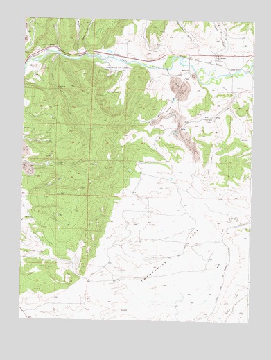
Milner, CO USGS Topographic Map
Click on map above to begin viewing in our Map Viewer.

This topographic map contains these locations and features:
Feature Name Type Latitude Longitude GNIS ID View Map
Bear River (historical)Populated PlaceN40.4839°W107.1173°171402View Map
Bear River MineMineN40.4389°W107.1139°1683225View Map
Blazer MineMineN40.4847°W107.0181°1683231View Map
Butcherknife GulchValleyN40.4853°W107.0958°171257View Map
Cheney CreekStreamN40.4814°W107.0334°171258View Map
Coal ViewLocaleN40.4714°W107.1062°171401View Map
Coal View GulchValleyN40.4848°W107.1064°171400View Map
Curtis MineMineN40.4591°W107.0303°1683227View Map
Elk CreekStreamN40.4711°W107.0103°171398View Map
Elk Creek MineMineN40.4603°W107.0245°1683226View Map
Fish Creek DamDamN40.4933°W107.0506°200020View Map
Fish Creek ReservoirReservoirN40.4933°W107.0506°200021View Map
International MineMineN40.4725°W107.0389°1683228View Map
Little Butcherknife GulchValleyN40.4863°W107.0917°171256View Map
Little Cheney GulchValleyN40.4916°W107.0169°171254View Map
McCrosky GulchValleyN40.4888°W107.0294°171255View Map
McGregorPopulated PlaceN40.4794°W107.0351°171403View Map
McGregor MineMineN40.4583°W107.0362°1683229View Map
Meadows Number One MineMineN40.4850°W107.0192°1683232View Map
MilnerPopulated PlaceN40.4847°W107.0195°171404View Map
Milner LandfillLocaleN40.4708°W107.0356°2678262View Map
Milner Spring CreekStreamN40.4664°W107.0437°171397View Map
Rustic Coal MineMineN40.4797°W107.1128°1683230View Map
Seneca Strip MineMineN40.4333°W107.1103°1683224View Map
Tow CreekStreamN40.4805°W107.0487°171259View Map
Tow Creek Oil FieldOilfieldN40.4805°W107.0756°171399View Map
Trout CreekStreamN40.4761°W107.0212°171394View Map
Trout Creek Number One MineMineN40.4850°W107.0192°1683233View Map
Twenty Mile MineMineN40.4094°W107.0395°1683234View Map
Twentymile ParkFlatN40.4000°W107.0506°201994View Map

Note: Coordinates in the location and feature list above are referenced to NAD83 datum.


Copyright (C) 2008-2025 Ryan Niemi / Sunset Dynamics ... All Rights Reserved