TopoQuest Logo
Do you find TopoQuest useful?
Help keep TopoQuest running and adding new maps/features by donating!
Bitcoin:  19c7KJd3qBynnjoSw5npx9KScwjBe4ifkT
Litecoin:  LXs6TkuXGGXo1vDsWCkWVdjQX94eUKd6ui
Home View Maps Find Maps Find Places Resources & Links


Coyote Creek, Montana Topographic Map

USGS Map Title: Coyote Creek, MT
USGS Map MRC: 45113A3
DRG (GeoTIFF) Download: o45113a3.tif


Neighboring USGS Topographic Map Quads:


  Selway Mountain, MT  
45113B4
 

  Peterson Lake, MT  
45113B3
 

  Brays Canyon, MT  
45113B2
 

  Kitty Creek, MT  
45113A4
 

  Coyote Creek, MT  
45113A3
 

  Bachelor Mountain, MT  
45113A2
 

  Lemhi Pass, MT  
44113H4
 

  Everson Creek, MT  
44113H3
 

  Jeff Davis Peak, MT  
44113H2


Map MRC Location:

N46°
W114°
N46°
W113°
H8 H7 H6 H5 H4 H3 H2 H1
G8 G7 G6 G5 G4 G3 G2 G1
F8 F7 F6 F5 F4 F3 F2 F1
E8 E7 E6 E5 E4 E3 E2 E1
D8 D7 D6 D5 D4 D3 D2 D1
C8 C7 C6 C5 C4 C3 C2 C1
B8 B7 B6 B5 B4 B3 B2 B1
A8 A7 A6 A5 A4 A3 A2 A1
N45°
W114°
N45°
W113°

Coyote Creek, MT USGS 1:24K Topographic Map Preview:
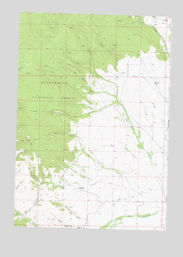
Coyote Creek, MT USGS Topographic Map
Click on map above to begin viewing in our Map Viewer.

This topographic map contains these locations and features:
Feature Name Type Latitude Longitude GNIS ID View Map
09S14W25DDCB01 WellWellN45.0180°W113.2578°807344View Map
09S14W25DDCC01 WellWellN45.0169°W113.2587°807340View Map
Big HollowValleyN45.0071°W113.3667°779825View Map
Frog CreekStreamN45.0280°W113.3073°783760View Map
Grimes CreekStreamN45.0135°W113.2520°784344View Map
Horse Prairie Guard StationLocaleN45.0235°W113.3220°785060View Map
Houlihan SpringsSpringN45.0868°W113.2611°785095View Map
Jensen CreekStreamN45.0580°W113.2784°785460View Map
Jung Fraction MineMineN45.0041°W113.3439°802469View Map
Lodgepole CreekStreamN45.0852°W113.2945°786429View Map
Lower Bloody Dick DitchCanalN45.0185°W113.2856°786659View Map
Monument MineMineN45.0002°W113.3225°802447View Map
Moument MineMineN45.0010°W113.3220°787735View Map
NE NE Section 4 MineMineN45.0002°W113.3348°802463View Map
Poverty FlatsFlatN45.0571°W113.2514°789151View Map
Roberts GulchValleyN45.0049°W113.3092°789635View Map
South Fork Roberts Gulch MineMineN45.0041°W113.3209°802462View Map
Station CreekStreamN45.0230°W113.2764°791464View Map
Stocker RanchLocaleN45.0171°W113.2600°794529View Map
Sunshine MineMineN45.0013°W113.3409°802465View Map
West Coyote CreekStreamN45.0771°W113.2937°792960View Map

Note: Coordinates in the location and feature list above are referenced to NAD83 datum.


Copyright (C) 2008-2025 Ryan Niemi / Sunset Dynamics ... All Rights Reserved