TopoQuest Logo
Do you find TopoQuest useful?
Help keep TopoQuest running and adding new maps/features by donating!
Bitcoin:  19c7KJd3qBynnjoSw5npx9KScwjBe4ifkT
Litecoin:  LXs6TkuXGGXo1vDsWCkWVdjQX94eUKd6ui
Home View Maps Find Maps Find Places Resources & Links


Kitty Creek, Montana Topographic Map

USGS Map Title: Kitty Creek, MT
USGS Map MRC: 45113A4
DRG (GeoTIFF) Download: o45113a4.tif


Neighboring USGS Topographic Map Quads:


  Goldstone Pass, MT  
45113B5
 

  Selway Mountain, MT  
45113B4
 

  Peterson Lake, MT  
45113B3
 

  Goldstone Mountain, ID  
45113A5
 

  Kitty Creek, MT  
45113A4
 

  Coyote Creek, MT  
45113A3
 

  Agency Creek, ID  
44113H5
 

  Lemhi Pass, MT  
44113H4
 

  Everson Creek, MT  
44113H3


Map MRC Location:

N46°
W114°
N46°
W113°
H8 H7 H6 H5 H4 H3 H2 H1
G8 G7 G6 G5 G4 G3 G2 G1
F8 F7 F6 F5 F4 F3 F2 F1
E8 E7 E6 E5 E4 E3 E2 E1
D8 D7 D6 D5 D4 D3 D2 D1
C8 C7 C6 C5 C4 C3 C2 C1
B8 B7 B6 B5 B4 B3 B2 B1
A8 A7 A6 A5 A4 A3 A2 A1
N45°
W114°
N45°
W113°

Kitty Creek, MT USGS 1:24K Topographic Map Preview:
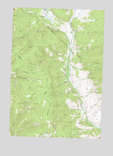
Kitty Creek, MT USGS Topographic Map
Click on map above to begin viewing in our Map Viewer.

This topographic map contains these locations and features:
Feature Name Type Latitude Longitude GNIS ID View Map
Bloody Dick Guard StationLocaleN45.1169°W113.4578°780126View Map
Brenneis CreekStreamN45.0558°W113.4225°780381View Map
Camp CreekStreamN45.0875°W113.4181°780844View Map
Dutch CreekStreamN45.0419°W113.4075°782727View Map
East CreekStreamN45.0838°W113.4203°782791View Map
East Peterson CreekStreamN45.0235°W113.3967°782943View Map
East Terrell CreekStreamN45.0502°W113.4081°782958View Map
Eunice CreekStreamN45.1066°W113.4464°783240View Map
Hamilton GulchValleyN45.0119°W113.3778°784501View Map
Hopps CreekStreamN45.0613°W113.4228°785011View Map
Hughes Cow CampLocaleN45.0830°W113.4167°785143View Map
Hughes GulchValleyN45.0791°W113.4239°785145View Map
Kelly CreekStreamN45.0110°W113.3828°785657View Map
Kelly Creek MineMineN45.0069°W113.4042°802478View Map
Kitty CreekStreamN45.0730°W113.4287°785780View Map
Lake CreekStreamN45.1196°W113.4573°785902View Map
Mooney CreekStreamN45.1191°W113.4151°787610View Map
Pattee Ridge TrailTrailN45.0394°W113.4934°388273View Map
Pyatt SpringsSpringN45.0479°W113.3988°2785592View Map
Pyramid HillSummitN45.0146°W113.4067°789244View Map
Reservoir Lake CampgroundLocaleN45.1216°W113.4542°794525View Map
Selway CreekStreamN45.0994°W113.4173°790212View Map
West Peterson CreekStreamN45.0280°W113.4003°793119View Map
West Terrell CreekStreamN45.0485°W113.4156°793132View Map

Note: Coordinates in the location and feature list above are referenced to NAD83 datum.


Copyright (C) 2008-2024 Ryan Niemi / Sunset Dynamics ... All Rights Reserved