TopoQuest Logo
Do you find TopoQuest useful?
Help keep TopoQuest running and adding new maps/features by donating!
Bitcoin:  19c7KJd3qBynnjoSw5npx9KScwjBe4ifkT
Litecoin:  LXs6TkuXGGXo1vDsWCkWVdjQX94eUKd6ui
Home View Maps Find Maps Find Places Resources & Links


Coyote Draw, New Mexico Topographic Map

USGS Map Title: Coyote Draw, NM
USGS Map MRC: 33104F4
DRG (GeoTIFF) Download: o33104f4.tif


Neighboring USGS Topographic Map Quads:


  Mesa SE, NM  
33104G5
 

  Shannon Draw, NM  
33104G4
 

  Cottonwood Draw, NM  
33104G3
 

  Marley Draw, NM  
33104F5
 

  Coyote Draw, NM  
33104F4
 

  Eightmile Draw, NM  
33104F3
 

  Panther Hill, NM  
33104E5
 

  Melena, NM  
33104E4
 

  Acme, NM  
33104E3


Map MRC Location:

N34°
W105°
N34°
W104°
H8 H7 H6 H5 H4 H3 H2 H1
G8 G7 G6 G5 G4 G3 G2 G1
F8 F7 F6 F5 F4 F3 F2 F1
E8 E7 E6 E5 E4 E3 E2 E1
D8 D7 D6 D5 D4 D3 D2 D1
C8 C7 C6 C5 C4 C3 C2 C1
B8 B7 B6 B5 B4 B3 B2 B1
A8 A7 A6 A5 A4 A3 A2 A1
N33°
W105°
N33°
W104°

Coyote Draw, NM USGS 1:24K Topographic Map Preview:
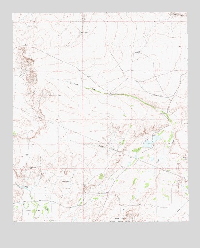
Coyote Draw, NM USGS Topographic Map
Click on map above to begin viewing in our Map Viewer.

This topographic map contains these locations and features:
Feature Name Type Latitude Longitude GNIS ID View Map
10007 Water WellWellN33.6587°W104.4172°930942View Map
10714 Water WellWellN33.6401°W104.3897°930938View Map
10753 Water WellWellN33.7015°W104.4247°931568View Map
10755 Water WellWellN33.6631°W104.4075°931567View Map
10772 Water WellWellN33.6465°W104.4916°930940View Map
10776 Water WellWellN33.6268°W104.4727°931576View Map
10777 Water WellWellN33.6265°W104.4727°931574View Map
10797 Water WellWellN33.6501°W104.3772°930941View Map
Acme Sand PitMineN33.6498°W104.3883°917761View Map
Cocklebur LakesLakeN33.6746°W104.3983°887724View Map
Coons LakeLakeN33.6655°W104.4888°887807View Map
Coyote DrawValleyN33.6526°W104.4066°888017View Map
Dixon WellLocaleN33.6795°W104.4850°888412View Map
Hilltop TankReservoirN33.7382°W104.4513°890023View Map
Milner DrawValleyN33.6701°W104.4069°892077View Map
Red Bluff RanchLocaleN33.7004°W104.3980°893720View Map
Savage WellLocaleN33.7256°W104.4105°894609View Map
Smith WindmillLocaleN33.6262°W104.4730°894955View Map
Stewart TankReservoirN33.6496°W104.4602°895348View Map
TX TankReservoirN33.7421°W104.4892°895480View Map
Yellow LakeLakeN33.6465°W104.4929°896815View Map
Yellow Lake SinkBasinN33.6573°W104.4880°896816View Map

Note: Coordinates in the location and feature list above are referenced to NAD83 datum.


Copyright (C) 2008-2025 Ryan Niemi / Sunset Dynamics ... All Rights Reserved