TopoQuest Logo
Do you find TopoQuest useful?
Help keep TopoQuest running and adding new maps/features by donating!
Bitcoin:  19c7KJd3qBynnjoSw5npx9KScwjBe4ifkT
Litecoin:  LXs6TkuXGGXo1vDsWCkWVdjQX94eUKd6ui
Home View Maps Find Maps Find Places Resources & Links


Cottonwood Draw, New Mexico Topographic Map

USGS Map Title: Cottonwood Draw, NM
USGS Map MRC: 33104G3
DRG (GeoTIFF) Download: o33104g3.tif


Neighboring USGS Topographic Map Quads:


  Swallow Nest Canyon, NM  
33104H4
 

  Deering Place, NM  
33104H3
 

  Hernandez Lake, NM  
33104H2
 

  Shannon Draw, NM  
33104G4
 

  Cottonwood Draw, NM  
33104G3
 

  Haystack Butte, NM  
33104G2
 

  Coyote Draw, NM  
33104F4
 

  Eightmile Draw, NM  
33104F3
 

  Haystack Mountain, NM  
33104F2


Map MRC Location:

N34°
W105°
N34°
W104°
H8 H7 H6 H5 H4 H3 H2 H1
G8 G7 G6 G5 G4 G3 G2 G1
F8 F7 F6 F5 F4 F3 F2 F1
E8 E7 E6 E5 E4 E3 E2 E1
D8 D7 D6 D5 D4 D3 D2 D1
C8 C7 C6 C5 C4 C3 C2 C1
B8 B7 B6 B5 B4 B3 B2 B1
A8 A7 A6 A5 A4 A3 A2 A1
N33°
W105°
N33°
W104°

Cottonwood Draw, NM USGS 1:24K Topographic Map Preview:
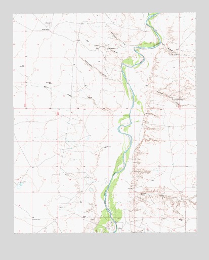
Cottonwood Draw, NM USGS Topographic Map
Click on map above to begin viewing in our Map Viewer.

This topographic map contains these locations and features:
Feature Name Type Latitude Longitude GNIS ID View Map
10686 Water WellWellN33.8668°W104.2827°930951View Map
10687 Water WellWellN33.8665°W104.2830°930950View Map
10688 Water WellWellN33.8362°W104.2827°930949View Map
10690 Water WellWellN33.8054°W104.2930°931566View Map
10691 Water WellWellN33.8070°W104.2933°930948View Map
10692 Water WellWellN33.7954°W104.3125°931565View Map
10693 Water WellWellN33.7954°W104.3339°931564View Map
10694 Water WellWellN33.7776°W104.3161°931563View Map
10695 Water WellWellN33.7776°W104.2977°931562View Map
10696 Water WellWellN33.7631°W104.2997°930944View Map
10697 Water WellWellN33.7649°W104.3434°930945View Map
10744 Water WellWellN33.7765°W104.3672°930947View Map
10745 Water WellWellN33.7679°W104.3411°930946View Map
10748 Water WellWellN33.7593°W104.3597°930943View Map
10749 Water WellWellN33.7513°W104.2844°931571View Map
Alkali DrawValleyN33.8140°W104.3022°885683View Map
Badger WellLocaleN33.7834°W104.3397°885983View Map
Benedict RanchLocaleN33.8656°W104.3502°886211View Map
Bosque DrawValleyN33.7601°W104.3086°886646View Map
Cocklebur DrawValleyN33.8540°W104.2925°887723View Map
Cottonwood DrawValleyN33.8368°W104.2997°887915View Map
Cottonwood RanchLocaleN33.7579°W104.3625°887922View Map
Crockett DrawValleyN33.8251°W104.2930°888077View Map
Crockett SpringSpringN33.8254°W104.2653°888079View Map
Huggins DrawValleyN33.8718°W104.2822°897384View Map
Indian WellLocaleN33.7645°W104.3433°890327View Map
Pollard WellLocaleN33.7790°W104.3705°893389View Map
Rabbit WellLocaleN33.7587°W104.3280°893601View Map
Red SpringSpringN33.8548°W104.3101°893787View Map
Red Spring DrawValleyN33.8468°W104.3000°893789View Map
River WindmillLocaleN33.7987°W104.3130°893981View Map
Sixmile DrawValleyN33.8584°W104.2741°894883View Map
Sixmile SpringSpringN33.8512°W104.2630°923692View Map
South WellLocaleN33.8351°W104.3491°895154View Map

Note: Coordinates in the location and feature list above are referenced to NAD83 datum.


Copyright (C) 2008-2025 Ryan Niemi / Sunset Dynamics ... All Rights Reserved