TopoQuest Logo
Do you find TopoQuest useful?
Help keep TopoQuest running and adding new maps/features by donating!
Bitcoin:  19c7KJd3qBynnjoSw5npx9KScwjBe4ifkT
Litecoin:  LXs6TkuXGGXo1vDsWCkWVdjQX94eUKd6ui
Home View Maps Find Maps Find Places Resources & Links


Craft Point, Oregon Topographic Map

USGS Map Title: Craft Point, OR
USGS Map MRC: 43118G6
DRG (GeoTIFF) Download: o43118g6.tif


Neighboring USGS Topographic Map Quads:


  Calamity Butte, OR  
43118H7
 

  Van, OR  
43118H6
 

  Moffit Table, OR  
43118H5
 

  Telephone Butte, OR  
43118G7
 

  Craft Point, OR  
43118G6
 

  House Butte, OR  
43118G5
 

  Harney, OR  
43118F7
 

  Buchanan, OR  
43118F6
 

  Stinkingwater Pass, OR  
43118F5


Map MRC Location:

N44°
W119°
N44°
W118°
H8 H7 H6 H5 H4 H3 H2 H1
G8 G7 G6 G5 G4 G3 G2 G1
F8 F7 F6 F5 F4 F3 F2 F1
E8 E7 E6 E5 E4 E3 E2 E1
D8 D7 D6 D5 D4 D3 D2 D1
C8 C7 C6 C5 C4 C3 C2 C1
B8 B7 B6 B5 B4 B3 B2 B1
A8 A7 A6 A5 A4 A3 A2 A1
N43°
W119°
N43°
W118°

Craft Point, OR USGS 1:24K Topographic Map Preview:
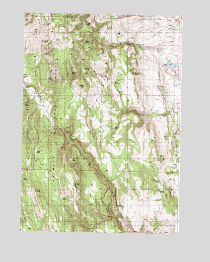
Craft Point, OR USGS Topographic Map
Click on map above to begin viewing in our Map Viewer.

This topographic map contains these locations and features:
Feature Name Type Latitude Longitude GNIS ID View Map
Buck ButteSummitN43.8338°W118.7033°1138741View Map
Craft PointCliffN43.7740°W118.7377°1140352View Map
Craft SpringSpringN43.7685°W118.7180°1140353View Map
Dietrich RanchLocaleN43.8140°W118.6847°1141023View Map
Dietrich SpringSpringN43.8101°W118.6775°1141024View Map
Elephant ButteSummitN43.7652°W118.6702°1141725View Map
Elk SpringSpringN43.8409°W118.6995°1141796View Map
Frog SpringSpringN43.7793°W118.7480°1142508View Map
Halfway SpringSpringN43.8364°W118.7245°1143215View Map
Jones CreekStreamN43.8054°W118.7119°1144379View Map
Jordan SpringSpringN43.8686°W118.7320°1144399View Map
Juniper SpringSpringN43.8591°W118.7340°1144463View Map
Miller DamDamN43.8449°W118.6294°1155619View Map
Miller ReservoirReservoirN43.8467°W118.6337°1146285View Map
Miller SpringSpringN43.8586°W118.7017°1146286View Map
Morgan SpringSpringN43.7955°W118.7385°1146456View Map
Mount TomSummitN43.8690°W118.6999°1151320View Map
Pine Creek Cow CampLocaleN43.8321°W118.7485°1147700View Map
Poer DamDamN43.8365°W118.6777°1153923View Map
Poer ReservoirReservoirN43.8357°W118.6779°1147814View Map
Ralphs SpringSpringN43.8601°W118.7223°1148188View Map
Rifle SpringSpringN43.8222°W118.7484°1148437View Map
Tats SpringSpringN43.8375°W118.7277°1150906View Map
Temple ReservoirReservoirN43.8434°W118.6976°1150961View Map
Thompson MountainSummitN43.7768°W118.7080°1151110View Map
Thompson SpringSpringN43.7877°W118.7120°1151115View Map
Three J SpringSpringN43.8730°W118.7185°1151166View Map
Widow B SpringSpringN43.8409°W118.7120°1152316View Map

Note: Coordinates in the location and feature list above are referenced to NAD83 datum.


Copyright (C) 2008-2025 Ryan Niemi / Sunset Dynamics ... All Rights Reserved