TopoQuest Logo
Do you find TopoQuest useful?
Help keep TopoQuest running and adding new maps/features by donating!
Bitcoin:  19c7KJd3qBynnjoSw5npx9KScwjBe4ifkT
Litecoin:  LXs6TkuXGGXo1vDsWCkWVdjQX94eUKd6ui
Home View Maps Find Maps Find Places Resources & Links


Telephone Butte, Oregon Topographic Map

USGS Map Title: Telephone Butte, OR
USGS Map MRC: 43118G7
DRG (GeoTIFF) Download: o43118g7.tif


Neighboring USGS Topographic Map Quads:


  Trout Creek, OR  
43118H8
 

  Calamity Butte, OR  
43118H7
 

  Van, OR  
43118H6
 

  Devine Ridge North, OR  
43118G8
 

  Telephone Butte, OR  
43118G7
 

  Craft Point, OR  
43118G6
 

  Devine Ridge South, OR  
43118F8
 

  Harney, OR  
43118F7
 

  Buchanan, OR  
43118F6


Map MRC Location:

N44°
W119°
N44°
W118°
H8 H7 H6 H5 H4 H3 H2 H1
G8 G7 G6 G5 G4 G3 G2 G1
F8 F7 F6 F5 F4 F3 F2 F1
E8 E7 E6 E5 E4 E3 E2 E1
D8 D7 D6 D5 D4 D3 D2 D1
C8 C7 C6 C5 C4 C3 C2 C1
B8 B7 B6 B5 B4 B3 B2 B1
A8 A7 A6 A5 A4 A3 A2 A1
N43°
W119°
N43°
W118°

Telephone Butte, OR USGS 1:24K Topographic Map Preview:
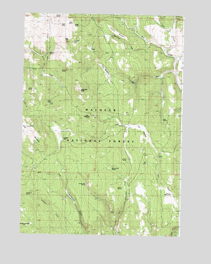
Telephone Butte, OR USGS Topographic Map
Click on map above to begin viewing in our Map Viewer.

This topographic map contains these locations and features:
Feature Name Type Latitude Longitude GNIS ID View Map
Alkali CreekStreamN43.8554°W118.7647°1137132View Map
Beaverdam CreekStreamN43.8602°W118.7752°1137853View Map
Black RockSummitN43.8593°W118.8427°1138215View Map
Black Rock SpringSpringN43.8592°W118.8366°1138221View Map
Cabin MeadowFlatN43.8439°W118.8120°1139113View Map
Call MeadowFlatN43.8111°W118.7809°1139163View Map
Call Meadow Forest Service FacilityLocaleN43.8124°W118.7919°1156176View Map
Call Meadow TrailTrailN43.8649°W118.7922°1139164View Map
Cochran SpringSpringN43.8729°W118.8569°1139881View Map
Harney Road SpringSpringN43.7869°W118.8043°1143313View Map
Haystack MeadowFlatN43.8657°W118.8052°1143417View Map
Ideal SpringSpringN43.8158°W118.7651°1143982View Map
Juniper Flat SpringSpringN43.7786°W118.8246°1144457View Map
Kendall SpringSpringN43.7768°W118.7961°1144551View Map
King MountainSummitN43.8110°W118.8710°1144612View Map
King Mountain LookoutTowerN43.8105°W118.8691°1167371View Map
Lems SpringSpringN43.8321°W118.8674°1144944View Map
Little Black RockSummitN43.8163°W118.8255°1145101View Map
Lowe MillLocaleN43.8032°W118.8452°1145596View Map
Middle Fork Rattlesnake CreekStreamN43.7540°W118.8024°1154171View Map
Miller SpringSpringN43.7922°W118.7786°1146203View Map
Mud SpringSpringN43.8691°W118.8391°1146593View Map
Nichols SpringSpringN43.7931°W118.7928°1146826View Map
Old McKinney Mill (historical)LocaleN43.7560°W118.8677°1133923View Map
P and P SpringSpringN43.8252°W118.8559°1147327View Map
Patterson SpringSpringN43.8427°W118.8453°1147494View Map
Perry MeadowsFlatN43.7732°W118.7588°1147602View Map
R T SpringSpringN43.8553°W118.8227°1148115View Map
Rattlesnake TrailTrailN43.7715°W118.8166°1148247View Map
Sage SpringSpringN43.8693°W118.8445°1148937View Map
Sheep SpringSpringN43.8678°W118.8344°1149358View Map
Telephone ButteSummitN43.8315°W118.8322°1150942View Map
Telephone SpringSpringN43.7723°W118.8714°1150951View Map
Two-Bit SpringSpringN43.8526°W118.8550°1151614View Map
West Fork Pine CreekStreamN43.8427°W118.7555°1152103View Map

Note: Coordinates in the location and feature list above are referenced to NAD83 datum.


Copyright (C) 2008-2024 Ryan Niemi / Sunset Dynamics ... All Rights Reserved