TopoQuest Logo
Do you find TopoQuest useful?
Help keep TopoQuest running and adding new maps/features by donating!
Bitcoin:  19c7KJd3qBynnjoSw5npx9KScwjBe4ifkT
Litecoin:  LXs6TkuXGGXo1vDsWCkWVdjQX94eUKd6ui
Home View Maps Find Maps Find Places Resources & Links


Craig, Colorado Topographic Map

USGS Map Title: Craig, CO
USGS Map MRC: 40107E5
DRG (GeoTIFF) Download: o40107e5.tif


Neighboring USGS Topographic Map Quads:


  Craig NW, CO  
40107F6
 

  Craig NE, CO  
40107F5
 

  McInturf Mesa, CO  
40107F4
 

  Pine Ridge, CO  
40107E6
 

  Craig, CO  
40107E5
 

  Ralph White Lake, CO  
40107E4
 

  Round Bottom, CO  
40107D6
 

  Castor Gulch, CO  
40107D5
 

  Breeze Mountain, CO  
40107D4


Map MRC Location:

N41°
W108°
N41°
W107°
H8 H7 H6 H5 H4 H3 H2 H1
G8 G7 G6 G5 G4 G3 G2 G1
F8 F7 F6 F5 F4 F3 F2 F1
E8 E7 E6 E5 E4 E3 E2 E1
D8 D7 D6 D5 D4 D3 D2 D1
C8 C7 C6 C5 C4 C3 C2 C1
B8 B7 B6 B5 B4 B3 B2 B1
A8 A7 A6 A5 A4 A3 A2 A1
N40°
W108°
N40°
W107°

Craig, CO USGS 1:24K Topographic Map Preview:
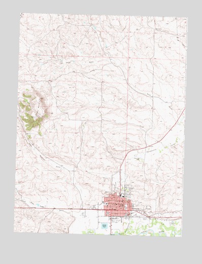
Craig, CO USGS Topographic Map
Click on map above to begin viewing in our Map Viewer.

This topographic map contains these locations and features:
Feature Name Type Latitude Longitude GNIS ID View Map
Breeze SchoolSchoolN40.5175°W107.5492°171300View Map
Cedar MountainSummitN40.5766°W107.6087°171306View Map
Cedar Mountain GulchValleyN40.5129°W107.5740°171305View Map
Centennial MallLocaleN40.5144°W107.5323°1763916View Map
City of CraigCivilN40.5170°W107.5557°2410255View Map
Colorado State Patrol Troop 4B CraigBuildingN40.5063°W107.5565°2757344View Map
Coyote DamDamN40.5300°W107.5856°201642View Map
Coyote ReservoirReservoirN40.5300°W107.5856°201643View Map
CraigPopulated PlaceN40.5152°W107.5465°171304View Map
Craig CemeteryCemeteryN40.5164°W107.5247°2750965View Map
Craig DitchCanalN40.5164°W107.5637°171303View Map
Craig Fire / RescueBuildingN40.5128°W107.5468°2666911View Map
Craig PitMineN40.5066°W107.5073°1683178View Map
Craig Police DepartmentBuildingN40.5060°W107.5564°2757255View Map
Craig Post OfficePost OfficeN40.5150°W107.5553°2750892View Map
Early Childhood CenterSchoolN40.5192°W107.5469°171299View Map
East Elementary SchoolSchoolN40.5168°W107.5370°171302View Map
Edmundson MineMineN40.5216°W107.5151°1683179View Map
Grace PitMineN40.5125°W107.5253°1683180View Map
KRAI-AM (Craig)TowerN40.5458°W107.5317°203994View Map
KRAI-FM (Craig)TowerN40.5764°W107.6087°204111View Map
Memorial Hospital HeliportAirportN40.5186°W107.5456°204326View Map
Moffat County Sheriff's OfficeBuildingN40.5063°W107.5562°2757269View Map
Moon PitMineN40.5133°W107.5253°1683181View Map
Pine Ridge GulchValleyN40.5099°W107.5781°171244View Map
Sand GulchValleyN40.5678°W107.5053°171307View Map
Sandrock Elementary SchoolSchoolN40.5220°W107.5446°171297View Map
Sunset Elementary SchoolSchoolN40.5176°W107.5566°171301View Map
The Memorial Hospital CraigHospitalN40.5185°W107.5798°171298View Map
The Memorial Hospital Medical ClinicBuildingN40.5194°W107.5457°2695602View Map
The Memorial Hospital Rehabilitation CenterHospitalN40.5153°W107.5605°2695634View Map
Three Sisters MineMineN40.5164°W107.5501°1683182View Map

Note: Coordinates in the location and feature list above are referenced to NAD83 datum.


Copyright (C) 2008-2025 Ryan Niemi / Sunset Dynamics ... All Rights Reserved