TopoQuest Logo
Do you find TopoQuest useful?
Help keep TopoQuest running and adding new maps/features by donating!
Bitcoin:  19c7KJd3qBynnjoSw5npx9KScwjBe4ifkT
Litecoin:  LXs6TkuXGGXo1vDsWCkWVdjQX94eUKd6ui
Home View Maps Find Maps Find Places Resources & Links


Cramer, Minnesota Topographic Map

USGS Map Title: Cramer, MN
USGS Map MRC: 47091E1
DRG (GeoTIFF) Download: o47091e1.tif


Neighboring USGS Topographic Map Quads:


  Silver Island Lake, MN  
47091F2
 

  Wilson Lake, MN  
47091F1
 

  Toohey Lake, MN  
47090F8
 

  Cabin Lake, MN  
47091E2
 

  Cramer, MN  
47091E1
 

  Schroeder, MN  
47090E8
 

  Finland, MN  
47091D2


Map MRC Location:

N48°
W92°
N48°
W91°
H8 H7 H6 H5 H4 H3 H2 H1
G8 G7 G6 G5 G4 G3 G2 G1
F8 F7 F6 F5 F4 F3 F2 F1
E8 E7 E6 E5 E4 E3 E2 E1
D8 D7 D6 D5 D4 D3 D2 D1
C8 C7 C6 C5 C4 C3 C2 C1
B8 B7 B6 B5 B4 B3 B2 B1
A8 A7 A6 A5 A4 A3 A2 A1
N47°
W92°
N47°
W91°

Cramer, MN USGS 1:24K Topographic Map Preview:
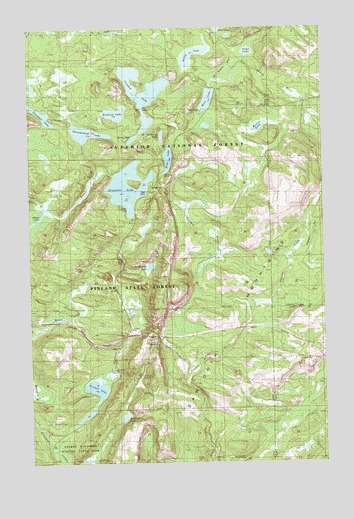
Cramer, MN USGS Topographic Map
Click on map above to begin viewing in our Map Viewer.

This topographic map contains these locations and features:
Feature Name Type Latitude Longitude GNIS ID View Map
Amenda CreekStreamN47.5441°W91.0310°655121View Map
Artlip LakeLakeN47.6183°W91.0533°655155View Map
Bonanza LakeLakeN47.6006°W91.0876°655474View Map
CramerPopulated PlaceN47.5271°W91.0902°655850View Map
Cramer LakeLakeN47.5222°W91.0959°659182View Map
Crooked LakeLakeN47.6064°W91.0758°655885View Map
Echo LakeLakeN47.5873°W91.0657°656112View Map
George H Crosby Manitou State ParkParkN47.5060°W91.1090°1814951View Map
Goldeneye LakeLakeN47.5939°W91.0683°656053View Map
Hare LakeLakeN47.6042°W91.0484°656522View Map
Kowalski LakeLakeN47.5132°W91.0852°659181View Map
Martin CreekStreamN47.5210°W91.0585°659176View Map
Meme LakeLakeN47.5929°W91.0807°657378View Map
Morris LakeLakeN47.5963°W91.0268°657479View Map
Ninemile CampgroundLocaleN47.5791°W91.0735°659183View Map
Ninemile CreekStreamN47.5049°W91.1146°657601View Map
Ninemile LakeLakeN47.5792°W91.0831°657602View Map
Paccini LakeLakeN47.5559°W91.0742°657718View Map
Pearl LakeLakeN47.6178°W91.0310°657761View Map
Shoepack LakeLakeN47.6001°W91.1196°658246View Map
Thunderbird LakeLakeN47.5950°W91.1007°657188View Map

Note: Coordinates in the location and feature list above are referenced to NAD83 datum.


Copyright (C) 2008-2024 Ryan Niemi / Sunset Dynamics ... All Rights Reserved