TopoQuest Logo
Do you find TopoQuest useful?
Help keep TopoQuest running and adding new maps/features by donating!
Bitcoin:  19c7KJd3qBynnjoSw5npx9KScwjBe4ifkT
Litecoin:  LXs6TkuXGGXo1vDsWCkWVdjQX94eUKd6ui
Home View Maps Find Maps Find Places Resources & Links


Finland, Minnesota Topographic Map

USGS Map Title: Finland, MN
USGS Map MRC: 47091D2
DRG (GeoTIFF) Download: o47091d2.tif


Neighboring USGS Topographic Map Quads:


  Isabella, MN  
47091E3
 

  Cabin Lake, MN  
47091E2
 

  Cramer, MN  
47091E1
 

  Doyle Lake, MN  
47091D3
 

  Finland, MN  
47091D2
 

  Little Marais, MN  
47090D8
 

  Silver Bay, MN  
47091C3
 

  Illgen City, MN  
47091C2


Map MRC Location:

N48°
W92°
N48°
W91°
H8 H7 H6 H5 H4 H3 H2 H1
G8 G7 G6 G5 G4 G3 G2 G1
F8 F7 F6 F5 F4 F3 F2 F1
E8 E7 E6 E5 E4 E3 E2 E1
D8 D7 D6 D5 D4 D3 D2 D1
C8 C7 C6 C5 C4 C3 C2 C1
B8 B7 B6 B5 B4 B3 B2 B1
A8 A7 A6 A5 A4 A3 A2 A1
N47°
W92°
N47°
W91°

Finland, MN USGS 1:24K Topographic Map Preview:
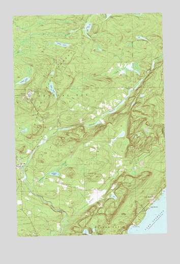
Finland, MN USGS Topographic Map
Click on map above to begin viewing in our Map Viewer.

This topographic map contains these locations and features:
Feature Name Type Latitude Longitude GNIS ID View Map
Bell HarborPopulated PlaceN47.3891°W91.1388°655036View Map
Blesener CreekStreamN47.4627°W91.1432°640258View Map
Blesener LakeLakeN47.4859°W91.1431°640259View Map
Cramer Homestead LakeLakeN47.4996°W91.1698°655851View Map
East Branch Baptism RiverStreamN47.4132°W91.2438°656088View Map
Egge CreekStreamN47.4430°W91.1752°643197View Map
Egge LakeLakeN47.4582°W91.2181°643198View Map
FinlandPopulated PlaceN47.4146°W91.2490°656231View Map
Finland Air Force StationMilitaryN47.4545°W91.2389°2512180View Map
Finland Air Force Station (historical)MilitaryN47.4553°W91.2378°2087611View Map
Finland Crystal Bay CemeteryCemeteryN47.4117°W91.1626°643632View Map
Finland Lookout TowerTowerN47.4563°W91.2321°659835View Map
Finland State ForestForestN47.4521°W91.2246°656232View Map
Finland Volunteer Fire DepartmentBuildingN47.4117°W91.2458°2666408View Map
Johnson LakeLakeN47.3763°W91.1918°645711View Map
Kennedy LandingPopulated PlaceN47.3794°W91.1507°654774View Map
Lake TwentythreeLakeN47.4920°W91.1871°654514View Map
Leskinen CreekStreamN47.3982°W91.2332°646610View Map
Leskinen LakeLakeN47.4102°W91.2179°646611View Map
Little Marais PostofficePopulated PlaceN47.3955°W91.1349°654801View Map
Lookout LakeLakeN47.4632°W91.2418°647156View Map
MaplePopulated PlaceN47.4580°W91.1518°654816View Map
Sawmill CreekStreamN47.3816°W91.2082°651249View Map
Schoolhouse CreekStreamN47.4663°W91.1577°651779View Map
Slade LakeLakeN47.4488°W91.1512°652143View Map
Sonju LakeLakeN47.4833°W91.2092°652254View Map
West Branch Baptism RiverStreamN47.4132°W91.2438°658941View Map

Note: Coordinates in the location and feature list above are referenced to NAD83 datum.


Copyright (C) 2008-2025 Ryan Niemi / Sunset Dynamics ... All Rights Reserved