TopoQuest Logo
Do you find TopoQuest useful?
Help keep TopoQuest running and adding new maps/features by donating!
Bitcoin:  19c7KJd3qBynnjoSw5npx9KScwjBe4ifkT
Litecoin:  LXs6TkuXGGXo1vDsWCkWVdjQX94eUKd6ui
Home View Maps Find Maps Find Places Resources & Links


Crannell, California Topographic Map

USGS Map Title: Crannell, CA
USGS Map MRC: 41124A1
DRG (GeoTIFF) Download: o41124a1.tif


Neighboring USGS Topographic Map Quads:


  Rodgers Peak, CA  
41124B1
 

  Bald Hills, CA  
41123B8


  Crannell, CA  
41124A1
 

  Panther Creek, CA  
41123A8
 

  Tyee City, CA  
40124H2
 

  Arcata North, CA  
40124H1
 

  Blue Lake, CA  
40123H8


Map MRC Location:

N42°
W125°
N42°
W124°
H8 H7 H6 H5 H4 H3 H2 H1
G8 G7 G6 G5 G4 G3 G2 G1
F8 F7 F6 F5 F4 F3 F2 F1
E8 E7 E6 E5 E4 E3 E2 E1
D8 D7 D6 D5 D4 D3 D2 D1
C8 C7 C6 C5 C4 C3 C2 C1
B8 B7 B6 B5 B4 B3 B2 B1
A8 A7 A6 A5 A4 A3 A2 A1
N41°
W125°
N41°
W124°

Crannell, CA USGS 1:24K Topographic Map Preview:
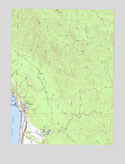
Crannell, CA USGS Topographic Map
Click on map above to begin viewing in our Map Viewer.

This topographic map contains these locations and features:
Feature Name Type Latitude Longitude GNIS ID View Map
Adams Fox FarmLocaleN41.0571°W124.1026°1682427View Map
Beach CreekStreamN41.0876°W124.0465°218771View Map
Buckley RanchLocaleN41.0071°W124.0890°1682428View Map
Bulwinkle CreekStreamN41.0104°W124.0909°220141View Map
Camp Twenty (historical)LocaleN41.0332°W124.0081°1682429View Map
Clam Beach County ParkParkN41.0001°W124.1148°221140View Map
Clam Beach PondsLakeN41.0035°W124.1115°1702450View Map
Clear CreekStreamN41.0921°W124.0176°221193View Map
Coon CreekStreamN41.0101°W124.0890°221502View Map
CrannellPopulated PlaceN41.0118°W124.0848°1655935View Map
Eighteen CreekStreamN41.0490°W124.0873°223005View Map
Freeman CreekStreamN41.0221°W124.0548°223859View Map
Grassy CreekStreamN41.0515°W124.0859°224478View Map
Honda CoveBayN41.0351°W124.1176°225512View Map
Houda Point AccessLocaleN41.0360°W124.1187°1702457View Map
Little RiverStreamN41.0271°W124.1112°227344View Map
Little River RockIslandN41.0354°W124.1234°227346View Map
Little River State BeachParkN41.0162°W124.1098°227347View Map
Lower South Fork Little RiverStreamN41.0287°W124.0187°227791View Map
Luffenholtz Beach County ParkParkN41.0401°W124.1201°1702460View Map
Luffenholtz CreekStreamN41.0415°W124.1198°227836View Map
M Line CreekStreamN41.0915°W124.0873°227880View Map
MoonstonePopulated PlaceN41.0301°W124.1095°1656179View Map
Moonstone BeachBeachN41.0301°W124.1123°254347View Map
Moonstone County ParkParkN41.0293°W124.1117°1702462View Map
North Coastal DivisionCivilN41.0944°W124.0111°1935222View Map
North Fork Luffenholtz CreekStreamN41.0543°W124.1070°254983View Map
Peters RanchLocaleN41.0115°W124.0945°1682436View Map
Railroad CreekStreamN41.0279°W124.0503°255014View Map
Reimann RanchLocaleN41.0051°W124.1015°1682438View Map
South Fork Little RiverStreamN41.0121°W124.0620°235022View Map
South Fork Luffenholtz CreekStreamN41.0493°W124.0953°254346View Map
Strawberry PrairieAreaN41.0112°W124.0984°254342View Map
Tepona PointCapeN41.0398°W124.1215°236121View Map
The GapGapN41.0957°W124.0473°236170View Map
Twentyone RockPillarN41.0651°W124.0915°236681View Map
Water GulchValleyN41.0137°W124.0612°237326View Map
WesthavenPopulated PlaceN41.0360°W124.1112°237548View Map
Westhaven Volunteer Fire DepartmentBuildingN41.0355°W124.1101°2621827View Map
Westhaven-Moonstone Census Designated PlaceCensusN41.0447°W124.1023°2409573View Map

Note: Coordinates in the location and feature list above are referenced to NAD83 datum.


Copyright (C) 2008-2024 Ryan Niemi / Sunset Dynamics ... All Rights Reserved