TopoQuest Logo
Do you find TopoQuest useful?
Help keep TopoQuest running and adding new maps/features by donating!
Bitcoin:  19c7KJd3qBynnjoSw5npx9KScwjBe4ifkT
Litecoin:  LXs6TkuXGGXo1vDsWCkWVdjQX94eUKd6ui
Home View Maps Find Maps Find Places Resources & Links


Bald Hills, California Topographic Map

USGS Map Title: Bald Hills, CA
USGS Map MRC: 41123B8
DRG (GeoTIFF) Download: o41123b8.tif


Neighboring USGS Topographic Map Quads:


  Orick, CA  
41124C1
 

  Holter Ridge, CA  
41123C8
 

  Johnsons, CA  
41123C7
 

  Rodgers Peak, CA  
41124B1
 

  Bald Hills, CA  
41123B8
 

  French Camp Ridge, CA  
41123B7
 

  Crannell, CA  
41124A1
 

  Panther Creek, CA  
41123A8
 

  Hupa Mountain, CA  
41123A7


Map MRC Location:

N42°
W124°
N42°
W123°
H8 H7 H6 H5 H4 H3 H2 H1
G8 G7 G6 G5 G4 G3 G2 G1
F8 F7 F6 F5 F4 F3 F2 F1
E8 E7 E6 E5 E4 E3 E2 E1
D8 D7 D6 D5 D4 D3 D2 D1
C8 C7 C6 C5 C4 C3 C2 C1
B8 B7 B6 B5 B4 B3 B2 B1
A8 A7 A6 A5 A4 A3 A2 A1
N41°
W124°
N41°
W123°

Bald Hills, CA USGS 1:24K Topographic Map Preview:
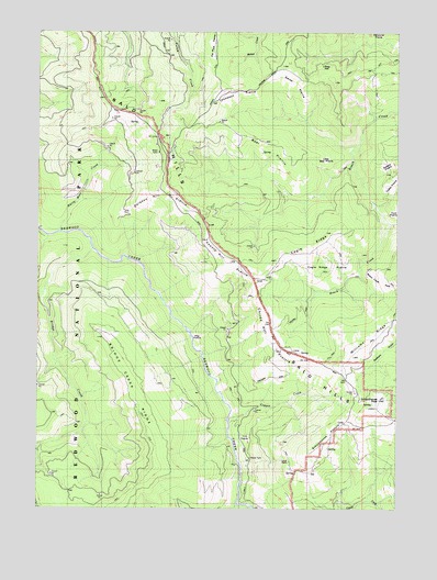
Bald Hills, CA USGS Topographic Map
Click on map above to begin viewing in our Map Viewer.

This topographic map contains these locations and features:
Feature Name Type Latitude Longitude GNIS ID View Map
Anton Lyons RanchLocaleN41.1843°W123.9215°218307View Map
Bald HillsRangeN41.1852°W123.9248°218576View Map
Bald Hills SchoolSchoolN41.2190°W123.9553°218578View Map
Bear PrairieAreaN41.2182°W123.9231°218871View Map
Bridge CreekStreamN41.1921°W123.9823°219823View Map
Bridge Creek RidgeRidgeN41.1374°W123.9601°1665205View Map
Cagle RidgeRidgeN41.1871°W123.9212°220367View Map
Cagle Ridge PrairieAreaN41.1890°W123.9031°220368View Map
Childs Hill PrairieAreaN41.1687°W123.9170°220989View Map
Copper CreekStreamN41.1493°W123.9342°1665211View Map
Counts Hill PrairieAreaN41.1843°W123.9387°221678View Map
Cuddy CabinLocaleN41.2104°W123.8765°221900View Map
Cuddy PrairieAreaN41.2101°W123.8781°1665213View Map
Devils CreekStreamN41.1262°W123.9306°222295View Map
Doiason Hill PrairieAreaN41.2076°W123.9573°222472View Map
Elk CampLocaleN41.2237°W123.9595°223102View Map
Graham and McCombs RanchLocaleN41.2257°W123.9651°1682568View Map
Griffith Place (historical)LocaleN41.1729°W123.8953°1682569View Map
Harry Weir CreekStreamN41.1973°W123.9937°1654912View Map
Hog PrairieAreaN41.1698°W123.9456°1665233View Map
Little Bear PrairieAreaN41.2165°W123.9012°1665248View Map
Pitt Place PrairieFlatN41.2471°W123.9406°233359View Map
Roach Creek HoleAreaN41.1846°W123.8812°1665273View Map
Schoolhouse PastureAreaN41.1446°W123.8987°1665279View Map
Schoolhouse Pasture RockPillarN41.1462°W123.8967°232685View Map
Schoolhouse PeakSummitN41.1533°W123.8819°232686View Map
Schoolhouse Peak LookoutLocaleN41.1515°W123.8828°1682580View Map
Sidehill PrairieAreaN41.2140°W123.8795°233078View Map
Smith PrairieAreaN41.2365°W123.9145°234718View Map
Thompson PrairieAreaN41.2318°W123.9312°236279View Map
Tick PrairieAreaN41.1435°W123.9284°1665293View Map
Tomlinson Brothers RanchLocaleN41.1676°W123.9137°1682581View Map

Note: Coordinates in the location and feature list above are referenced to NAD83 datum.


Copyright (C) 2008-2025 Ryan Niemi / Sunset Dynamics ... All Rights Reserved