TopoQuest Logo
Do you find TopoQuest useful?
Help keep TopoQuest running and adding new maps/features by donating!
Bitcoin:  19c7KJd3qBynnjoSw5npx9KScwjBe4ifkT
Litecoin:  LXs6TkuXGGXo1vDsWCkWVdjQX94eUKd6ui
Home View Maps Find Maps Find Places Resources & Links


Crazy Mountain, Colorado Topographic Map

USGS Map Title: Crazy Mountain, CO
USGS Map MRC: 40105H8
DRG (GeoTIFF) Download: o40105h8.tif


Neighboring USGS Topographic Map Quads:


  Woods Landing, WY  
41106A1
 

  Jelm Mountain, WY  
41105A8
 

  Downey Lakes, WY  
41105A7
 

  Old Roach, CO  
40106H1
 

  Crazy Mountain, CO  
40105H8
 

  Sand Creek Pass, CO  
40105H7
 

  Shipman Mountain, CO  
40106G1
 

  Glendevey, CO  
40105G8
 

  Deadman, CO  
40105G7


Map MRC Location:

N41°
W106°
N41°
W105°
H8 H7 H6 H5 H4 H3 H2 H1
G8 G7 G6 G5 G4 G3 G2 G1
F8 F7 F6 F5 F4 F3 F2 F1
E8 E7 E6 E5 E4 E3 E2 E1
D8 D7 D6 D5 D4 D3 D2 D1
C8 C7 C6 C5 C4 C3 C2 C1
B8 B7 B6 B5 B4 B3 B2 B1
A8 A7 A6 A5 A4 A3 A2 A1
N40°
W106°
N40°
W105°

Crazy Mountain, CO USGS 1:24K Topographic Map Preview:
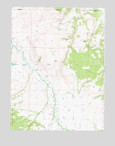
Crazy Mountain, CO USGS Topographic Map
Click on map above to begin viewing in our Map Viewer.

This topographic map contains these locations and features:
Feature Name Type Latitude Longitude GNIS ID View Map
Bluebell CreekStreamN40.9153°W105.9095°170058View Map
Crazy MountainSummitN40.9403°W105.9533°170071View Map
Dempsey DomeSummitN40.9272°W105.9683°170074View Map
East LakeLakeN40.9411°W105.9817°170078View Map
Forrester CemeteryCemeteryN40.9422°W105.9797°170079View Map
Forrester CreekStreamN40.9364°W105.9714°170455View Map
Forrester Ditch Number 1CanalN40.9333°W105.9895°170067View Map
Frenchwoman CreekStreamN40.9164°W105.9111°170059View Map
Grace CreekStreamN40.9603°W105.9983°171002View Map
Granny CreekStreamN40.9461°W105.9806°170060View Map
Hills DitchCanalN40.8766°W105.9339°201891View Map
Hohnholz Lakes CampgroundLocaleN40.9361°W105.9683°170076View Map
Homestead Ditch 1CanalN40.8941°W105.9808°2722915View Map
Homestead Ditch 2CanalN40.8896°W105.9822°2722919View Map
Horse Ranch PassGapN40.9591°W105.9256°170073View Map
Jenkins CreekStreamN40.8925°W105.9611°170453View Map
Jim DitchCanalN40.8833°W105.8836°170069View Map
Jimmy CreekStreamN40.9158°W105.9358°170056View Map
Jimmy Creek DitchCanalN40.9222°W105.9486°170066View Map
La Garde CreekStreamN40.9216°W105.9517°170308View Map
La Garde DitchCanalN40.9151°W105.9533°2723196View Map
Little Hohnholtz DamDamN40.9416°W105.9981°198866View Map
Little Hohnholz LakeLakeN40.9417°W105.9980°170077View Map
Little Jenkins CreekStreamN40.8922°W105.9658°170454View Map
Lower La Garde DitchCanalN40.9278°W105.9672°170065View Map
Mansfield and Enlargement DitchCanalN40.9583°W105.9878°170070View Map
Mansfield DitchCanalN40.9528°W105.9911°170068View Map
McIntyre CreekStreamN40.8989°W105.9422°170057View Map
Pache DitchCanalN40.8916°W105.9570°170063View Map
Pfister DrawValleyN40.9634°W105.9937°170061View Map
Red MountainSummitN40.9947°W105.9350°201894View Map
Red Mountain PassGapN40.9830°W105.9367°170075View Map
Smith Brown DitchCanalN40.8972°W105.9395°170062View Map
Trollop CreekStreamN40.8953°W105.9014°170055View Map
Whiskey SpringsSpringN40.9458°W105.9387°170072View Map
Yelton DitchCanalN40.9083°W105.9450°170064View Map

Note: Coordinates in the location and feature list above are referenced to NAD83 datum.


Copyright (C) 2008-2025 Ryan Niemi / Sunset Dynamics ... All Rights Reserved