TopoQuest Logo
Do you find TopoQuest useful?
Help keep TopoQuest running and adding new maps/features by donating!
Bitcoin:  19c7KJd3qBynnjoSw5npx9KScwjBe4ifkT
Litecoin:  LXs6TkuXGGXo1vDsWCkWVdjQX94eUKd6ui
Home View Maps Find Maps Find Places Resources & Links


Cresson, Texas Topographic Map

USGS Map Title: Cresson, TX
USGS Map MRC: 32097E5
DRG (GeoTIFF) Download: o32097e5.tif


Neighboring USGS Topographic Map Quads:


  Annetta, TX  
32097F6
 

  Aledo, TX  
32097F5
 

  Benbrook, TX  
32097F4
 

  Chapin, TX  
32097E6
 

  Cresson, TX  
32097E5
 

  Primrose, TX  
32097E4
 

  Acton, TX  
32097D6
 

  Godley, TX  
32097D5
 

  Joshua, TX  
32097D4


Map MRC Location:

N33°
W98°
N33°
W97°
H8 H7 H6 H5 H4 H3 H2 H1
G8 G7 G6 G5 G4 G3 G2 G1
F8 F7 F6 F5 F4 F3 F2 F1
E8 E7 E6 E5 E4 E3 E2 E1
D8 D7 D6 D5 D4 D3 D2 D1
C8 C7 C6 C5 C4 C3 C2 C1
B8 B7 B6 B5 B4 B3 B2 B1
A8 A7 A6 A5 A4 A3 A2 A1
N32°
W98°
N32°
W97°

Cresson, TX USGS 1:24K Topographic Map Preview:
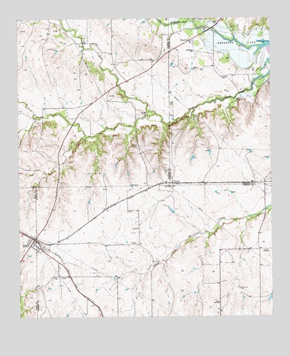
Cresson, TX USGS Topographic Map
Click on map above to begin viewing in our Map Viewer.

This topographic map contains these locations and features:
Feature Name Type Latitude Longitude GNIS ID View Map
BossPopulated PlaceN32.5557°W97.5081°1378036View Map
Bourland FieldAirportN32.5818°W97.5908°1386665View Map
Chicken StripAirportN32.5149°W97.5950°2717039View Map
Chigger FieldAirportN32.5343°W97.5891°2675947View Map
City of CressonCivilN32.5299°W97.6154°2410263View Map
Clark DamDamN32.5085°W97.5003°1861381View Map
Clark LakeReservoirN32.5085°W97.5003°1861382View Map
CressonPopulated PlaceN32.5326°W97.6178°1333663View Map
Cresson CemeteryCemeteryN32.5168°W97.6059°1333664View Map
Cresson City OfficeBuildingN32.5312°W97.6211°2754016View Map
Cresson Post OfficePost OfficeN32.5308°W97.6214°2731531View Map
Cresson Volunteer Fire DepartmentBuildingN32.5302°W97.6190°2551425View Map
Day - Radcliff CemeteryCemeteryN32.5857°W97.5639°1334115View Map
Dickeys BranchStreamN32.5751°W97.5934°1334344View Map
Goforth CemeteryCemeteryN32.5891°W97.5491°1336642View Map
Keyes CemeteryCemeteryN32.6082°W97.5217°1339068View Map
South Bear CreekStreamN32.5851°W97.5572°1347404View Map
WheatlandPopulated PlaceN32.6160°W97.5397°1379262View Map
Wheatland SchoolSchoolN32.6112°W97.5378°1349897View Map
WinscottPopulated PlaceN32.5562°W97.5492°1379287View Map

Note: Coordinates in the location and feature list above are referenced to NAD83 datum.


Copyright (C) 2008-2025 Ryan Niemi / Sunset Dynamics ... All Rights Reserved