TopoQuest Logo
Do you find TopoQuest useful?
Help keep TopoQuest running and adding new maps/features by donating!
Bitcoin:  19c7KJd3qBynnjoSw5npx9KScwjBe4ifkT
Litecoin:  LXs6TkuXGGXo1vDsWCkWVdjQX94eUKd6ui
Home View Maps Find Maps Find Places Resources & Links


Godley, Texas Topographic Map

USGS Map Title: Godley, TX
USGS Map MRC: 32097D5
DRG (GeoTIFF) Download: o32097d5.tif


Neighboring USGS Topographic Map Quads:


  Chapin, TX  
32097E6
 

  Cresson, TX  
32097E5
 

  Primrose, TX  
32097E4
 

  Acton, TX  
32097D6
 

  Godley, TX  
32097D5
 

  Joshua, TX  
32097D4
 

  Nemo, TX  
32097C6
 

  Bono, TX  
32097C5
 

  Cleburne West, TX  
32097C4


Map MRC Location:

N33°
W98°
N33°
W97°
H8 H7 H6 H5 H4 H3 H2 H1
G8 G7 G6 G5 G4 G3 G2 G1
F8 F7 F6 F5 F4 F3 F2 F1
E8 E7 E6 E5 E4 E3 E2 E1
D8 D7 D6 D5 D4 D3 D2 D1
C8 C7 C6 C5 C4 C3 C2 C1
B8 B7 B6 B5 B4 B3 B2 B1
A8 A7 A6 A5 A4 A3 A2 A1
N32°
W98°
N32°
W97°

Godley, TX USGS 1:24K Topographic Map Preview:
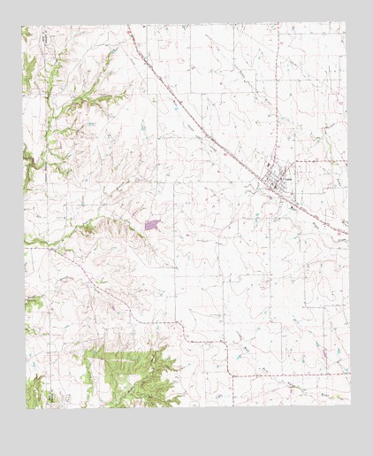
Godley, TX USGS Topographic Map
Click on map above to begin viewing in our Map Viewer.

This topographic map contains these locations and features:
Feature Name Type Latitude Longitude GNIS ID View Map
Aresti AerodromeAirportN32.4707°W97.5603°1386737View Map
Bethel Baptist ChurchChurchN32.4554°W97.5442°2022727View Map
City of GodleyCivilN32.4512°W97.5322°2410607View Map
Coppenger Farm AirportAirportN32.4195°W97.5371°1386735View Map
GodleyPopulated PlaceN32.4490°W97.5267°1336634View Map
Godley CemeteryCemeteryN32.4357°W97.5300°1336635View Map
Godley City HallBuildingN32.4469°W97.5284°2753818View Map
Godley DivisionCivilN32.4187°W97.5501°1938785View Map
Godley Elementary SchoolSchoolN32.4576°W97.5289°2007083View Map
Godley Fire DepartmentBuildingN32.4463°W97.5292°2551419View Map
Godley High SchoolSchoolN32.4535°W97.5297°2007084View Map
Godley Middle SchoolSchoolN32.4518°W97.5314°2007085View Map
Godley Police DepartmentBuildingN32.4470°W97.5291°2738952View Map
Godley Post OfficePost OfficeN32.4470°W97.5283°2731689View Map
Hawkins Private AirportAirportN32.4762°W97.5020°1386736View Map
Lake CharcaReservoirN32.4348°W97.5759°1862912View Map
Lake Charca DamDamN32.4335°W97.5786°1862911View Map
Little Fall CreekStreamN32.4543°W97.6228°1374580View Map
Lone Cottonwood CemeteryCemeteryN32.4049°W97.5495°1340365View Map
Unity CemeteryCemeteryN32.4935°W97.5789°1349100View Map

Note: Coordinates in the location and feature list above are referenced to NAD83 datum.


Copyright (C) 2008-2024 Ryan Niemi / Sunset Dynamics ... All Rights Reserved