TopoQuest Logo
Do you find TopoQuest useful?
Help keep TopoQuest running and adding new maps/features by donating!
Bitcoin:  19c7KJd3qBynnjoSw5npx9KScwjBe4ifkT
Litecoin:  LXs6TkuXGGXo1vDsWCkWVdjQX94eUKd6ui
Home View Maps Find Maps Find Places Resources & Links


Crestview, California Topographic Map

USGS Map Title: Crestview, CA
USGS Map MRC: 37118G8
DRG (GeoTIFF) Download: o37118g8.tif


Neighboring USGS Topographic Map Quads:


  Lee Vining, CA  
37119H1
 

  Mono Mills, CA  
37118H8
 

  Cowtrack Mountain, CA  
37118H7
 

  June Lake, CA  
37119G1
 

  Crestview, CA  
37118G8
 

  Dexter Canyon, CA  
37118G7
 

  Mammoth Mountain, CA  
37119F1
 

  Old Mammoth, CA  
37118F8
 

  Whitmore Hot Springs, CA  
37118F7


Map MRC Location:

N38°
W119°
N38°
W118°
H8 H7 H6 H5 H4 H3 H2 H1
G8 G7 G6 G5 G4 G3 G2 G1
F8 F7 F6 F5 F4 F3 F2 F1
E8 E7 E6 E5 E4 E3 E2 E1
D8 D7 D6 D5 D4 D3 D2 D1
C8 C7 C6 C5 C4 C3 C2 C1
B8 B7 B6 B5 B4 B3 B2 B1
A8 A7 A6 A5 A4 A3 A2 A1
N37°
W119°
N37°
W118°

Crestview, CA USGS 1:24K Topographic Map Preview:
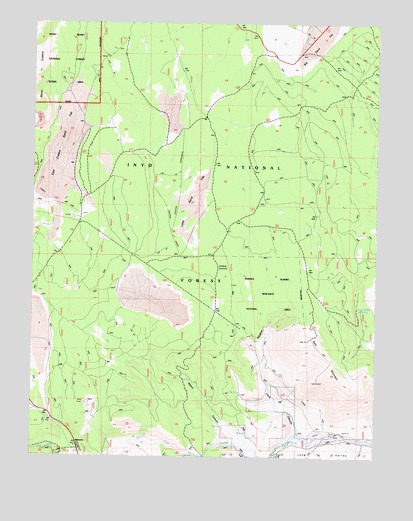
Crestview, CA USGS Topographic Map
Click on map above to begin viewing in our Map Viewer.

This topographic map contains these locations and features:
Feature Name Type Latitude Longitude GNIS ID View Map
Alpers CanyonValleyN37.7566°W118.9274°256199View Map
Bald MountainSummitN37.7838°W118.9012°256457View Map
Bald Mountain LookoutLocaleN37.7838°W118.9015°275590View Map
Bald Mountain SpringSpringN37.7928°W118.8813°256470View Map
Bald Mountain Springs Camping AreaLocaleN37.7926°W118.8813°2547593View Map
Big SpringsSpringN37.7507°W118.9409°257022View Map
Clark CanyonValleyN37.7566°W118.9029°258398View Map
CrestviewPopulated PlaceN37.7524°W118.9843°1655939View Map
Deadman CreekStreamN37.7502°W118.9388°259131View Map
East Craters Sand FlatFlatN37.8427°W118.9915°259699View Map
East PortalLocaleN37.7574°W118.8907°259770View Map
Glass Creek CampgroundLocaleN37.7535°W118.9979°275591View Map
Indiana SummitSummitN37.8047°W118.9318°1656091View Map
Indiana Summit Research Natural AreaParkN37.7974°W118.9160°275589View Map
Inyo National ForestForestN37.8329°W118.9920°855668View Map
Little Sand FlatFlatN37.8269°W118.9415°262712View Map
Owens River RanchLocaleN37.7502°W118.9232°267100View Map

Note: Coordinates in the location and feature list above are referenced to NAD83 datum.


Copyright (C) 2008-2025 Ryan Niemi / Sunset Dynamics ... All Rights Reserved