TopoQuest Logo
Do you find TopoQuest useful?
Help keep TopoQuest running and adding new maps/features by donating!
Bitcoin:  19c7KJd3qBynnjoSw5npx9KScwjBe4ifkT
Litecoin:  LXs6TkuXGGXo1vDsWCkWVdjQX94eUKd6ui
Home View Maps Find Maps Find Places Resources & Links


Crooks Peak, Wyoming Topographic Map

USGS Map Title: Crooks Peak, WY
USGS Map MRC: 42107C7
DRG (GeoTIFF) Download: o42107c7.tif


Neighboring USGS Topographic Map Quads:


  Crooks Mountain, WY  
42107D8
 

  Jeffrey City, WY  
42107D7
 

  Split Rock NW, WY  
42107D6
 

  Brenton Springs, WY  
42107C8
 

  Crooks Peak, WY  
42107C7
 

  Sagebrush Park, WY  
42107C6
 

  Antelope Reservoir, WY  
42107B8
 

  Osborne Well, WY  
42107B7
 

  Hadsell Spring, WY  
42107B6


Map MRC Location:

N43°
W108°
N43°
W107°
H8 H7 H6 H5 H4 H3 H2 H1
G8 G7 G6 G5 G4 G3 G2 G1
F8 F7 F6 F5 F4 F3 F2 F1
E8 E7 E6 E5 E4 E3 E2 E1
D8 D7 D6 D5 D4 D3 D2 D1
C8 C7 C6 C5 C4 C3 C2 C1
B8 B7 B6 B5 B4 B3 B2 B1
A8 A7 A6 A5 A4 A3 A2 A1
N42°
W108°
N42°
W107°

Crooks Peak, WY USGS 1:24K Topographic Map Preview:
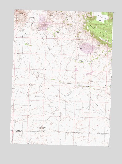
Crooks Peak, WY USGS Topographic Map
Click on map above to begin viewing in our Map Viewer.

This topographic map contains these locations and features:
Feature Name Type Latitude Longitude GNIS ID View Map
B Seventeen-Eighteen MineMineN42.3158°W107.7659°1746559View Map
Bare Ring ButteSummitN42.2650°W107.8362°1585119View Map
Bare Ring SloughStreamN42.3202°W107.8481°1596767View Map
Big Bertha MineMineN42.2697°W107.7854°1746560View Map
Big Eagle MineMineN42.3194°W107.7917°1746548View Map
Butte MineMineN42.2691°W107.8629°1746561View Map
Crooks Creek ReservoirReservoirN42.3302°W107.7980°1587248View Map
Crooks GapGapN42.3675°W107.8523°1587249View Map
Crooks PeakSummitN42.3713°W107.8670°1587252View Map
Fourth CreekStreamN42.3055°W107.7592°1588697View Map
J.J Claims Number Four MineMineN42.3708°W107.8623°1746549View Map
Jenson RanchLocaleN42.3291°W107.7887°1590092View Map
Jost CreekStreamN42.3027°W107.7620°1590241View Map
Lost Creek ClaimsMineN42.3561°W107.8033°1746550View Map
McIntosh PitMineN42.3561°W107.8425°1746551View Map
McThomas Number Two MineMineN42.3561°W107.8237°1746552View Map
Rock DamDamN42.3333°W107.7923°1608448View Map
Rock ReservoirReservoirN42.3333°W107.7923°1608449View Map
Sand SpringSpringN42.3106°W107.7763°1593910View Map
Sheep Creek ParkFlatN42.3700°W107.7626°1594196View Map
Sheep MountainSummitN42.3724°W107.8137°1594207View Map
Sheep Mountain Number One MineMineN42.3705°W107.8234°1746562View Map
Snoball MineMineN42.3705°W107.8429°1746553View Map
Snoball Number Three MineMineN42.3750°W107.8381°1703982View Map
Spring CreekStreamN42.3450°W107.8667°1594870View Map
Sun and Sunday ClaimsMineN42.3719°W107.7939°1746557View Map
Sun Number Four MineMineN42.3727°W107.8231°1746556View Map
Sun Number Three P Sundog Number Two MineMineN42.3688°W107.8306°1746555View Map
Taggart MeadowsFlatN42.3277°W107.7892°1595298View Map
Troy Number Thirteen MineMineN42.3730°W107.8231°1746558View Map
Utah MineMineN42.3416°W107.7848°1746563View Map
Waverly ClaimsMineN42.3561°W107.8619°1746554View Map
West Fork Crooks CreekStreamN42.3497°W107.8623°1596185View Map

Note: Coordinates in the location and feature list above are referenced to NAD83 datum.


Copyright (C) 2008-2024 Ryan Niemi / Sunset Dynamics ... All Rights Reserved