TopoQuest Logo
Do you find TopoQuest useful?
Help keep TopoQuest running and adding new maps/features by donating!
Bitcoin:  19c7KJd3qBynnjoSw5npx9KScwjBe4ifkT
Litecoin:  LXs6TkuXGGXo1vDsWCkWVdjQX94eUKd6ui
Home View Maps Find Maps Find Places Resources & Links


Jeffrey City, Wyoming Topographic Map

USGS Map Title: Jeffrey City, WY
USGS Map MRC: 42107D7
DRG (GeoTIFF) Download: o42107d7.tif


Neighboring USGS Topographic Map Quads:


  Graham Ranch, WY  
42107E8
 

  Stampede Meadow, WY  
42107E7
 

  Black Rock Gap, WY  
42107E6
 

  Crooks Mountain, WY  
42107D8
 

  Jeffrey City, WY  
42107D7
 

  Split Rock NW, WY  
42107D6
 

  Brenton Springs, WY  
42107C8
 

  Crooks Peak, WY  
42107C7
 

  Sagebrush Park, WY  
42107C6


Map MRC Location:

N43°
W108°
N43°
W107°
H8 H7 H6 H5 H4 H3 H2 H1
G8 G7 G6 G5 G4 G3 G2 G1
F8 F7 F6 F5 F4 F3 F2 F1
E8 E7 E6 E5 E4 E3 E2 E1
D8 D7 D6 D5 D4 D3 D2 D1
C8 C7 C6 C5 C4 C3 C2 C1
B8 B7 B6 B5 B4 B3 B2 B1
A8 A7 A6 A5 A4 A3 A2 A1
N42°
W108°
N42°
W107°

Jeffrey City, WY USGS 1:24K Topographic Map Preview:
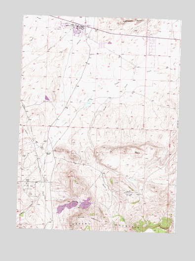
Jeffrey City, WY USGS Topographic Map
Click on map above to begin viewing in our Map Viewer.

This topographic map contains these locations and features:
Feature Name Type Latitude Longitude GNIS ID View Map
Beatrice MineMineN42.4186°W107.8320°1703961View Map
Betty Mae ClaimsMineN42.3847°W107.8422°1746573View Map
Common School Section Lease MineMineN42.3994°W107.8237°1703962View Map
Congo Incline MineMineN42.3902°W107.8312°1703957View Map
Continental MineMineN42.3850°W107.8281°1703963View Map
Continental Section Sixteen MineMineN42.3994°W107.8237°1703964View Map
Crooks Gap MineMineN42.3908°W107.8345°1703965View Map
Crooks Gap MineMineN42.3900°W107.8298°1746572View Map
Crooks Gap Oil FieldOilfieldN42.3986°W107.8667°1587250View Map
Fluke Number One MineMineN42.3844°W107.8734°1726289View Map
Golden Goose Number Four MineMineN42.3875°W107.8337°1703966View Map
Golden Goose Number One MineMineN42.3847°W107.8145°1703958View Map
Golden Goose Number Two MineMineN42.3844°W107.8226°1703959View Map
Green MountainsRangeN42.3766°W107.8159°1589123View Map
Hazel Number Four MineMineN42.4186°W107.8320°1746574View Map
Hazel Number Three MineMineN42.4175°W107.8284°1703967View Map
Helen May MineMineN42.3902°W107.8415°1703968View Map
Ion Exchange MineMineN42.3930°W107.8320°1726423View Map
Jeffrey CityPopulated PlaceN42.4947°W107.8273°1590071View Map
Jeffrey City Census Designated PlaceCensusN42.4808°W107.8256°2408442View Map
Jeffrey City High SchoolSchoolN42.4947°W107.8273°1795495View Map
Jeffrey City Junior High SchoolSchoolN42.4947°W107.8273°1795496View Map
Jeffrey City SchoolSchoolN42.4947°W107.8273°1795497View Map
Jeffrey City Volunteer Fire DepartmentBuildingN42.4936°W107.8274°2673641View Map
Jim D Number Six MineMineN42.3991°W107.8429°1703969View Map
John Kirk RanchLocaleN42.4188°W107.8531°1590141View Map
Kirk DamDamN42.4500°W107.8490°1606220View Map
Kirk ReservoirReservoirN42.4500°W107.8490°1606221View Map
L.J. Bergstein Claims MineMineN42.4086°W107.8301°1703970View Map
Lost Eight MineMineN42.4283°W107.8429°1703971View Map
Mason CreekStreamN42.3958°W107.8551°1596858View Map
N H MineMineN42.4325°W107.8223°1703972View Map
O'Brian CreekStreamN42.4975°W107.8645°1592330View Map
Pay Dirt North Incline MineMineN42.4986°W107.8240°1703985View Map
Paydirt MineMineN42.3852°W107.8229°1703973View Map
Paydirt Number Four MineMineN42.3850°W107.8231°1703976View Map
Paydirt Number Three MineMineN42.3850°W107.8281°1703975View Map
Paydirt Number Two MineMineN42.3852°W107.8229°1703974View Map
Ravine MineMineN42.3991°W107.8220°1703977View Map
Reserve MineMineN42.3908°W107.8198°1703960View Map
Roberts Number 2 DamDamN42.3916°W107.8340°1608440View Map
Roberts Number 2 ReservoirReservoirN42.3916°W107.8340°1608441View Map
Seismic MineMineN42.3888°W107.8281°1703978View Map
Seismic Number One MineMineN42.3875°W107.8381°1703979View Map
Sheep CreekStreamN42.4666°W107.7820°1594193View Map
Sheep Creek Oil FieldOilfieldN42.3977°W107.7865°1594195View Map
Shinkolobwe MineMineN42.3994°W107.8234°1703984View Map
Sioux and Mary Number One MineMineN42.3952°W107.8379°1703980View Map
Snoball Number Two MineMineN42.3875°W107.8381°1703981View Map
Summit Claim MineMineN42.4175°W107.8184°1703983View Map
Sun and Sunday ClaimsMineN42.3844°W107.8297°1746575View Map

Note: Coordinates in the location and feature list above are referenced to NAD83 datum.


Copyright (C) 2008-2025 Ryan Niemi / Sunset Dynamics ... All Rights Reserved