TopoQuest Logo
Do you find TopoQuest useful?
Help keep TopoQuest running and adding new maps/features by donating!
Bitcoin:  19c7KJd3qBynnjoSw5npx9KScwjBe4ifkT
Litecoin:  LXs6TkuXGGXo1vDsWCkWVdjQX94eUKd6ui
Home View Maps Find Maps Find Places Resources & Links


Crow Agency, Montana Topographic Map

USGS Map Title: Crow Agency, MT
USGS Map MRC: 45107E4
DRG (GeoTIFF) Download: o45107e4.tif


Neighboring USGS Topographic Map Quads:


  Hardin, MT  
45107F5
 

  Little Dry Creek, MT  
45107F4
 

  Crow Agency NE, MT  
45107F3
 

  Prante Ranch, MT  
45107E5
 

  Crow Agency, MT  
45107E4
 

  Crow Agency SE, MT  
45107E3
 

  Saint Xavier NE, MT  
45107D5
 

  Benteen, MT  
45107D4
 

  Lodge Grass NE, MT  
45107D3


Map MRC Location:

N46°
W108°
N46°
W107°
H8 H7 H6 H5 H4 H3 H2 H1
G8 G7 G6 G5 G4 G3 G2 G1
F8 F7 F6 F5 F4 F3 F2 F1
E8 E7 E6 E5 E4 E3 E2 E1
D8 D7 D6 D5 D4 D3 D2 D1
C8 C7 C6 C5 C4 C3 C2 C1
B8 B7 B6 B5 B4 B3 B2 B1
A8 A7 A6 A5 A4 A3 A2 A1
N45°
W108°
N45°
W107°

Crow Agency, MT USGS 1:24K Topographic Map Preview:
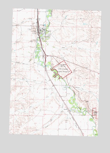
Crow Agency, MT USGS Topographic Map
Click on map above to begin viewing in our Map Viewer.

This topographic map contains these locations and features:
Feature Name Type Latitude Longitude GNIS ID View Map
02S34E25CD__01 WellWellN45.6222°W107.4665°810612View Map
02S34E35BBAB01 WellWellN45.6222°W107.4918°810613View Map
02S34E36AB__01 WellWellN45.6186°W107.4612°810583View Map
02S34E36AC__01 WellWellN45.6150°W107.4612°810552View Map
02S34E36ACCC01 WellWellN45.6155°W107.4634°810564View Map
02S34E36ACCC02 WellWellN45.6155°W107.4634°810565View Map
02S34E36CA__01 WellWellN45.6114°W107.4665°810522View Map
02S34E36CA__02 WellWellN45.6114°W107.4665°810523View Map
02S34E36DB__01 WellWellN45.6114°W107.4612°810515View Map
02S34E36DB__02 WellWellN45.6114°W107.4612°810516View Map
02S34E36DB__03 WellWellN45.6114°W107.4612°810517View Map
02S34E36DB__04 WellWellN45.6114°W107.4612°810518View Map
02S34E36DB__05 WellWellN45.6114°W107.4612°810519View Map
02S34E36DB__06 WellWellN45.6114°W107.4612°810520View Map
02S34E36DB__07 WellWellN45.6114°W107.4612°810521View Map
02S34E36DD__01 WellWellN45.6078°W107.4562°810474View Map
02S35E30CCBC01 WellWellN45.6244°W107.4526°810628View Map
02S35E31BB__01 WellWellN45.6191°W107.4512°810598View Map
02S35E31BC__01 WellWellN45.6155°W107.4512°810563View Map
03S34E01AA__01 WellWellN45.6033°W107.4545°810440View Map
03S34E01AC__01 WellWellN45.5997°W107.4598°810400View Map
03S34E01AC__04 WellWellN45.5997°W107.4598°810401View Map
03S34E01AC__05 WellWellN45.5997°W107.4598°810402View Map
03S34E01AC__06 WellWellN45.5997°W107.4598°810403View Map
03S34E01AC__07 WellWellN45.5997°W107.4598°810404View Map
03S34E01AC__08 WellWellN45.5997°W107.4598°810405View Map
03S34E01AD__01 WellWellN45.5997°W107.4545°810398View Map
03S34E01AD__02 WellWellN45.5997°W107.4545°810399View Map
03S34E01BA__01 WellWellN45.6033°W107.4651°810441View Map
03S34E01BD__01 WellWellN45.5997°W107.4651°810406View Map
03S34E01DC__01 WellWellN45.5925°W107.4598°810341View Map
03S34E12DA__01 WellWellN45.5816°W107.4545°810248View Map
03S34E12DBAB01 WellWellN45.5853°W107.4595°810271View Map
03S34E12DCBA01 WellWellN45.5816°W107.4618°810249View Map
03S34E13AA__01 WellWellN45.5744°W107.4545°810222View Map
03S34E13AB__01 WellWellN45.5744°W107.4598°810223View Map
03S34E13DA__01 WellWellN45.5672°W107.4545°810161View Map
03S34E24AA__01 WellWellN45.5597°W107.4545°810117View Map
03S34E24AAAC01 WellWellN45.5625°W107.4543°810130View Map
03S34E36DC__01 WellWellN45.5200°W107.4598°809934View Map
03S35E13CDAA01 WellWellN45.5675°W107.4637°810164View Map
03S35E18BA__01 WellWellN45.5755°W107.4443°810227View Map
03S35E18BC__01 WellWellN45.5719°W107.4495°810206View Map
03S35E18DABD01 WellWellN45.5703°W107.4345°810197View Map
03S35E18DCBD01 WellWellN45.5661°W107.4406°810155View Map
03S35E18DCCB01 WellWellN45.5650°W107.4418°810152View Map
03S35E19AABA01 WellWellN45.5639°W107.4495°810139View Map
03S35E19AABA02 WellWellN45.5639°W107.4495°810140View Map
03S35E19BA__01 WellWellN45.5608°W107.4443°810123View Map
03S35E19BC__01 WellWellN45.5572°W107.4495°810108View Map
03S35E19CA__01 WellWellN45.5536°W107.4443°810092View Map
03S35E19CBDD01 WellWellN45.5541°W107.4479°810095View Map
03S35E19CC__01 WellWellN45.5500°W107.4495°810076View Map
03S35E19CD__01 WellWellN45.5500°W107.4443°810075View Map
03S35E19DC__01 WellWellN45.5500°W107.4393°810074View Map
03S35E19DCDA01 WellWellN45.5511°W107.4381°810081View Map
03S35E19DD__01 WellWellN45.5500°W107.4340°810073View Map
03S35E20CC__01 WellWellN45.5500°W107.4287°810072View Map
03S35E24AADB01 WellWellN45.5622°W107.4543°810129View Map
03S35E29ABCC01 WellWellN45.5464°W107.4212°810056View Map
03S35E29BDAA01 WellWellN45.5453°W107.4212°810053View Map
03S35E29CA__01 WellWellN45.5391°W107.4237°810034View Map
03S35E29CC__01 WellWellN45.5355°W107.4287°810021View Map
03S35E29CC__02 WellWellN45.5355°W107.4287°810022View Map
03S35E29CD__01 WellWellN45.5355°W107.4237°810020View Map
03S35E29CDBA01 WellWellN45.5380°W107.4240°810027View Map
03S35E29DA__01 WellWellN45.5391°W107.4134°810031View Map
03S35E29DA__02 WellWellN45.5391°W107.4134°810032View Map
03S35E29DB__01 WellWellN45.5391°W107.4184°810033View Map
03S35E30AB__01 WellWellN45.5464°W107.4393°810057View Map
03S35E30BA__01 WellWellN45.5464°W107.4443°810058View Map
03S35E30BADA01 WellWellN45.5475°W107.4429°810060View Map
03S35E30DA__01 WellWellN45.5391°W107.4340°810035View Map
03S35E32AB__01 WellWellN45.5319°W107.4184°810000View Map
03S35E32AC__01 WellWellN45.5283°W107.4184°809982View Map
03S35E32BA__01 WellWellN45.5319°W107.4237°810001View Map
03S35E32DB__01 WellWellN45.5247°W107.4184°809964View Map
03S35E32DB__02 WellWellN45.5247°W107.4184°809965View Map
03S35E32DBDA01 WellWellN45.5264°W107.4168°809972View Map
03S35E32DDABO1 WellWellN45.5241°W107.4131°809960View Map
0435S05ACAA01_ WellWellN45.5169°W107.4165°809915View Map
04S35E03BB__01 WellWellN45.5166°W107.3884°809908View Map
04S35E03CB__01 WellWellN45.5094°W107.3884°809862View Map
04S35E03CD__01 WellWellN45.5058°W107.3834°809843View Map
04S35E04AABC01 WellWellN45.5200°W107.3951°809933View Map
04S35E04AACC01 WellWellN45.5180°W107.3945°809923View Map
04S35E04AB__01 WellWellN45.5166°W107.3984°809909View Map
04S35E04BB__01 WellWellN45.5166°W107.4084°809910View Map
04S35E04BB__02 WellWellN45.5166°W107.4084°809911View Map
04S35E04BBBC01 WellWellN45.5202°W107.4101°809937View Map
04S35E04BBBC02 WellWellN45.5202°W107.4101°809938View Map
04S35E04BC__01 WellWellN45.5130°W107.4084°809883View Map
04S35E04DDDD01 WellWellN45.5075°W107.3904°809851View Map
04S35E05AA__01 WellWellN45.5166°W107.4137°809912View Map
04S35E05AB__01 WellWellN45.5166°W107.4187°809913View Map
04S35E05CDCC01 WellWellN45.5066°W107.4262°809848View Map
04S35E06AA__01 WellWellN45.5166°W107.4337°809914View Map
04S35E06AAAB01 WellWellN45.5202°W107.4326°809940View Map
04S35E06AAAB02 WellWellN45.5202°W107.4326°809941View Map
04S35E06AAAB03 WellWellN45.5202°W107.4312°809939View Map
04S35E06AAAB03 WellWellN45.5202°W107.4326°809942View Map
04S35E06BDCD01 WellWellN45.5144°W107.4443°809893View Map
04S35E09AA__01 WellWellN45.5022°W107.3934°809821View Map
04S35E09AB__01 WellWellN45.5022°W107.3984°809822View Map
04S35E09BA__01 WellWellN45.5022°W107.4034°809823View Map
04S35E10BB__01 WellWellN45.5022°W107.3884°809820View Map
Absaloka Baptist ChurchChurchN45.6016°W107.4612°1716333View Map
B B Naylor DamDamN45.6000°W107.3806°797160View Map
Battle RidgeSummitN45.5672°W107.4234°1956267View Map
Brush CouleeValleyN45.6139°W107.4698°769306View Map
Burgess Memorial Baptist ChurchChurchN45.6016°W107.4612°1716332View Map
Calhoun HillSummitN45.5639°W107.4176°1956268View Map
Cedar CouleeValleyN45.5408°W107.3834°1956269View Map
Crow AgencyLocaleN45.6041°W107.4645°1716282View Map
Crow AgencyPopulated PlaceN45.6016°W107.4612°770332View Map
Crow Agency CemeteryCemeteryN45.6044°W107.4737°770333View Map
Crow Agency Census Designated PlaceCensusN45.6026°W107.4591°2407687View Map
Crow Agency Fire DepartmentBuildingN45.6025°W107.4558°1716316View Map
Crow Agency Police DepartmentBuildingN45.5795°W107.4491°1716315View Map
Crow Agency Post OfficePost OfficeN45.6017°W107.4612°2781816View Map
Crow Agency Post Office (historical)Post OfficeN45.6016°W107.4612°1716281View Map
Crow Agency SchoolSchoolN45.6051°W107.4586°1716413View Map
Crow Agency Sewage Lagoons DamDamN45.6100°W107.4540°797191View Map
Crow Number 59 DamDamN45.5366°W107.3773°797163View Map
Crow Number 6 DamDamN45.6116°W107.3990°797162View Map
Crow Revival CenterChurchN45.6016°W107.4612°1716335View Map
Custer CreekStreamN45.5980°W107.4573°770390View Map
Custer National CemeteryCemeteryN45.5700°W107.4320°770391View Map
D S Scott Number 2 DamDamN45.6166°W107.4256°797161View Map
Dawussuua AshkaateStreamN45.5533°W107.4501°777123View Map
Deep CouleeValleyN45.5489°W107.4181°770542View Map
Deep RavineValleyN45.5608°W107.4334°1956270View Map
GarryowenPopulated PlaceN45.5266°W107.4195°771723View Map
Garryowen (historical)LocaleN45.5264°W107.4195°1716272View Map
Garryowen Historical MarkerParkN45.5277°W107.4193°1716395View Map
Garryowen Mission School (historical)SchoolN45.5277°W107.4312°1716421View Map
Garryowen Post OfficePost OfficeN45.5267°W107.4167°1716271View Map
Greasy Grass RidgeRidgeN45.5589°W107.4234°1956271View Map
IHS Crow / Northern Cheyenne HospitalHospitalN45.5821°W107.4488°1716382View Map
Interchange 509CrossingN45.6014°W107.4626°1716390View Map
Interchange 510CrossingN45.5789°W107.4526°1716389View Map
Interchange 514CrossingN45.5277°W107.4190°1716388View Map
Last Stand HillSummitN45.5703°W107.4270°1956272View Map
Little Big Horn CampLocaleN45.5778°W107.4479°1716375View Map
Little Big Horn CollegeSchoolN45.6038°W107.4554°1716331View Map
Little Bighorn Battlefield National MonumentParkN45.5651°W107.4286°806297View Map
Little Bighorn Battlefield Visitor CenterBuildingN45.5700°W107.4298°1716376View Map
Lutheran Church - Missouri SynodChurchN45.6016°W107.4612°1716334View Map
Medicine Tail CouleeValleyN45.5469°W107.4156°1956435View Map
Medicine Tail CreekStreamN45.5472°W107.4154°774083View Map
Medicine Tail FordLocaleN45.5469°W107.4162°774084View Map
National Cemetery Military Reservation (historical)MilitaryN45.5653°W107.4317°1716300View Map
Nye-Cartwright RidgeRidgeN45.5561°W107.3967°1956431View Map
Onion CreekStreamN45.5597°W107.4331°774972View Map
Reno CanalCanalN45.5314°W107.4262°775703View Map
Reno CreekStreamN45.5019°W107.3790°775704View Map
Reno-Benteen BattlefieldParkN45.5219°W107.3776°1716308View Map
Retreat CrossingCrossingN45.5231°W107.3900°2079420View Map
Saint Dennis ParishChurchN45.6016°W107.4612°1716337View Map
Seventh Cavalry MemorialParkN45.5703°W107.4273°1956252View Map
Sharpshooter RidgeRidgeN45.5278°W107.3826°1956433View Map
Shoulder Blade CreekStreamN45.5558°W107.4334°776528View Map
Spirit of Life Foursquare ChurchChurchN45.6016°W107.4612°1716336View Map
Spotted Tail CouleeValleyN45.5769°W107.4690°776945View Map
The RoundhouseBuildingN45.5978°W107.4531°777538View Map
Weir PointSummitN45.5341°W107.3929°778173View Map

Note: Coordinates in the location and feature list above are referenced to NAD83 datum.


Copyright (C) 2008-2024 Ryan Niemi / Sunset Dynamics ... All Rights Reserved