TopoQuest Logo
Do you find TopoQuest useful?
Help keep TopoQuest running and adding new maps/features by donating!
Bitcoin:  19c7KJd3qBynnjoSw5npx9KScwjBe4ifkT
Litecoin:  LXs6TkuXGGXo1vDsWCkWVdjQX94eUKd6ui
Home View Maps Find Maps Find Places Resources & Links


Benteen, Montana Topographic Map

USGS Map Title: Benteen, MT
USGS Map MRC: 45107D4
DRG (GeoTIFF) Download: o45107d4.tif


Neighboring USGS Topographic Map Quads:


  Prante Ranch, MT  
45107E5
 

  Crow Agency, MT  
45107E4
 

  Crow Agency SE, MT  
45107E3
 

  Saint Xavier NE, MT  
45107D5
 

  Benteen, MT  
45107D4
 

  Lodge Grass NE, MT  
45107D3
 

  Shick Ranch, MT  
45107C5
 

  Good Luck Creek, MT  
45107C4
 

  Lodge Grass, MT  
45107C3


Map MRC Location:

N46°
W108°
N46°
W107°
H8 H7 H6 H5 H4 H3 H2 H1
G8 G7 G6 G5 G4 G3 G2 G1
F8 F7 F6 F5 F4 F3 F2 F1
E8 E7 E6 E5 E4 E3 E2 E1
D8 D7 D6 D5 D4 D3 D2 D1
C8 C7 C6 C5 C4 C3 C2 C1
B8 B7 B6 B5 B4 B3 B2 B1
A8 A7 A6 A5 A4 A3 A2 A1
N45°
W108°
N45°
W107°

Benteen, MT USGS 1:24K Topographic Map Preview:
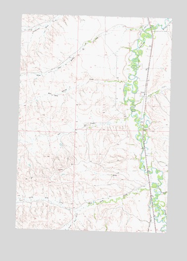
Benteen, MT USGS Topographic Map
Click on map above to begin viewing in our Map Viewer.

This topographic map contains these locations and features:
Feature Name Type Latitude Longitude GNIS ID View Map
04S34E11DA__01 WellWellN45.4944°W107.4768°809778View Map
04S35E09AC__01 WellWellN45.4986°W107.3984°809806View Map
04S35E09AD__01 WellWellN45.4986°W107.3934°809805View Map
04S35E09DABA01 WellWellN45.4989°W107.3937°809808View Map
04S35E09DB__01 WellWellN45.4950°W107.3984°809779View Map
04S35E09DC__01 WellWellN45.4914°W107.3984°809767View Map
04S35E09DDD_01 WellWellN45.4925°W107.3906°809773View Map
04S35E10CC__01 WellWellN45.4914°W107.3884°809766View Map
04S35E15ABBB01 WellWellN45.4916°W107.3795°809768View Map
04S35E16AD__01 WellWellN45.4841°W107.3934°809715View Map
04S35E16BD__01 WellWellN45.4841°W107.4034°809716View Map
04S35E16DC__01 WellWellN45.4769°W107.3984°809684View Map
04S35E16DC__02 WellWellN45.4769°W107.3984°809685View Map
04S35E16DCCC01 WellWellN45.4780°W107.4001°809693View Map
04S35E16DD__01 WellWellN45.4769°W107.3934°809683View Map
04S35E16DDDD01 WellWellN45.4780°W107.3912°809692View Map
04S35E21AA__01 WellWellN45.4730°W107.3934°809669View Map
04S35E21AACD01 WellWellN45.4744°W107.3931°809674View Map
04S35E21AD__01 WellWellN45.4694°W107.3934°809646View Map
04S35E21CD__01 WellWellN45.4622°W107.4034°809615View Map
04S35E21CD__02 WellWellN45.4622°W107.4034°809616View Map
04S35E21DC__01 WellWellN45.4622°W107.3984°809614View Map
04S35E28BD__01 WellWellN45.4550°W107.4034°809559View Map
04S35E28CBDB01 WellWellN45.4536°W107.4076°809552View Map
04S35E28DB__01 WellWellN45.4514°W107.3984°809544View Map
04S35E33AC__01 WellWellN45.4405°W107.3984°809501View Map
04S35E33DB__01 WellWellN45.4369°W107.3984°809482View Map
04S35E34DAAD01 WellWellN45.4402°W107.3915°809500View Map
05S35E03CC__01 WellWellN45.4202°W107.3884°809401View Map
05S35E03CCBC01 WellWellN45.4216°W107.3895°809403View Map
05S35E04AB__01 WellWellN45.4311°W107.3987°809447View Map
05S35E04DB__01 WellWellN45.4239°W107.3987°809413View Map
05S35E09AD__01 WellWellN45.4130°W107.3934°809373View Map
05S35E09DBDD01 WellWellN45.4097°W107.3956°809359View Map
05S35E09DD__01 WellWellN45.4058°W107.3934°809340View Map
05S35E09DDAA01 WellWellN45.4089°W107.3904°809356View Map
05S35E15CB__01 WellWellN45.3950°W107.3884°809289View Map
05S35E16AA__01 WellWellN45.4022°W107.3934°809324View Map
05S35E16AADC01 WellWellN45.4019°W107.3920°809321View Map
05S35E16DDDC01 WellWellN45.3914°W107.3912°809254View Map
05S35E22BB__01 WellWellN45.3875°W107.3884°809237View Map
05S35E22BDBB01 WellWellN45.3872°W107.3834°809231View Map
05S35E22CB__01 WellWellN45.3802°W107.3884°809204View Map
05S35E22CC__01 WellWellN45.3766°W107.3884°809181View Map
05S35E22DCBB01 WellWellN45.3794°W107.3784°809197View Map
Bear-in-Middle CreekStreamN45.4922°W107.3987°768612View Map
BenteenPopulated PlaceN45.4564°W107.3965°802027View Map
Benteen (historical)LocaleN45.4564°W107.3965°1716297View Map
Big Horn CountyCivilN45.4234°W107.4899°1716521View Map
Long Otter CreekStreamN45.4489°W107.4043°773650View Map
Mud Springs CreekStreamN45.4647°W107.4101°768072View Map
Nest CreekStreamN45.4439°W107.4070°774591View Map
North Sand CreekStreamN45.3858°W107.4504°774850View Map
Reno FordCrossingN45.4997°W107.3753°2079419View Map
Sand CreekStreamN45.4016°W107.3840°776171View Map
Shavings CreekStreamN45.3977°W107.3806°776409View Map
South Sand CreekStreamN45.3858°W107.4504°776905View Map

Note: Coordinates in the location and feature list above are referenced to NAD83 datum.


Copyright (C) 2008-2025 Ryan Niemi / Sunset Dynamics ... All Rights Reserved