TopoQuest Logo
Do you find TopoQuest useful?
Help keep TopoQuest running and adding new maps/features by donating!
Bitcoin:  19c7KJd3qBynnjoSw5npx9KScwjBe4ifkT
Litecoin:  LXs6TkuXGGXo1vDsWCkWVdjQX94eUKd6ui
Home View Maps Find Maps Find Places Resources & Links


Crowley, Oregon Topographic Map

USGS Map Title: Crowley, OR
USGS Map MRC: 43117C8
DRG (GeoTIFF) Download: o43117c8.tif


Neighboring USGS Topographic Map Quads:


  Hickey Basin, OR  
43118D1
 

  Star Creek Reservoir, OR  
43117D8
 

  Skull Spring, OR  
43117D7
 

  Stockade Mountain, OR  
43118C1
 

  Crowley, OR  
43117C8
 

  Burnt Flat, OR  
43117C7
 

  Dowell Butte, OR  
43118B1
 

  Mustang Butte, OR  
43117B8
 

  Sacramento Butte, OR  
43117B7


Map MRC Location:

N44°
W118°
N44°
W117°
H8 H7 H6 H5 H4 H3 H2 H1
G8 G7 G6 G5 G4 G3 G2 G1
F8 F7 F6 F5 F4 F3 F2 F1
E8 E7 E6 E5 E4 E3 E2 E1
D8 D7 D6 D5 D4 D3 D2 D1
C8 C7 C6 C5 C4 C3 C2 C1
B8 B7 B6 B5 B4 B3 B2 B1
A8 A7 A6 A5 A4 A3 A2 A1
N43°
W118°
N43°
W117°

Crowley, OR USGS 1:24K Topographic Map Preview:
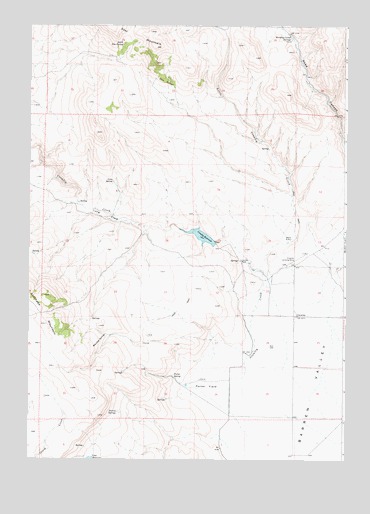
Crowley, OR USGS Topographic Map
Click on map above to begin viewing in our Map Viewer.

This topographic map contains these locations and features:
Feature Name Type Latitude Longitude GNIS ID View Map
CrowleyPopulated PlaceN43.2915°W117.8943°1119587View Map
Crowley CreekStreamN43.2565°W117.9135°1119588View Map
Crowley DamDamN43.3127°W117.9269°1133497View Map
Crowley Post Office (historical)Post OfficeN43.2915°W117.8943°1165115View Map
Crowley RanchLocaleN43.3074°W117.9171°1119591View Map
Crowley Ranch AirstripAirportN43.3072°W117.8961°1131411View Map
Crowley ReservoirReservoirN43.3143°W117.9321°1119592View Map
Jurries SpringsSpringN43.2634°W117.9642°1122622View Map
Little Crowley CreekStreamN43.3049°W117.9113°1123173View Map
Long FieldFlatN43.3202°W117.9705°1123412View Map
Long SpringSpringN43.3302°W117.9674°1123450View Map
Marking Corral SpringsSpringN43.3718°W117.8969°1123768View Map
Porter FieldFlatN43.2704°W117.9293°1125574View Map
Porter SpringSpringN43.2736°W117.9426°1125580View Map
Rapid CreekStreamN43.2846°W117.9288°1129627View Map
South Star SpringSpringN43.3697°W117.9633°1127352View Map
Twin SpringsSpringN43.3573°W117.9432°1128369View Map
Whiskey SpringsSpringN43.2861°W117.9699°1128949View Map

Note: Coordinates in the location and feature list above are referenced to NAD83 datum.


Copyright (C) 2008-2025 Ryan Niemi / Sunset Dynamics ... All Rights Reserved