TopoQuest Logo
Do you find TopoQuest useful?
Help keep TopoQuest running and adding new maps/features by donating!
Bitcoin:  19c7KJd3qBynnjoSw5npx9KScwjBe4ifkT
Litecoin:  LXs6TkuXGGXo1vDsWCkWVdjQX94eUKd6ui
Home View Maps Find Maps Find Places Resources & Links


Star Creek Reservoir, Oregon Topographic Map

USGS Map Title: Star Creek Reservoir, OR
USGS Map MRC: 43117D8
DRG (GeoTIFF) Download: o43117d8.tif


Neighboring USGS Topographic Map Quads:


  Mosquito Mountain, OR  
43118E1
 

  Shumway Reservoir, OR  
43117E8
 

  Alder Creek, OR  
43117E7
 

  Hickey Basin, OR  
43118D1
 

  Star Creek Reservoir, OR  
43117D8
 

  Skull Spring, OR  
43117D7
 

  Stockade Mountain, OR  
43118C1
 

  Crowley, OR  
43117C8
 

  Burnt Flat, OR  
43117C7


Map MRC Location:

N44°
W118°
N44°
W117°
H8 H7 H6 H5 H4 H3 H2 H1
G8 G7 G6 G5 G4 G3 G2 G1
F8 F7 F6 F5 F4 F3 F2 F1
E8 E7 E6 E5 E4 E3 E2 E1
D8 D7 D6 D5 D4 D3 D2 D1
C8 C7 C6 C5 C4 C3 C2 C1
B8 B7 B6 B5 B4 B3 B2 B1
A8 A7 A6 A5 A4 A3 A2 A1
N43°
W118°
N43°
W117°

Star Creek Reservoir, OR USGS 1:24K Topographic Map Preview:
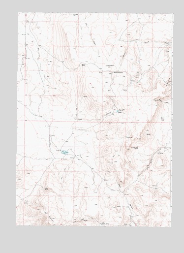
Star Creek Reservoir, OR USGS Topographic Map
Click on map above to begin viewing in our Map Viewer.

This topographic map contains these locations and features:
Feature Name Type Latitude Longitude GNIS ID View Map
Aspen SpringSpringN43.3961°W117.9771°1117073View Map
Cold SpringSpringN43.4182°W117.8870°1119108View Map
Cold Springs RanchLocaleN43.4193°W117.8816°1639138View Map
Dry Creek PassGapN43.4985°W117.9563°1120148View Map
Little Crowley SpringsSpringN43.3766°W117.9318°1123174View Map
Monument SpringsSpringN43.4651°W117.9242°1124310View Map
Monumental RockSummitN43.4568°W117.9399°1130347View Map
Rock SpringSpringN43.4384°W117.8850°1639139View Map
Rodger RanchLocaleN43.4935°W117.9899°1126254View Map
Rogers PlaceLocaleN43.4582°W117.9774°1639137View Map
RoostercombRidgeN43.4602°W117.8780°1126285View Map
Sack CanyonValleyN43.4374°W117.9746°1126401View Map
Sack Canyon ReservoirReservoirN43.4427°W117.9193°1126402View Map
Star Creek DamDamN43.4172°W117.9623°1133684View Map
Star Creek DitchCanalN43.4290°W117.9474°1164027View Map
Star Creek ReservoirReservoirN43.4180°W117.9611°1127534View Map
Star MountainSummitN43.3752°W117.9696°1136784View Map
Star RanchLocaleN43.4140°W117.9632°1127537View Map
Stump SpringSpringN43.3887°W117.9905°1127676View Map
Sutherland CabinLocaleN43.4821°W117.8780°1127771View Map
The MonumentsSummitN43.4682°W117.9255°1127982View Map
Whiskey Jack SpringSpringN43.4212°W117.9024°1152191View Map
Willow SpringSpringN43.4696°W117.9484°1129165View Map
Wood SpringSpringN43.4278°W117.9120°1129301View Map

Note: Coordinates in the location and feature list above are referenced to NAD83 datum.


Copyright (C) 2008-2025 Ryan Niemi / Sunset Dynamics ... All Rights Reserved