TopoQuest Logo
Do you find TopoQuest useful?
Help keep TopoQuest running and adding new maps/features by donating!
Bitcoin:  19c7KJd3qBynnjoSw5npx9KScwjBe4ifkT
Litecoin:  LXs6TkuXGGXo1vDsWCkWVdjQX94eUKd6ui
Home View Maps Find Maps Find Places Resources & Links


Curtis West, Michigan Topographic Map

USGS Map Title: Curtis West, MI
USGS Map MRC: 46085B7
DRG (GeoTIFF) Download: o46085b7.tif


Neighboring USGS Topographic Map Quads:


  Seney, MI  
46085C8
 

  Hardwood Island, MI  
46085C7
 

  McMillan, MI  
46085C6
 

  Germfask, MI  
46085B8
 

  Curtis West, MI  
46085B7
 

  Curtis East, MI  
46085B6
 

  Blaney Park, MI  
46085A8
 

  Milakokia Lake, MI  
46085A7
 

  Gould City, MI  
46085A6


Map MRC Location:

N47°
W86°
N47°
W85°
H8 H7 H6 H5 H4 H3 H2 H1
G8 G7 G6 G5 G4 G3 G2 G1
F8 F7 F6 F5 F4 F3 F2 F1
E8 E7 E6 E5 E4 E3 E2 E1
D8 D7 D6 D5 D4 D3 D2 D1
C8 C7 C6 C5 C4 C3 C2 C1
B8 B7 B6 B5 B4 B3 B2 B1
A8 A7 A6 A5 A4 A3 A2 A1
N46°
W86°
N46°
W85°

Curtis West, MI USGS 1:24K Topographic Map Preview:
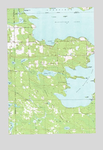
Curtis West, MI USGS Topographic Map
Click on map above to begin viewing in our Map Viewer.

This topographic map contains these locations and features:
Feature Name Type Latitude Longitude GNIS ID View Map
Blue Heron Golf CourseLocaleN46.2311°W85.8656°2356712View Map
Cooks BayBayN46.2155°W85.8154°623751View Map
Cornell LakeLakeN46.1760°W85.8735°623843View Map
Crescent LakeLakeN46.1877°W85.8737°624048View Map
Curtis CemeteryCemeteryN46.2100°W85.7604°624233View Map
Curtis Elementary SchoolSchoolN46.2061°W85.7583°2359936View Map
Curtis ParkParkN46.2061°W85.7506°2359932View Map
Diller Post Office (historical)Post OfficeN46.2167°W85.8347°2358172View Map
Foster IslandIslandN46.2497°W85.8132°626312View Map
Greenfield IslandIslandN46.2411°W85.7935°627346View Map
Gull IslandIslandN46.2411°W85.8101°627514View Map
Hempfield LakeLakeN46.1555°W85.8171°628098View Map
Lilly LakeLakeN46.1305°W85.7916°630394View Map
Little Mud LakeLakeN46.2374°W85.8555°630702View Map
Long PointCapeN46.1805°W85.7682°630993View Map
Lost LakeLakeN46.1961°W85.8673°631103View Map
Manistique LakeLakeN46.2390°W85.7834°631385View Map
Moon LakeLakeN46.1305°W85.8739°632630View Map
Norton CreekStreamN46.1553°W85.7571°633738View Map
Norton IslandIslandN46.1608°W85.7637°633740View Map
Portage Township Community Recreation AreaParkN46.2108°W85.7603°2359934View Map
Shoepac LakeLakeN46.1853°W85.8180°637831View Map
Shoepac RiverStreamN46.1803°W85.7907°637833View Map
South Manistique LakeLakeN46.1753°W85.7679°638382View Map
South Manistique Lake CampgroundLocaleN46.1761°W85.7915°638383View Map
Sprangs PointCapeN46.1908°W85.7590°638528View Map
Stuart LakeLakeN46.1980°W85.8530°638976View Map
Taylor CreekStreamN46.1519°W85.7734°1614620View Map
Wolf CreekStreamN46.1841°W85.8323°1616682View Map

Note: Coordinates in the location and feature list above are referenced to NAD83 datum.


Copyright (C) 2008-2024 Ryan Niemi / Sunset Dynamics ... All Rights Reserved