TopoQuest Logo
Do you find TopoQuest useful?
Help keep TopoQuest running and adding new maps/features by donating!
Bitcoin:  19c7KJd3qBynnjoSw5npx9KScwjBe4ifkT
Litecoin:  LXs6TkuXGGXo1vDsWCkWVdjQX94eUKd6ui
Home View Maps Find Maps Find Places Resources & Links


Cushing, Minnesota Topographic Map

USGS Map Title: Cushing, MN
USGS Map MRC: 46094B5
DRG (GeoTIFF) Download: o46094b5.tif


Neighboring USGS Topographic Map Quads:


  Motley, MN  
46094C6
 

  Motley SE, MN  
46094C5
 

  Pillager, MN  
46094C4
 

  Lincoln, MN  
46094B6
 

  Cushing, MN  
46094B5
 

  Belle Prairie NW, MN  
46094B4
 

  Lake Beauty, MN  
46094A6
 

  Randall West, MN  
46094A5
 

  Randall East, MN  
46094A4


Map MRC Location:

N47°
W95°
N47°
W94°
H8 H7 H6 H5 H4 H3 H2 H1
G8 G7 G6 G5 G4 G3 G2 G1
F8 F7 F6 F5 F4 F3 F2 F1
E8 E7 E6 E5 E4 E3 E2 E1
D8 D7 D6 D5 D4 D3 D2 D1
C8 C7 C6 C5 C4 C3 C2 C1
B8 B7 B6 B5 B4 B3 B2 B1
A8 A7 A6 A5 A4 A3 A2 A1
N46°
W95°
N46°
W94°

Cushing, MN USGS 1:24K Topographic Map Preview:
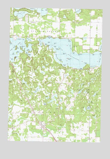
Cushing, MN USGS Topographic Map
Click on map above to begin viewing in our Map Viewer.

This topographic map contains these locations and features:
Feature Name Type Latitude Longitude GNIS ID View Map
Anderson BayBayN46.1958°W94.5142°1815238View Map
Anderson PointCapeN46.1986°W94.5197°1815237View Map
Bakers IslandIslandN46.2075°W94.6158°646277View Map
Bass BayBayN46.2164°W94.5767°1815256View Map
Bass LakeIslandN46.1797°W94.5261°639669View Map
Bernhart LakeLakeN46.2222°W94.5228°639973View Map
Betesta ChurchChurchN46.1291°W94.5145°639983View Map
Bethany Lutheran ChurchChurchN46.1403°W94.5764°2068753View Map
Big IslandIslandN46.2130°W94.6161°640090View Map
Birch LakeLakeN46.1717°W94.5197°1815230View Map
Blue Front BayBayN46.2239°W94.5711°1815255View Map
Braggans BayBayN46.2214°W94.6097°1815262View Map
Buzzard RoostCapeN46.2033°W94.6178°1815260View Map
Canton LakeLakeN46.1661°W94.5728°1815233View Map
Corner LakeLakeN46.1826°W94.6233°641509View Map
Crookneck LakeLakeN46.2442°W94.6111°642474View Map
CushingLocaleN46.1400°W94.5772°2068751View Map
CushingPopulated PlaceN46.1397°W94.5770°642566View Map
Cushing Baptist ChurchChurchN46.1403°W94.5764°2068754View Map
Cushing LandingLocaleN46.1933°W94.5258°1815236View Map
Cushing Post OfficePost OfficeN46.1394°W94.5778°2068752View Map
Cushing Union CemeteryCemeteryN46.1408°W94.5755°2068632View Map
Duck Nest IslandIslandN46.2080°W94.5531°1815250View Map
East End BayBayN46.2039°W94.5008°1815235View Map
Fish Trap LakeLakeN46.2021°W94.6169°660487View Map
Fishtrap Lake CampgroundLocaleN46.2044°W94.6006°2068755View Map
Goodwin BayBayN46.2205°W94.5433°1815254View Map
Grass IslandIslandN46.2014°W94.6231°640305View Map
Green IslandIslandN46.2008°W94.5570°1815242View Map
Ham LakeLakeN46.2205°W94.5992°644596View Map
Hay Stack IslandIslandN46.2036°W94.5458°644782View Map
Headleys BayBayN46.2180°W94.5836°1815261View Map
Hines Farm AirportAirportN46.2372°W94.5931°660311View Map
Hohler BayBayN46.2061°W94.5975°1815257View Map
Holister BayBayN46.2044°W94.5614°1815243View Map
Johnson LakeLakeN46.1700°W94.5089°645691View Map
Krantz BayBayN46.1964°W94.5503°1815234View Map
Lagerquist LakeLakeN46.1729°W94.5282°643686View Map
Lake AlexanderLakeN46.2076°W94.5415°660485View Map
Lake CamileLakeN46.1572°W94.5168°646317View Map
Lake JenniferLakeN46.1631°W94.5155°1815229View Map
Lake LeslieLakeN46.1559°W94.5217°1815228View Map
Lake MadalineLakeN46.1800°W94.6039°642962View Map
Loberg Wildlife Pond DamDamN46.1383°W94.6170°1776635View Map
Longs LakeLakeN46.1734°W94.5870°647153View Map
Meadow LakeLakeN46.1487°W94.5077°647719View Map
Midway IslandIslandN46.2139°W94.5617°1815251View Map
Millers LakeLakeN46.1604°W94.5759°1815232View Map
Mohrs PointCapeN46.2083°W94.5133°1815239View Map
Mud LakeLakeN46.2136°W94.5007°648359View Map
Ogema PointCapeN46.2094°W94.5400°1815241View Map
Overlook LakeLakeN46.1724°W94.5221°1815231View Map
Pickerel BarBarN46.2175°W94.5656°1815252View Map
Pig IslandIslandN46.2069°W94.6186°649396View Map
Preachers PointCapeN46.2130°W94.6106°1815259View Map
Roseland Roselund CemeteryCemeteryN46.1288°W94.5144°650297View Map
Round LakeLakeN46.2494°W94.5337°650360View Map
Scandia Valley CemeteryCemeteryN46.2146°W94.5401°651265View Map
Scandia Valley Fire DepartmentBuildingN46.2234°W94.5883°2068757View Map
Scandia Valley Town HallLocaleN46.2219°W94.5786°651266View Map
School Number 119SchoolN46.1369°W94.5322°651359View Map
School Number 64SchoolN46.1655°W94.5564°651705View Map
School Number 67SchoolN46.1375°W94.6200°651712View Map
School Number 77SchoolN46.2230°W94.5583°651732View Map
Shamineau ParkParkN46.2383°W94.6142°1815263View Map
Soldiers IslandIslandN46.2119°W94.5581°652235View Map
Swamp IslandIslandN46.2180°W94.5736°1815253View Map
Tayors IslandIslandN46.2100°W94.6014°1815258View Map
The FlatsBayN46.2139°W94.5420°1815244View Map
Township of CushingCivilN46.1506°W94.5086°663908View Map
Township of Scandia ValleyCivilN46.2402°W94.5107°665565View Map
Weyerhaeuser PointCapeN46.2080°W94.5322°1815240View Map

Note: Coordinates in the location and feature list above are referenced to NAD83 datum.


Copyright (C) 2008-2024 Ryan Niemi / Sunset Dynamics ... All Rights Reserved