TopoQuest Logo
Do you find TopoQuest useful?
Help keep TopoQuest running and adding new maps/features by donating!
Bitcoin:  19c7KJd3qBynnjoSw5npx9KScwjBe4ifkT
Litecoin:  LXs6TkuXGGXo1vDsWCkWVdjQX94eUKd6ui
Home View Maps Find Maps Find Places Resources & Links


Lake Beauty, Minnesota Topographic Map

USGS Map Title: Lake Beauty, MN
USGS Map MRC: 46094A6
DRG (GeoTIFF) Download: o46094a6.tif


Neighboring USGS Topographic Map Quads:


  Browerville NE, MN  
46094B7
 

  Lincoln, MN  
46094B6
 

  Cushing, MN  
46094B5
 

  Browerville, MN  
46094A7
 

  Lake Beauty, MN  
46094A6
 

  Randall West, MN  
46094A5
 

  Long Prairie, MN  
45094H7
 

  Swanville, MN  
45094H6
 

  Flensburg, MN  
45094H5


Map MRC Location:

N47°
W95°
N47°
W94°
H8 H7 H6 H5 H4 H3 H2 H1
G8 G7 G6 G5 G4 G3 G2 G1
F8 F7 F6 F5 F4 F3 F2 F1
E8 E7 E6 E5 E4 E3 E2 E1
D8 D7 D6 D5 D4 D3 D2 D1
C8 C7 C6 C5 C4 C3 C2 C1
B8 B7 B6 B5 B4 B3 B2 B1
A8 A7 A6 A5 A4 A3 A2 A1
N46°
W95°
N46°
W94°

Lake Beauty, MN USGS 1:24K Topographic Map Preview:
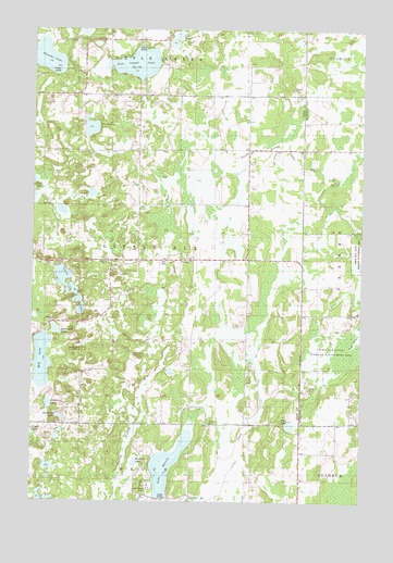
Lake Beauty, MN USGS Topographic Map
Click on map above to begin viewing in our Map Viewer.

This topographic map contains these locations and features:
Feature Name Type Latitude Longitude GNIS ID View Map
Beauty LakeLakeN46.0096°W94.6982°639805View Map
Chain of LakesLakeN46.0568°W94.7365°641090View Map
Howard LakeLakeN46.0102°W94.7110°645260View Map
Hudallas LakeLakeN46.0253°W94.7442°645273View Map
Lake Beauty CampLocaleN46.0041°W94.7067°1815226View Map
Lake Beauty Covenant Bible ChurchChurchN46.0053°W94.7058°2068881View Map
Little Elk State Wildlife Management AreaParkN46.0486°W94.6258°1815225View Map
Little Mill LakeLakeN46.0452°W94.7412°646857View Map
Loon LakeLakeN46.1220°W94.6968°647167View Map
Mill LakeLakeN46.0372°W94.7463°647851View Map
Mud LakeLakeN46.0202°W94.6520°648273View Map
Nazarene ChurchChurchN46.0208°W94.6695°648435View Map
Pine Island LakeLakeN46.1159°W94.7112°649468View Map
R Biermeier PondReservoirN46.1133°W94.7436°1776355View Map
R Biermeier Pond DamDamN46.1133°W94.7436°1776354View Map
School Number 105SchoolN46.1080°W94.7106°651333View Map
School Number 130SchoolN46.1008°W94.6400°651378View Map
School Number 132SchoolN46.0133°W94.6400°651379View Map
School Number 139SchoolN46.0633°W94.6911°651387View Map
School Number 149SchoolN46.0208°W94.6845°651394View Map
School Number 151SchoolN46.1016°W94.6683°651395View Map
Steinerts LakeLakeN46.0222°W94.7397°652612View Map
Thunder LakeLakeN46.1176°W94.7472°653190View Map
Tower HillSummitN46.0400°W94.7336°1815227View Map
Township of Little ElkCivilN46.0640°W94.7100°664800View Map
Wintergreen LakeLakeN46.0990°W94.7289°654279View Map
Zion ChurchChurchN46.0647°W94.6917°654480View Map

Note: Coordinates in the location and feature list above are referenced to NAD83 datum.


Copyright (C) 2008-2025 Ryan Niemi / Sunset Dynamics ... All Rights Reserved