TopoQuest Logo
Do you find TopoQuest useful?
Help keep TopoQuest running and adding new maps/features by donating!
Bitcoin:  19c7KJd3qBynnjoSw5npx9KScwjBe4ifkT
Litecoin:  LXs6TkuXGGXo1vDsWCkWVdjQX94eUKd6ui
Home View Maps Find Maps Find Places Resources & Links


Cyrene, Missouri Topographic Map

USGS Map Title: Cyrene, MO
USGS Map MRC: 39091C1
DRG (GeoTIFF) Download: o39091c1.tif


Neighboring USGS Topographic Map Quads:


  Vera, MO  
39091D2
 

  Louisiana, MO  
39091D1
 

  Pleasant Hill West, IL  
39090D8
 

  Bowling Green, MO  
39091C2
 

  Cyrene, MO  
39091C1
 

  Clarksville, MO  
39090C8
 

  Louisville, MO  
39091B2
 

  Eolia, MO  
39091B1
 

  Auburn, MO  
39090B8


Map MRC Location:

N40°
W92°
N40°
W91°
H8 H7 H6 H5 H4 H3 H2 H1
G8 G7 G6 G5 G4 G3 G2 G1
F8 F7 F6 F5 F4 F3 F2 F1
E8 E7 E6 E5 E4 E3 E2 E1
D8 D7 D6 D5 D4 D3 D2 D1
C8 C7 C6 C5 C4 C3 C2 C1
B8 B7 B6 B5 B4 B3 B2 B1
A8 A7 A6 A5 A4 A3 A2 A1
N39°
W92°
N39°
W91°

Cyrene, MO USGS 1:24K Topographic Map Preview:
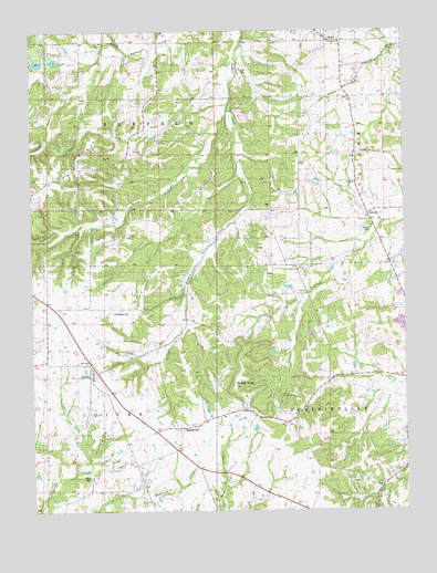
Cyrene, MO USGS Topographic Map
Click on map above to begin viewing in our Map Viewer.

This topographic map contains these locations and features:
Feature Name Type Latitude Longitude GNIS ID View Map
Buffalo KnobSummitN39.2825°W91.0571°715010View Map
CalumetPopulated PlaceN39.3270°W91.0121°740719View Map
CyrenePopulated PlaceN39.2864°W91.1065°716629View Map
Dover CemeteryCemeteryN39.3239°W91.0118°717021View Map
Dover ChurchChurchN39.3256°W91.0124°729474View Map
Eagle Point School (historical)SchoolN39.2520°W91.0863°741804View Map
EdgewoodPopulated PlaceN39.2717°W91.0749°717402View Map
Eolia CemeteryCemeteryN39.2567°W91.0082°717614View Map
Gibbs CemeteryCemeteryN39.2586°W91.1065°718422View Map
Goose CreekStreamN39.3570°W91.0574°718588View Map
Hickerson CemeteryCemeteryN39.3017°W91.0982°719418View Map
J R Wilson DamDamN39.3084°W91.0418°761264View Map
Knob School (historical)SchoolN39.2898°W91.0357°741803View Map
Kritz CemeteryCemeteryN39.3645°W91.0540°720699View Map
Mount Ayre ChurchChurchN39.2798°W91.0376°722713View Map
Mount Zion Baptist ChurchChurchN39.3437°W91.0879°729571View Map
Mount Zion School (historical)SchoolN39.3370°W91.0913°741805View Map
Norton School (historical)SchoolN39.3350°W91.0349°741802View Map
Number 150 DamDamN39.3667°W91.1201°761083View Map
StarkPopulated PlaceN39.3725°W91.0249°727029View Map
Stark CemeteryCemeteryN39.3434°W91.0140°727031View Map
Township of PrairievilleCivilN39.2692°W91.0075°767193View Map
Wertz LakeReservoirN39.3284°W91.1035°761965View Map
Wertz Lake DamDamN39.3284°W91.1035°761964View Map
Wilson LakeReservoirN39.3081°W91.0388°761265View Map

Note: Coordinates in the location and feature list above are referenced to NAD83 datum.


Copyright (C) 2008-2025 Ryan Niemi / Sunset Dynamics ... All Rights Reserved