TopoQuest Logo
Do you find TopoQuest useful?
Help keep TopoQuest running and adding new maps/features by donating!
Bitcoin:  19c7KJd3qBynnjoSw5npx9KScwjBe4ifkT
Litecoin:  LXs6TkuXGGXo1vDsWCkWVdjQX94eUKd6ui
Home View Maps Find Maps Find Places Resources & Links


Cyril, Oklahoma Topographic Map

USGS Map Title: Cyril, OK
USGS Map MRC: 34098H2
DRG (GeoTIFF) Download: o34098h2.tif


Neighboring USGS Topographic Map Quads:


  Anadarko West, OK  
35098A3
 

  Anadarko East, OK  
35098A2
 

  Verden, OK  
35098A1
 

  Apache, OK  
34098H3
 

  Cyril, OK  
34098H2
 

  Laverty, OK  
34098H1
 

  Elgin, OK  
34098G3
 

  Fletcher, OK  
34098G2
 

  Rocky Ford, OK  
34098G1


Map MRC Location:

N35°
W99°
N35°
W98°
H8 H7 H6 H5 H4 H3 H2 H1
G8 G7 G6 G5 G4 G3 G2 G1
F8 F7 F6 F5 F4 F3 F2 F1
E8 E7 E6 E5 E4 E3 E2 E1
D8 D7 D6 D5 D4 D3 D2 D1
C8 C7 C6 C5 C4 C3 C2 C1
B8 B7 B6 B5 B4 B3 B2 B1
A8 A7 A6 A5 A4 A3 A2 A1
N34°
W99°
N34°
W98°

Cyril, OK USGS 1:24K Topographic Map Preview:
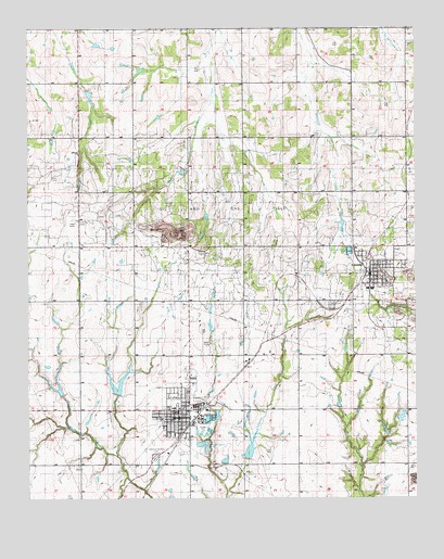
Cyril, OK USGS Topographic Map
Click on map above to begin viewing in our Map Viewer.

This topographic map contains these locations and features:
Feature Name Type Latitude Longitude GNIS ID View Map
Celestial Gardens CemeteryCemeteryN34.8864°W98.2103°1101132View Map
CementPopulated PlaceN34.9320°W98.1403°1091138View Map
Cement CemeteryCemeteryN34.9264°W98.1527°1101131View Map
Cement Elementary SchoolSchoolN34.9308°W98.1396°1803884View Map
Cement High SchoolSchoolN34.9308°W98.1396°1790289View Map
Cement Police DepartmentBuildingN34.9355°W98.1405°2757544View Map
Cement Post OfficePost OfficeN34.9353°W98.1399°1813508View Map
Cement Volunteer Fire DepartmentBuildingN34.9358°W98.1404°2658625View Map
CyrilPopulated PlaceN34.8965°W98.2006°1091906View Map
Cyril Ambulance ServiceBuildingN34.8967°W98.2013°2695854View Map
Cyril Elementary SchoolSchoolN34.8992°W98.2035°1790618View Map
Cyril Fire DepartmentBuildingN34.8992°W98.2062°2658528View Map
Cyril High SchoolSchoolN34.8991°W98.2018°1803944View Map
Cyril ParkParkN34.8856°W98.2095°1777780View Map
Cyril Police DepartmentBuildingN34.8968°W98.2013°2757729View Map
Cyril Post OfficePost OfficeN34.8967°W98.2003°1813769View Map
Cyril-Cement DivisionCivilN34.9213°W98.1711°1937683View Map
Delaware Creek Site 108 DamDamN34.9601°W98.2037°1754622View Map
Delaware Creek Site 108 ReservoirReservoirN34.9601°W98.2037°1754623View Map
Little Washita Creek Site 25 DamDamN34.8751°W98.2220°1754973View Map
Little Washita Creek Site 25 ReservoirReservoirN34.8751°W98.2220°1754974View Map
Little Washita Creek Site 26 DamDamN34.8984°W98.2370°1754975View Map
Little Washita Creek Site 26 ReservoirReservoirN34.8984°W98.2370°1754976View Map
Little Washita Creek Site 27 DamDamN34.8984°W98.2220°1754977View Map
Little Washita Creek Site 27 ReservoirReservoirN34.8984°W98.2220°1754978View Map
Little Washita Creek Site 49 DamDamN34.8851°W98.1803°1754983View Map
Little Washita Creek Site 49 ReservoirReservoirN34.8879°W98.1792°1754984View Map
Midway ChurchChurchN34.9667°W98.2334°1102171View Map
Tonkawa Creek Site 1a DamDamN34.9601°W98.2437°1754626View Map
Tonkawa Creek Site 1a ReservoirReservoirN34.9601°W98.2437°1754627View Map
Town of CementCivilN34.9362°W98.1364°2413185View Map
Town of CyrilCivilN34.8987°W98.2030°2412400View Map
Township of North CementCivilN34.9723°W98.1309°1825309View Map
Township of South CementCivilN34.9028°W98.1559°1825312View Map

Note: Coordinates in the location and feature list above are referenced to NAD83 datum.


Copyright (C) 2008-2024 Ryan Niemi / Sunset Dynamics ... All Rights Reserved