TopoQuest Logo
Do you find TopoQuest useful?
Help keep TopoQuest running and adding new maps/features by donating!
Bitcoin:  19c7KJd3qBynnjoSw5npx9KScwjBe4ifkT
Litecoin:  LXs6TkuXGGXo1vDsWCkWVdjQX94eUKd6ui
Home View Maps Find Maps Find Places Resources & Links


Dakota, Illinois Topographic Map

USGS Map Title: Dakota, IL
USGS Map MRC: 42089D5
DRG (GeoTIFF) Download: o42089d5.tif


Neighboring USGS Topographic Map Quads:


  Monroe, WI  
42089E6
 

  Juda, WI  
42089E5
 

  Brodhead West, WI  
42089E4
 

  Orangeville, IL  
42089D6
 

  Dakota, IL  
42089D5
 

  Davis, IL  
42089D4
 

  Freeport West, IL  
42089C6
 

  Freeport East, IL  
42089C5
 

  Ridott, IL  
42089C4


Map MRC Location:

N43°
W90°
N43°
W89°
H8 H7 H6 H5 H4 H3 H2 H1
G8 G7 G6 G5 G4 G3 G2 G1
F8 F7 F6 F5 F4 F3 F2 F1
E8 E7 E6 E5 E4 E3 E2 E1
D8 D7 D6 D5 D4 D3 D2 D1
C8 C7 C6 C5 C4 C3 C2 C1
B8 B7 B6 B5 B4 B3 B2 B1
A8 A7 A6 A5 A4 A3 A2 A1
N42°
W90°
N42°
W89°

Dakota, IL USGS 1:24K Topographic Map Preview:
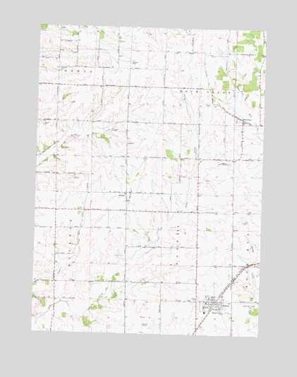
Dakota, IL USGS Topographic Map
Click on map above to begin viewing in our Map Viewer.

This topographic map contains these locations and features:
Feature Name Type Latitude Longitude GNIS ID View Map
AfolkeyPopulated PlaceN42.4325°W89.5746°422388View Map
Afolkey CemeteryCemeteryN42.4289°W89.5759°1821228View Map
Afolkey School (historical)SchoolN42.4217°W89.5751°423770View Map
Bethel ChurchChurchN42.4289°W89.5751°404316View Map
Brush Creek School (historical)SchoolN42.4467°W89.6143°423781View Map
Buckeye School (historical)SchoolN42.4031°W89.6137°423782View Map
Busjahn FarmsLocaleN42.4764°W89.5494°2680964View Map
Center Hill School (historical)SchoolN42.4231°W89.5357°423784View Map
Champion Hill School (historical)SchoolN42.4247°W89.6140°423786View Map
Coon CreekStreamN42.3870°W89.6101°406521View Map
DakotaPopulated PlaceN42.3886°W89.5262°406926View Map
Dakota CemeteryCemeteryN42.3900°W89.5340°406927View Map
Dakota Community Presbyterian ChurchChurchN42.3900°W89.5282°1967767View Map
Dakota Fire Protection DistrictBuildingN42.3891°W89.5231°2640846View Map
Dakota High SchoolSchoolN42.3867°W89.5307°1821234View Map
Dakota Post OfficePost OfficeN42.3887°W89.5262°1967769View Map
Dakota United Methodist ChurchChurchN42.3881°W89.5282°1967768View Map
Eldorado CemeteryCemeteryN42.4831°W89.6137°407846View Map
Eldorado School (historical)SchoolN42.4833°W89.6135°423796View Map
Fountain Creek Post Office (historical)Post OfficeN42.4247°W89.5751°1821237View Map
Hickory Grove DairyLocaleN42.4458°W89.5503°2628336View Map
Hickory Grove School (historical)SchoolN42.4470°W89.5407°423811View Map
Monte QuarryMineN42.4597°W89.6212°1967571View Map
Mount Pleasant School (historical)SchoolN42.4467°W89.5754°423824View Map
Pleasant Hill School (historical)SchoolN42.4833°W89.5748°423829View Map
Rock GrovePopulated PlaceN42.4631°W89.5121°416814View Map
Stearns Landing Strip (historical)AirportN42.4453°W89.5268°1821271View Map
Sylvan School (historical)SchoolN42.4856°W89.5343°423846View Map
Tammany School (historical)SchoolN42.3961°W89.5662°423847View Map
Township of DakotaCivilN42.4177°W89.5452°428868View Map
Union CemeteryCemeteryN42.4689°W89.5296°420035View Map
Village of DakotaCivilN42.3875°W89.5269°2398670View Map
Wirth Prairie Nature PreserveParkN42.3870°W89.5643°2009738View Map

Note: Coordinates in the location and feature list above are referenced to NAD83 datum.


Copyright (C) 2008-2025 Ryan Niemi / Sunset Dynamics ... All Rights Reserved