TopoQuest Logo
Do you find TopoQuest useful?
Help keep TopoQuest running and adding new maps/features by donating!
Bitcoin:  19c7KJd3qBynnjoSw5npx9KScwjBe4ifkT
Litecoin:  LXs6TkuXGGXo1vDsWCkWVdjQX94eUKd6ui
Home View Maps Find Maps Find Places Resources & Links


Dale Mountain, New Mexico Topographic Map

USGS Map Title: Dale Mountain, NM
USGS Map MRC: 36104H2
DRG (GeoTIFF) Download: o36104h2.tif


Neighboring USGS Topographic Map Quads:


  Barela, CO  
37104A3
 

  Abeyta, CO  
37104A2
 

  Trinchera, CO  
37104A1
 

  Yankee, NM  
36104H3
 

  Dale Mountain, NM  
36104H2
 

  Trinchera Pass, NM  
36104H1
 

  Hunter Mesa, NM  
36104G3
 

  Johnson Park, NM  
36104G2
 

  Robinson Peak, NM  
36104G1


Map MRC Location:

N37°
W105°
N37°
W104°
H8 H7 H6 H5 H4 H3 H2 H1
G8 G7 G6 G5 G4 G3 G2 G1
F8 F7 F6 F5 F4 F3 F2 F1
E8 E7 E6 E5 E4 E3 E2 E1
D8 D7 D6 D5 D4 D3 D2 D1
C8 C7 C6 C5 C4 C3 C2 C1
B8 B7 B6 B5 B4 B3 B2 B1
A8 A7 A6 A5 A4 A3 A2 A1
N36°
W105°
N36°
W104°

Dale Mountain, NM USGS 1:24K Topographic Map Preview:
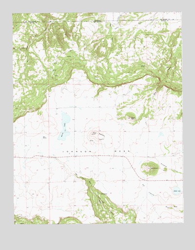
Dale Mountain, NM USGS Topographic Map
Click on map above to begin viewing in our Map Viewer.

This topographic map contains these locations and features:
Feature Name Type Latitude Longitude GNIS ID View Map
Bear CanyonStreamN36.9792°W104.2397°194977View Map
Bellisle LakeLakeN36.8942°W104.1300°886197View Map
BerryLocaleN36.9589°W104.2244°924623View Map
Berry LakeReservoirN36.9297°W104.2136°886254View Map
Dale MountainSummitN36.9281°W104.1894°898756View Map
Dale Mountain MineMineN36.9250°W104.1866°916511View Map
Dale SpringsSpringN36.8923°W104.1848°888182View Map
DemcheckLocaleN36.9500°W104.2433°928354View Map
DohertyLocaleN36.9909°W104.1744°928366View Map
Gutierrez SpringSpringN36.9684°W104.1555°889663View Map
Madrid PeakSummitN36.9375°W104.1630°891535View Map
Mestas DitchCanalN36.9936°W104.1728°891913View Map
Mestas DitchCanalN36.9975°W104.1708°203743View Map
Red MountainMineN36.9106°W104.1472°916093View Map
Red MountainSummitN36.9075°W104.1494°893777View Map
Red Mountain Post Office (historical)Post OfficeN36.9075°W104.1494°937281View Map
Ross SpringSpringN36.9264°W104.2284°894169View Map
Saint John's Methodist Episcopal Church CemeteryCemeteryN36.9156°W104.2048°931325View Map
Saint Johns ChurchChurchN36.9145°W104.2053°1953270View Map

Note: Coordinates in the location and feature list above are referenced to NAD83 datum.


Copyright (C) 2008-2025 Ryan Niemi / Sunset Dynamics ... All Rights Reserved