TopoQuest Logo
Do you find TopoQuest useful?
Help keep TopoQuest running and adding new maps/features by donating!
Bitcoin:  19c7KJd3qBynnjoSw5npx9KScwjBe4ifkT
Litecoin:  LXs6TkuXGGXo1vDsWCkWVdjQX94eUKd6ui
Home View Maps Find Maps Find Places Resources & Links


Robinson Peak, New Mexico Topographic Map

USGS Map Title: Robinson Peak, NM
USGS Map MRC: 36104G1
DRG (GeoTIFF) Download: o36104g1.tif


Neighboring USGS Topographic Map Quads:


  Dale Mountain, NM  
36104H2
 

  Trinchera Pass, NM  
36104H1
 

  Alps Mesa, NM  
36103H8
 

  Johnson Park, NM  
36104G2
 

  Robinson Peak, NM  
36104G1
 

  Folsom, NM  
36103G8
 

  Mesa Larga, NM  
36104F2
 

  Kiowa, NM  
36104F1
 

  Capulin, NM  
36103F8


Map MRC Location:

N37°
W105°
N37°
W104°
H8 H7 H6 H5 H4 H3 H2 H1
G8 G7 G6 G5 G4 G3 G2 G1
F8 F7 F6 F5 F4 F3 F2 F1
E8 E7 E6 E5 E4 E3 E2 E1
D8 D7 D6 D5 D4 D3 D2 D1
C8 C7 C6 C5 C4 C3 C2 C1
B8 B7 B6 B5 B4 B3 B2 B1
A8 A7 A6 A5 A4 A3 A2 A1
N36°
W105°
N36°
W104°

Robinson Peak, NM USGS 1:24K Topographic Map Preview:
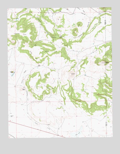
Robinson Peak, NM USGS Topographic Map
Click on map above to begin viewing in our Map Viewer.

This topographic map contains these locations and features:
Feature Name Type Latitude Longitude GNIS ID View Map
10000 Water WellWellN36.7600°W104.0314°919454View Map
10001 Water WellWellN36.7561°W104.0630°919455View Map
10007 Water WellWellN36.7509°W104.0991°922940View Map
Archuleta CreekStreamN36.8653°W104.0264°885873View Map
Cherry CreekStreamN36.8678°W104.0302°887487View Map
Cinder ButteMineN36.7967°W104.1116°916091View Map
Cinder ButteSummitN36.7970°W104.1086°899584View Map
CruzLocaleN36.7900°W104.0755°927293View Map
DohertyLocaleN36.8689°W104.0483°928365View Map
Griego MesaSummitN36.8411°W104.1022°899657View Map
Griego SpringSpringN36.8197°W104.0866°889630View Map
Gringo LakeLakeN36.8116°W104.1195°889637View Map
Gringo PeakSummitN36.8136°W104.1197°899658View Map
Jack Miller CanyonValleyN36.8667°W104.0161°890385View Map
Jose ButteMineN36.8100°W104.0464°916483View Map
Jose ButteSummitN36.8111°W104.0497°898345View Map
KingLocaleN36.7689°W104.0583°927346View Map
King LakeLakeN36.7541°W104.0432°890708View Map
Martinez CanyonValleyN36.8442°W104.0511°891650View Map
Prudencio CanyonValleyN36.8464°W104.0569°893500View Map
Rattlesnake DrawValleyN36.7834°W104.1030°893683View Map
Robinson PeakSummitN36.8217°W104.0089°897457View Map
Rockwell LakeLakeN36.7713°W104.1233°894105View Map
Twin ButtesSummitN36.8511°W104.0444°902374View Map
Wild Horse ArroyoStreamN36.8745°W104.0564°896589View Map

Note: Coordinates in the location and feature list above are referenced to NAD83 datum.


Copyright (C) 2008-2024 Ryan Niemi / Sunset Dynamics ... All Rights Reserved