TopoQuest Logo
Do you find TopoQuest useful?
Help keep TopoQuest running and adding new maps/features by donating!
Bitcoin:  19c7KJd3qBynnjoSw5npx9KScwjBe4ifkT
Litecoin:  LXs6TkuXGGXo1vDsWCkWVdjQX94eUKd6ui
Home View Maps Find Maps Find Places Resources & Links


Dallas, Colorado Topographic Map

USGS Map Title: Dallas, CO
USGS Map MRC: 38107B6
DRG (GeoTIFF) Download: o38107b6.tif


Neighboring USGS Topographic Map Quads:


  Colona, CO  
38107C7
 

  Buckhorn Lakes, CO  
38107C6
 

  Washboard Rock, CO  
38107C5
 

  Ridgway, CO  
38107B7
 

  Dallas, CO  
38107B6
 

  Courthouse Mountain, CO  
38107B5
 

  Mount Sneffels, CO  
38107A7
 

  Ouray, CO  
38107A6
 

  Wetterhorn Peak, CO  
38107A5


Map MRC Location:

N39°
W108°
N39°
W107°
H8 H7 H6 H5 H4 H3 H2 H1
G8 G7 G6 G5 G4 G3 G2 G1
F8 F7 F6 F5 F4 F3 F2 F1
E8 E7 E6 E5 E4 E3 E2 E1
D8 D7 D6 D5 D4 D3 D2 D1
C8 C7 C6 C5 C4 C3 C2 C1
B8 B7 B6 B5 B4 B3 B2 B1
A8 A7 A6 A5 A4 A3 A2 A1
N38°
W108°
N38°
W107°

Dallas, CO USGS 1:24K Topographic Map Preview:
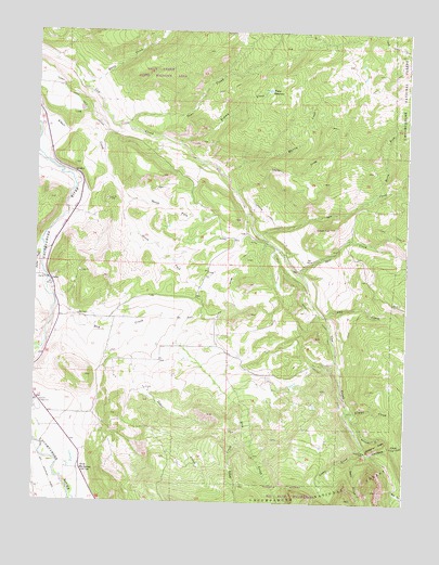
Dallas, CO USGS Topographic Map
Click on map above to begin viewing in our Map Viewer.

This topographic map contains these locations and features:
Feature Name Type Latitude Longitude GNIS ID View Map
Alkali Ditch Number 1CanalN38.1817°W107.6678°188438View Map
Alkali Ditch Number 2CanalN38.2097°W107.6981°188437View Map
Andy CreekStreamN38.1455°W107.6798°188428View Map
Bear GulchValleyN38.1377°W107.6372°188430View Map
Burro CreekStreamN38.2358°W107.7362°188251View Map
Cedar CreekStreamN38.1692°W107.7201°188421View Map
Cobbs GulchValleyN38.1395°W107.6391°188429View Map
Courthouse CreekStreamN38.1380°W107.6367°188425View Map
DallasPopulated PlaceN38.1833°W107.7448°188420View Map
Dallas CreekStreamN38.1911°W107.7478°188418View Map
Deer CreekStreamN38.2253°W107.7201°188252View Map
Dry CreekStreamN38.1814°W107.7462°188427View Map
Dry GulchValleyN38.1736°W107.7044°188445View Map
Flume CreekStreamN38.1505°W107.6448°188424View Map
Fortuna MineMineN38.1430°W107.7334°1745599View Map
Lou CreekStreamN38.1964°W107.6762°188431View Map
Martin CreekStreamN38.2119°W107.6873°188435View Map
Nate CreekStreamN38.1858°W107.6614°188426View Map
North Fork Alkali CreekStreamN38.2042°W107.7209°188442View Map
North Fork Lou CreekStreamN38.2064°W107.6376°188444View Map
Onion HillSummitN38.1983°W107.6514°188432View Map
Orvis Hot SpringSpringN38.1333°W107.7343°188419View Map
Ouray County FairgroundLocaleN38.1505°W107.7487°197607View Map
Owl CreekStreamN38.1744°W107.6523°188467View Map
Ramshorn GulchValleyN38.1443°W107.6409°188423View Map
Ramshorn RidgeRidgeN38.1403°W107.6345°188422View Map
Red CreekStreamN38.1286°W107.6289°188443View Map
Sneva DitchCanalN38.1589°W107.6492°188439View Map
South Fork Alkali CreekStreamN38.2042°W107.7209°188440View Map
Taylor DrawValleyN38.2079°W107.6825°188436View Map
Tommy CreekStreamN38.2200°W107.7026°188433View Map
Uncompahgre Placer MineMineN38.1697°W107.7481°1745600View Map
Victor ReservoirReservoirN38.2346°W107.6721°188434View Map

Note: Coordinates in the location and feature list above are referenced to NAD83 datum.


Copyright (C) 2008-2024 Ryan Niemi / Sunset Dynamics ... All Rights Reserved