TopoQuest Logo
Do you find TopoQuest useful?
Help keep TopoQuest running and adding new maps/features by donating!
Bitcoin:  19c7KJd3qBynnjoSw5npx9KScwjBe4ifkT
Litecoin:  LXs6TkuXGGXo1vDsWCkWVdjQX94eUKd6ui
Home View Maps Find Maps Find Places Resources & Links


Damascus, Pennsylvania Topographic Map

USGS Map Title: Damascus, PA
USGS Map MRC: 41075F1
DRG (GeoTIFF) Download: o41075f1.tif


Neighboring USGS Topographic Map Quads:


  Long Eddy, NY  
41075G2
 

  Callicoon, NY  
41075G1
 

  Jeffersonville, NY  
41074G8
 

  Galilee, PA  
41075F2
 

  Damascus, PA  
41075F1
 

  Lake Huntington, NY  
41074F8
 

  White Mills, PA  
41075E2
 

  Narrowsburg, NY  
41075E1
 

  Eldred, NY  
41074E8


Map MRC Location:

N42°
W76°
N42°
W75°
H8 H7 H6 H5 H4 H3 H2 H1
G8 G7 G6 G5 G4 G3 G2 G1
F8 F7 F6 F5 F4 F3 F2 F1
E8 E7 E6 E5 E4 E3 E2 E1
D8 D7 D6 D5 D4 D3 D2 D1
C8 C7 C6 C5 C4 C3 C2 C1
B8 B7 B6 B5 B4 B3 B2 B1
A8 A7 A6 A5 A4 A3 A2 A1
N41°
W76°
N41°
W75°

Damascus, PA USGS 1:24K Topographic Map Preview:
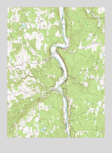
Damascus, PA USGS Topographic Map
Click on map above to begin viewing in our Map Viewer.

This topographic map contains these locations and features:
Feature Name Type Latitude Longitude GNIS ID View Map
Barkley LakeLakeN41.6330°W75.0783°1168717View Map
Beaverdam CreekStreamN41.7040°W75.0660°1169062View Map
Big IslandIslandN41.7343°W75.0524°943910View Map
Calkins CreekStreamN41.6729°W75.0599°1170891View Map
Campis AirportAirportN41.6905°W75.0129°978108View Map
CochectonPopulated PlaceN41.7059°W75.0604°946985View Map
Cochecton Dam Road BridgeBridgeN41.7050°W75.0667°2599187View Map
Conklin HillPopulated PlaceN41.7373°W75.0829°1203325View Map
DamascusPopulated PlaceN41.7031°W75.0682°1172912View Map
Damascus Post OfficePost OfficeN41.6982°W75.0792°2779828View Map
Damascus Township Volunteer Ambulance CorpsBuildingN41.6936°W75.1140°2722143View Map
East CochectonPopulated PlaceN41.7154°W75.0157°972414View Map
East Cochecton CemeteryCemeteryN41.7158°W75.0155°2554095View Map
Hillside CemeteryCemeteryN41.6995°W75.0741°1177116View Map
Lake Huntington Presbyterian CemeteryCemeteryN41.6813°W75.0133°954920View Map
Lake Huntington Volunteer Fire Company Station 3BuildingN41.7079°W75.0619°2735408View Map
MilanvillePopulated PlaceN41.6715°W75.0652°1181094View Map
Milanville Post OfficePost OfficeN41.6725°W75.0651°2779825View Map
Mitchell PondLakeN41.7054°W75.0011°957447View Map
Mitchell Pond BrookStreamN41.6862°W75.0516°957448View Map
Nobody StationLocaleN41.6537°W75.0435°958639View Map
North Branch Calkins CreekStreamN41.6698°W75.0691°1182529View Map
Overlook CemeteryCemeteryN41.7030°W75.0665°1183138View Map
Perry PondLakeN41.6573°W75.0174°960209View Map
Riverside SchoolSchoolN41.6345°W75.0507°1197806View Map
Saint Lucys CemeteryCemeteryN41.6558°W75.0436°963817View Map
Saint Lucys ChurchChurchN41.6995°W75.0541°963818View Map
Schoolhouse CreekStreamN41.7137°W75.0624°1187108View Map
Skinners FallsLocaleN41.6720°W75.0541°965361View Map
Smith SwitchLocaleN41.6423°W75.0446°965523View Map
South Branch Calkins CreekStreamN41.6698°W75.0691°1188018View Map
Stanton CornerPopulated PlaceN41.6256°W75.1149°1205084View Map
Sunny BrookStreamN41.6859°W75.0988°1189069View Map
Swago PondLakeN41.7326°W75.1035°1189119View Map
Tamarack SwampSwampN41.7342°W75.0236°967020View Map
Tyler HillPopulated PlaceN41.6951°W75.1079°1190038View Map
Tyler HillSummitN41.7098°W75.1110°1190039View Map
Upper Tyler Hill DamDamN41.6937°W75.1171°1208798View Map

Note: Coordinates in the location and feature list above are referenced to NAD83 datum.


Copyright (C) 2008-2024 Ryan Niemi / Sunset Dynamics ... All Rights Reserved