TopoQuest Logo
Do you find TopoQuest useful?
Help keep TopoQuest running and adding new maps/features by donating!
Bitcoin:  19c7KJd3qBynnjoSw5npx9KScwjBe4ifkT
Litecoin:  LXs6TkuXGGXo1vDsWCkWVdjQX94eUKd6ui
Home View Maps Find Maps Find Places Resources & Links


Dana, Wyoming Topographic Map

USGS Map Title: Dana, WY
USGS Map MRC: 41106G6
DRG (GeoTIFF) Download: o41106g6.tif


Neighboring USGS Topographic Map Quads:


  Pats Bottom, WY  
41106H7
 

  Tenmile Spring, WY  
41106H6
 

  Elmo, WY  
41106H5
 

  Walcott, WY  
41106G7
 

  Dana, WY  
41106G6
 

  Hanna, WY  
41106G5
 

  Meads, WY  
41106F7
 

  Coal Bank Basin, WY  
41106F6
 

  Rattlesnake Pass, WY  
41106F5


Map MRC Location:

N42°
W107°
N42°
W106°
H8 H7 H6 H5 H4 H3 H2 H1
G8 G7 G6 G5 G4 G3 G2 G1
F8 F7 F6 F5 F4 F3 F2 F1
E8 E7 E6 E5 E4 E3 E2 E1
D8 D7 D6 D5 D4 D3 D2 D1
C8 C7 C6 C5 C4 C3 C2 C1
B8 B7 B6 B5 B4 B3 B2 B1
A8 A7 A6 A5 A4 A3 A2 A1
N41°
W107°
N41°
W106°

Dana, WY USGS 1:24K Topographic Map Preview:
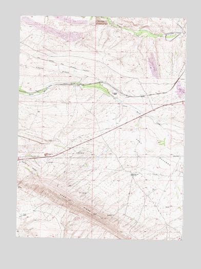
Dana, WY USGS Topographic Map
Click on map above to begin viewing in our Map Viewer.

This topographic map contains these locations and features:
Feature Name Type Latitude Longitude GNIS ID View Map
Big Ditch PitMineN41.8716°W106.6881°1585445View Map
Buck SpringReservoirN41.7989°W106.7033°1586026View Map
DanaLocaleN41.8363°W106.7042°1597277View Map
Dana MeadowsFlatN41.8014°W106.6523°1587339View Map
Dana MineMineN41.8252°W106.6623°1703925View Map
Dana One MineMineN41.8233°W106.6786°1726050View Map
Dana Two MineMineN41.8230°W106.6698°1703926View Map
Eagle RockSummitN41.8319°W106.6781°1587993View Map
Hanna South MineMineN41.8472°W106.6436°1703929View Map
Iron SpringSpringN41.7783°W106.7498°1589965View Map
Lucky Annie Claims MineMineN41.8336°W106.6453°1703924View Map
Mud Springs ReservoirReservoirN41.7864°W106.6646°1591865View Map
Section Eighteen Pit MineMineN41.8730°W106.6898°1703927View Map
Seminoe Strip MineMineN41.8727°W106.6400°1703928View Map
Twin LakesLakeN41.7618°W106.7442°1595793View Map
Vanguard Number Two Energy Development MineMineN41.8747°W106.6428°1726051View Map
Vanguard Number Two MineMineN41.8736°W106.6867°1726053View Map

Note: Coordinates in the location and feature list above are referenced to NAD83 datum.


Copyright (C) 2008-2025 Ryan Niemi / Sunset Dynamics ... All Rights Reserved